In today’s rapidly developing world, accurate information about the Earth’s surface is more valuable than ever. From planning new roads and bridges to managing urban expansion or protecting natural resources, one thing remains constant: the need for reliable, up-to-date spatial data. This is where modern land surveying and Geographic Information Systems (GIS) come together to form an indispensable partnership.
From Chains and Theodolites to Drones and GIS
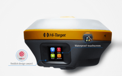
Land surveying has come a long way since the days of chains, compasses, and theodolites. Today, surveyors use cutting-edge tools like GPS, total stations, drones, and laser scanners to collect precise measurements faster and more efficiently. But collecting data is only the first step what happens next determines its true value.
This is where GIS comes in. GIS is the powerful technology that allows surveyors, planners, and decision-makers to store, analyze, visualize, and share spatial data. By integrating field survey data into a GIS, raw measurements become meaningful maps, insightful layers, and actionable information that drive real-world solutions.
Why GIS Matters for Surveyors
1. Better Data Management:
A GIS database organizes large amounts of data from various sources cadastral maps, topographic surveys, satellite imagery, and more into a single, manageable system. This eliminates paper clutter and makes data accessible anytime, anywhere, even on mobile devices in the field.
2. Smarter Analysis:
GIS helps surveyors perform advanced spatial analysis from checking land encroachments and right-of-way alignments to modeling flood risks or planning utility networks. This makes their work more valuable for engineers, urban planners, and government agencies seeking precise information for critical decisions.
3. Improved Collaboration:
Survey data integrated into a GIS can be easily shared with multiple stakeholders. Municipalities, developers, real estate companies, and environmental consultants can access the same up-to-date maps and layers, improving transparency, eliminating duplication of effort, and speeding up project timelines.
4. Future-Proof Skills:
Surveyors who understand GIS are better positioned to adapt to new industry trends. They can expand their services beyond traditional boundary surveys to include asset mapping, 3D terrain modeling, drone photogrammetry, and spatial data consulting all of which are increasingly in demand in sectors like urban development, agriculture, and environmental management.
Real-World Example: Mapping a Growing City
Consider a fast-growing city in Africa or Asia. New residential estates, commercial centers, and roads are built every year. Surveyors are on the front lines, collecting accurate ground data that feeds into a GIS. City planners use this GIS data to create up-to-date digital maps showing land use, road networks, water lines, and power grids. These maps help determine where new schools, hospitals, and public services are most needed. Without GIS, coordinating this kind of urban growth would be slow, costly, and error prone.
What’s Next: The Evolution Continues
As technology evolves, the synergy between surveying and GIS will only grow stronger. Tools like drones and LiDAR now make it possible to capture high-resolution 3D models of entire neighborhoods or forests in hours instead of weeks. Meanwhile, AI and cloud-based GIS platforms make it easier to analyze huge datasets, monitor changes over time, and make data-driven decisions faster than ever before.
The future belongs to surveyors and GIS professionals who are ready to embrace this shift combining field expertise with digital skills to deliver smarter, more impactful solutions for the communities they serve.
Final Thoughts
Whether you’re a student considering a career in surveying, a seasoned professional, or an organization seeking to make better land-related decisions, investing in GIS is no longer optional it’s essential for staying competitive and relevant.


