Document

Drone Services in Abuja: What to Know About FCT Airspace

Geoinfotech Author

October 10, 2025
Licensed drone operator performing aerial survey in Abuja

drone-services-abuja.jpg

Learn how to fly drones legally in Abuja. Understand NCAA rules, Aso Rock restrictions, and clearance procedures for safe drone operations in the FCT.

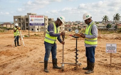
Abuja isn’t just Nigeria’s capital city; it’s the seat of government, a hub of infrastructure projects, and home to some of the country’s most sensitive airspace. As drones become indispensable tools for mapping, aerial photography, inspection, and surveillance, understanding the rules that govern their use in the Federal Capital Territory (FCT) has never been more important.

Flying a drone over Abuja isn’t like flying in any other Nigerian city. Between strict NCAA regulations, high-security restricted zones around Aso Rock, and clearance requirements for operations near government districts, drone operators must exercise exceptional care. This guide breaks down everything you need to know to fly safely, legally, and confidently in the FCT.

Aso Rock restricted zone and FCT airspace map

aso-rock-restricted-airspace.jpg

1. The Legal Foundation: NCAA Regulations for Drone Operations

The Nigeria Civil Aviation Authority (NCAA) is the body that regulates all remotely piloted aircraft systems (RPAS) in Nigeria. Whether you’re a commercial operator, a surveyor, or a drone hobbyist, you fall under their oversight.

Under NCAA guidelines, drone operations in Nigeria require adherence to certain fundamental rules:

  • Registration: Every drone that exceeds the approved weight threshold must be registered with the NCAA before it can be flown.

  • Certification: Operators conducting commercial flights must possess a Remotely Piloted Aircraft Systems (RPAS) Pilot License.

  • Flight Authorisation: You must obtain flight approval before every operation, especially in controlled or urban airspace like Abuja.

  • Operational Safety: All flights must maintain a visual line of sight (VLOS) unless special approval has been granted for beyond visual line of sight (BVLOS) missions.

Failure to comply with NCAA standards can lead to equipment seizure, fines, or prosecution. The takeaway is simple: you can’t afford to skip documentation in Abuja’s sky.

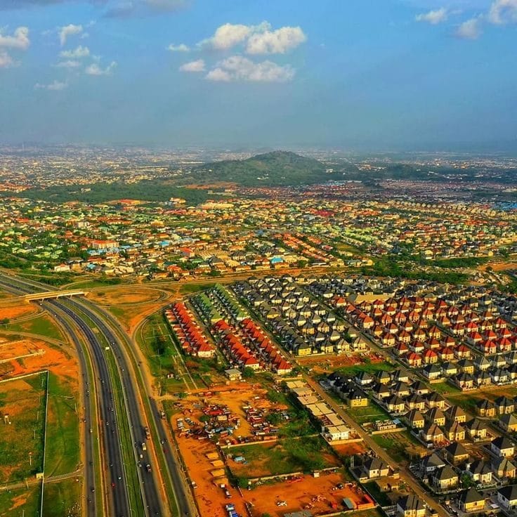
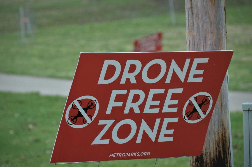
2. Understanding the Aso Rock Restricted Zone

Abuja’s skyline is dominated by the Aso Rock, the granite outcrop overlooking the Presidential Villa and Three Arms Zone,  home to Nigeria’s top executive, legislative, and judicial institutions. Unsurprisingly, this area is classified as a prohibited flight zone by aviation and security authorities.

Any aerial device, including drones, is strictly forbidden from entering this zone without explicit clearance. The Aso Rock Restricted Zone (often referred to in aviation circles as DNP4) is heavily monitored. Unauthorised drone flights around the area can attract swift responses from security operatives and trigger investigations.

Here’s what this means for drone pilots:

  • No drone should fly over or near Aso Rock. Even a few hundred meters too far can breach the restricted boundary.

  • Plan your flight paths carefully. Use geofencing features on your drone to automatically block entry into restricted airspace.

  • Respect government security limits. Never attempt to capture aerial imagery of the Presidential Villa, military facilities, or foreign embassies.

The rule of thumb: if you’re not 100% sure your area is authorised, don’t fly there.

3. Security Clearances for Government District Operations

Operating a drone in the FCT’s central government district involves more than just NCAA approval. Because the area hosts national institutions, ministries, and embassies, additional security clearance may be required.

Typically, drone operations in these sensitive zones require coordination with:

  • The NCAA – for official flight authorisation and compliance oversight.

  • The Nigerian Airspace Management Agency (NAMA) – for air traffic and NOTAM (Notice to Airmen) coordination.

  • Security Agencies (such as DSS or military units) – for background checks and operational clearance, especially when filming or mapping near critical infrastructure.

  • The FCT Administration – for land-use or location permits if you are launching or landing on public property.

Each agency plays a role in ensuring the drone activity aligns with safety and security standards. Depending on your project’s purpose (surveying, cinematography, or inspection), the clearance process can take days to weeks, so plan.


4. Pre-Flight Compliance Checklist for Drone Operators in Abuja

If you’re planning a flight in Abuja, here’s a simplified checklist to help you stay compliant:

  1. Register your drone with the NCAA and attach its registration number visibly on the aircraft.

  2. Obtain a valid RPAS license and carry your certification during operations.

  3. File a flight plan indicating the time, coordinates, and purpose of your flight. Submit it to the NCAA (and NAMA if required).

  4. Secure security clearance for operations near Aso Rock, the National Assembly, or the Central Business District.

  5. Use approved launch and landing zones, avoiding government or private property without consent.

  6. Monitor weather and NOTAMs before each flight.

  7. Maintain communication with ground control or local authorities during active operations.

  8. Respect data privacy, especially if recording near residential or administrative areas.

This process may seem bureaucratic, but in Abuja’s context, it’s essential for your safety and credibility as an operator.


5. Best Practices for Safe Drone Operations in the FCT

Beyond legal compliance, professionalism in drone service delivery requires attention to operational detail. Here are the best practices to follow:

  • Plan every mission meticulously:  Analyze maps, assess terrain, and identify restricted and safe corridors.

  • Train your team:  Every crew member should understand Abuja’s unique restrictions and emergency protocols.

  • Keep records: Store permits, flight logs, and authorizations for at least six months after each operation.

  • Invest in safety technology: Use drones with GPS fail-safes, return-to-home functions, and built-in airspace awareness systems.

  • Engage with regulators proactively: Building rapport with the NCAA and local agencies simplifies future approvals.

Remember,  drone professionalism isn’t only about the footage you capture; it’s also about how responsibly you operate.


6. The Risks of Unauthorised Drone Flights

Flying a drone without authorisation in Abuja can have serious consequences. Security operatives have zero tolerance for aerial incursions near sensitive locations, and ignorance of the law offers no protection. Violations can result in:

  • Confiscation of drone equipment

  • Arrest and interrogation

  • Monetary fines or court action

  • Blacklisting from future aviation approvals

Always treat the Abuja airspace as a high-security environment. When in doubt, consult the NCAA or your company’s regulatory liaison before take-off.


Despite the strict rules, the future of drone operations in Abuja looks promising. Government agencies, real estate firms, construction companies, and environmental organisations are increasingly adopting geo-spatial and aerial data solutions.

As more professionals embrace licensed drone operations, the city will benefit from improved infrastructure monitoring, mapping accuracy, and smart urban planning, all while maintaining national security.

Drone technology is here to stay. The key is to operate legally, safely, and responsibly.

NCAA drone permit process in Nigeria 2025

ncaa-drone-permit-abuja.jpg

Final Thoughts

Navigating Abuja’s airspace requires more than technical skill; it demands a clear understanding of aviation law, security protocols, and professional ethics.

For every drone operator in the FCT, compliance isn’t just about avoiding trouble; it’s about earning trust in a high-stakes environment where safety and security are paramount.

Before you fly:

  • Check NCAA guidelines

  • Confirm your authorisations

  • Stay clear of restricted zones

  • And always put safety above speed

Mastering these steps will keep your drone operations secure, compliant, and respected across Nigeria’s most regulated airspace.


RECENT ACTIVITIES AND PROJECT...

URABN HEAT ISLAND EFFECT IN CALABAR MUNICIPAL

URABN HEAT ISLAND EFFECT IN CALABAR MUNICIPAL

ANALYZING URBANIZATION TRENDS IN KANO STATE, NIGERIA USING NIGHTTIME LIGHTS REMOTE SENSING DATA

ANALYZING URBANIZATION TRENDS IN KANO STATE, NIGERIA USING NIGHTTIME LIGHTS REMOTE SENSING DATA

COMPREHENSIVE OFFSHORE SURVEILLANCE AND MARITIME INFRASTRUCTURE MONITORING

COMPREHENSIVE OFFSHORE SURVEILLANCE AND MARITIME INFRASTRUCTURE MONITORING

Comprehensive Aerial Survey and Mapping for Golf Course Asset Management at Lakowe Golf Lake

Comprehensive Aerial Survey and Mapping for Golf Course Asset Management at Lakowe Golf Lake

Professional Drone Training Program for Enhanced Corporate Security Operations at Sahara Group

Professional Drone Training Program for Enhanced Corporate Security Operations at Sahara Group

Advanced Aerial Topographic Survey and Mapping for Land Development in Ogun State

Advanced Aerial Topographic Survey and Mapping for Land Development in Ogun State

Precision RGB and Thermal Imaging Revolutionizes Solar Infrastructure Inspection In Enugu

Precision RGB and Thermal Imaging Revolutionizes Solar Infrastructure Inspection In Enugu

Advanced Drone-Based Topographic Survey for Precision Land Development Planning

Advanced Drone-Based Topographic Survey for Precision Land Development Planning

Mapping the Future: Comprehensive Area Survey Transforms Land Development in Akure

Mapping the Future: Comprehensive Area Survey Transforms Land Development in Akure

Precision Topographical Survey and Mapping for Smarter Infrastructure Planning

Precision Topographical Survey and Mapping for Smarter Infrastructure Planning

Precision Drone Volumetric Surveys: How Purechem Industries Optimized Mineral Stockpile Management

Precision Drone Volumetric Surveys: How Purechem Industries Optimized Mineral Stockpile Management

Advanced Mapping & Environmental Survey for Ilubirin Property, Lagos Island

Advanced Mapping & Environmental Survey for Ilubirin Property, Lagos Island

Unveiling the Invisible: LiDAR Technology Transforms Terrain Analysis in Abeokuta North

Unveiling the Invisible: LiDAR Technology Transforms Terrain Analysis in Abeokuta North

 DETAILED AERIAL, LAND SURVEY AND GIS ANALYSIS FOR ADVANCED REAL ESTATE DEVELOPMENT

 DETAILED AERIAL, LAND SURVEY AND GIS ANALYSIS FOR ADVANCED REAL ESTATE DEVELOPMENT

Professional Drone Mapping and GIS Training For ETA-ZUMA Mining Company

Professional Drone Mapping and GIS Training For ETA-ZUMA Mining Company

Installation of Intelligent Traffic Lights

Installation of Intelligent Traffic Lights

Geological Report on a Mining/Exploration Survey

Geological Report on a Mining/Exploration Survey

Drone Survey and Mapping of Shaishen Foods Limited

Drone Survey and Mapping of Shaishen Foods Limited

Lidar Topographic Mapping Project

Lidar Topographic Mapping Project

Geophysical/hydrogeophysical Studies for Groundwater Development

Geophysical/hydrogeophysical Studies for Groundwater Development

Togo Digital Terrain Model Project

Togo Digital Terrain Model Project

Drone Mapping of Parts of Lome Rail Line for Graceland Energy Located at Lome Togo

Drone Mapping of Parts of Lome Rail Line for Graceland Energy Located at Lome Togo

Drone/land Survey of Pure-chem Industrial Limited, Ogun State.

Drone/land Survey of Pure-chem Industrial Limited, Ogun State.

Drone Inspection/survey of Southern Lake Estate, Chevron, Lekki, Lagos State

Drone Inspection/survey of Southern Lake Estate, Chevron, Lekki, Lagos State

Anniversary-Workshop on the Application of Remote Sensing and Drone Technology in GIS -Abuja

Anniversary-Workshop on the Application of Remote Sensing and Drone Technology in GIS -Abuja

Topographic Mapping of Oyo State

Topographic Mapping of Oyo State

Topographic Mapping of Part of the Local Government Areas in Oyo State

Topographic Mapping of Part of the Local Government Areas in Oyo State

Topographic Mapping of Part of Kwara, Ekiti and Kogi State Local Government Area

Topographic Mapping of Part of Kwara, Ekiti and Kogi State Local Government Area

Political Map of South West, Nigeria Located in Nigeria

Political Map of South West, Nigeria Located in Nigeria

Topographic Mapping of Parts of Niger State Located at Niger State, Nigeria

Topographic Mapping of Parts of Niger State Located at Niger State, Nigeria

Topographic Mapping of Part of Kwara, Ekiti, and Kogi State Local Government Area Located in Nigeria

Topographic Mapping of Part of Kwara, Ekiti, and Kogi State Local Government Area Located in Nigeria

Topographic Mapping of Part of Kwara State Local Government Area Located at Kwara State Nigeria

Topographic Mapping of Part of Kwara State Local Government Area Located at Kwara State Nigeria

Flood Analysis of Amuwo-odofin Orthophoto.

Flood Analysis of Amuwo-odofin Orthophoto.

Site Inspection Using Drone of Water Corporation Located at Oke-aro Agege

Site Inspection Using Drone of Water Corporation Located at Oke-aro Agege

24,000 meter Lome Rail Line for Drone Mapping, Graceland Energy Located at Lome, Togo

24,000 meter Lome Rail Line for Drone Mapping, Graceland Energy Located at Lome, Togo

10 Drone Inspection Traffic Signal in Lagos

10 Drone Inspection Traffic Signal in Lagos

Lagos October 1st Free GIS Training Workshop

Lagos October 1st Free GIS Training Workshop

Osun state parcel project

Osun state parcel project

Drone Mapping & Vectorization Of Abu-allied Farm

Drone Mapping & Vectorization Of Abu-allied Farm

Proposal for aerial deployment, tracking and monitoring of threats in victoria island phase 1 and ikoyi phase 2, nigeria

Proposal for aerial deployment, tracking and monitoring of threats in victoria island phase 1 and ikoyi phase 2, nigeria

Jabi Lake Mall Solar Inspection – Abuja

Jabi Lake Mall Solar Inspection – Abuja

Ground Control and Drone Survey for Mast 3D Modeling

Ground Control and Drone Survey for Mast 3D Modeling

Telecom Drone 3D and 2D Modeling of Cellsite

Telecom Drone 3D and 2D Modeling of Cellsite

Free GIS Spatial Analysis Training (Lagos Branch)

Free GIS Spatial Analysis Training (Lagos Branch)

800 Building Plots Aerial Capture and Delineation for Database. Greenfield Estate

800 Building Plots Aerial Capture and Delineation for Database. Greenfield Estate

100 Hectares Aerial Survey with Differential GPS of High Accuracy

100 Hectares Aerial Survey with Differential GPS of High Accuracy

Protected: Nigeria Crime Report and Dashboard

Protected: Nigeria Crime Report and Dashboard

Drone Survey and Mapping – Victoria Island  Copy

Drone Survey and Mapping – Victoria Island Copy

Akwa-Ibom 500 Hectares Drone Survey and Mapping in Nigeria

Akwa-Ibom 500 Hectares Drone Survey and Mapping in Nigeria

Ground Control Establishment – Republic of the Niger – Kano, Kastina, Jigawa, Kaduna

Ground Control Establishment – Republic of the Niger – Kano, Kastina, Jigawa, Kaduna

Drone Survey and Mapping – Victoria Island

Drone Survey and Mapping – Victoria Island

Control Point Establishment – DGPS

Control Point Establishment – DGPS

Land Survey – Northern Nigeria

Land Survey – Northern Nigeria

Biodiversity Mapping – Sweden

Biodiversity Mapping – Sweden

Flood Impact Mapping – United Kingdom

Flood Impact Mapping – United Kingdom

M and E GIS Dashboard for Control Establishment Project

M and E GIS Dashboard for Control Establishment Project

Geodatabase Management System Training For National Boundary Commission

Geodatabase Management System Training For National Boundary Commission

Nigeria Topographic Map – Project

Nigeria Topographic Map – Project

Abuja Training on Introduction to GIS

Abuja Training on Introduction to GIS

200 Hectares Land and Drone Survey – Lagos Nigeria

200 Hectares Land and Drone Survey – Lagos Nigeria

Inspection of 30 hectares drainage

Inspection of 30 hectares drainage

Drainage Drone Mapping and Surveying in Lagos Nigeria

Drainage Drone Mapping and Surveying in Lagos Nigeria

GIS Cadastral Mobile Application

GIS Cadastral Mobile Application

Abuja Topographical Map – HD GIS Mapping

Abuja Topographical Map – HD GIS Mapping

Ground Topography Survey (Lagos Island)

Ground Topography Survey (Lagos Island)

2.7km2 Topography Survey in Snake Island

2.7km2 Topography Survey in Snake Island

GIS Masterclass

GIS Masterclass

Sokoto Contour Map

Sokoto Contour Map

NDVI Vegetation Assessment in Lagos State

NDVI Vegetation Assessment in Lagos State

Lagos drone training master class

Lagos drone training master class

Ifako drone topographic survey and mapping

Ifako drone topographic survey and mapping

CMD Lagos 3D mapping aerial modeling

CMD Lagos 3D mapping aerial modeling

GIS and Drone Masterclass

GIS and Drone Masterclass

Drone aerial survey and mapping – Lagos Island _ Somolu

Drone aerial survey and mapping – Lagos Island _ Somolu

Covid-19 | Nigeria Data Visualisation

Covid-19 | Nigeria Data Visualisation

Benue Flood Analysis

Benue Flood Analysis

Aerial photography Ile-Ife Osun State

Aerial photography Ile-Ife Osun State

Kenya Forest Project

Kenya Forest Project

Tunsun Consultants Ltd

Tunsun Consultants Ltd

Introduction To Gis In Maritime at the National Boundary Commission

Introduction To Gis In Maritime at the National Boundary Commission

Training on GIS and Drone Mapping (batch-4 & 5)

Training on GIS and Drone Mapping (batch-4 & 5)

Osun Flood Mapping

Osun Flood Mapping

Lahass International Limited

Lahass International Limited

Linguistic Association of Nigeria

Linguistic Association of Nigeria

West African Indexing Services

West African Indexing Services

Lagos Ikeja Road Network Map

Lagos Ikeja Road Network Map

LASU Land Regularisation Portal

LASU Land Regularisation Portal

Lingua Plus International

Lingua Plus International

Lagferry Web Route

Lagferry Web Route

YOU MAY ALSO LIKE...

COURSES

Explore Geoinfotech courses and establish a strong foundation of knowledge and skills to be productive with the latest Technology.

1000 University Student in Drone and GIS

This course is designed to equip university students with the essential knowledge and practical skills needed to become proficient in…

Find out more

Spatial Analysis using ArcGIS

Learn essential concepts and a standard workflow you can apply to any spatial analysis project.
Duration: 2 Weekends (Every Friday 2pm and Saturday 10am)
Package: Field Experience, 100% Hands-on practical, jotter, Biro and Software
Others: Test, Exam and Certificate

Find out more

Drone Pilot for Beginners to Professional

The Drone Professional Training course is a comprehensive program designed to equip participants with the necessary skills and knowledge to operate drones effectively and safely in a professional setting.
Duration: 3 Weekends (Every Friday 2pm and Saturday 10am)
Package: Field Experience, 100% Hands-on practical, jotter, Biro and Software Others, Test, Exam and Certificate.

Find out more
Training Venue Available in,Lagos and Abuja100253Nigeria
+ Google Map

Differential GPS (DGPS) Land Surveying Training

Professional 2 weekends ▪ Field Experience 5.0 (100% Practical) ▪ Exam & CertificateFree Software and AppsHands on Practical and Field…

Find out more