Document

At the highly anticipated annual Geo Week 2025 conference in Denver, Colorado, known for bringing together professionals from various sectors, including surveying, mapping, and remote sensing, a number of industry leaders showcased their company’s latest advancements in geospatial technology. 

WISPR: Cloud-Based Geospatial Data Management Solution

WISPR Systems, a leader in drone-based geospatial data collection and processing, announced the launch of its new cloud-based data management solution. This platform aims to streamline the workflow for geospatial professionals, from data acquisition to analysis and sharing. The WISPR Cloud solution offers several key features:

  • Seamless Integration: The platform integrates directly with WISPR’s drone systems, allowing for automatic data upload and processing immediately after flight completion.
  • Advanced Processing Capabilities: Leveraging cloud computing power, the system can handle large datasets, performing tasks such as point cloud classification, orthomosaic generation and 3D model creation more efficiently than traditional desktop solutions.
  • Collaborative Environment: Users can easily share projects with team members or clients for real-time collaboration and feedback on geospatial data.
  • AI-Powered Analytics: The platform incorporates machine learning algorithms to assist in feature extraction, change detection, and anomaly identification within datasets.
  • Scalable Storage: With cloud-based storage, users can access their data from anywhere and scale their storage needs as projects grow.
  • Compliance and Security: WISPR designed its cloud with industry-standard security protocols to help users maintain compliance with data handling regulations.

“Our new cloud solution represents a significant step forward in geospatial data management,” explained John McArthur, WISPR’s Vice President of Sales & Marketing. “By moving processing and storage to the cloud, we’re enabling our clients to work more efficiently and collaboratively, ultimately leading to better decision-making and project outcomes.” 

The WISPR Cloud platform will be available in March for existing WISPR drone system users. The company has plans to expand compatibility to other data sources in the near future

Vexcel: Enhanced Reality Mapping Capabilities

Vexcel, a pioneer in aerial imaging and mapping, introduced noteworthy updates to their reality mapping platform. The company has made significant strides in bridging the gap between reality capture and GIS ecosystems by offering tools that allow users to process various types of imagery and seamlessly integrate them into their workflows. Its UltraCam Dragon, a hybrid aerial mapping system, combines advanced oblique imaging with LiDAR technology the following capabilities:

  • High-Resolution Imaging: The Dragon incorporates two high-resolution nadir sensors (RGB Bayer pattern and NIR), four oblique RGB sensors and the Sony IMX-411 (CMOS) with 3.76 μm physical pixel size.
  • Powerful LiDAR: Equipped with a 2.4 MHz RIEGL OEM LiDAR scanner capable of collecting up to 2 million measurements per second.
  • Advanced Scanning Geometry: The LiDAR’s multi-axis scanning geometry, including a true nadir scan line, ensures maximum coverage of vertical features.
  • Proprietary Image Processing: Utilizes Vexcel’s Adaptive Motion Compensation (AMC) and True Pixel Processing (TPP) for sharp, accurate imagery.
  • Digital Twin Creation: Enables the creation of precise digital twins with comprehensive data capture13.
  • Plug & Play Data Processing: Compatible with UltraMap Essentials and RIEGL’s RiProcess software.

One of the standout features is the ability to produce a full range of photogrammetry products, including digital surface models (DSM), 3D mesh models, and image mosaics. Vexcel’s platform now supports compatibility with LiDAR data, enhancing its versatility for users across different industries.The UltraCam Dragon represents Vexcel’s entry into the integrated line of their product lineup for enhanced accuracy and coverage for various mapping applications, including high-resolution mapping of complex urban environments. The WISPR Cloud platform is available in March for existing WISPR drone system users. The company has plans to expand compatibility to other data sources in the near future. 

Trimble: Next-Generation GNSS Solutions

Trimble introduced its next-generation GNSS solution, the APX, designed to provide high-accuracy positioning for various applications, including UAV mapping. The APX brings several key features to the table:

  • CenterPoint RTX Complete: This service offers centimeter-level positioning in real-time and post-processing without the need for a base station. It provides fast convergence times in North America and Europe, with global availability for post-processing.
  • Advanced IMU Technology: The APX incorporates Trimble’s Maxwell technology, offering high-sensitivity and performance in a compact 55g package.
  • Flexible Models: Trimble introduced multiple APX models, including the APX 15, APX Extended, and higher-end models like APX Extended D3 and APX 50, catering to different performance requirements and applications.
  • Improved Post-Processing: The new APX system allows for UAV post-processing without additional licenses, enabling users to install multiple instances of the software on different desktops.

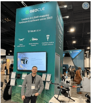
Geocue’s booth at the Geo week 2025. The company revealed two new drone LIDER products, the TrueView 1 Lite and TrueView 1

Riegl: Advancements in UAV LiDAR Systems

A shot from the show of Trimble’s next-generation GNSS solution for UAVs, the APX.

Riegl showcased its latest developments in the UAV LiDAR space, introducing the new VUX-100 system. This update to their popular VUX line offers several improvements:

  • Increased Field of View: The VUX-100 features a 160-degree field of view with a fully rotating scan pattern, optimizing data capture for typical UAV flight patterns.
  • Higher Pulse Repetition Rate: The system now operates at 1.5 MHz, allowing for denser point clouds and more detailed data capture.
  • Compact Design: Despite the performance improvements, the VUX-100 maintains a similar form factor to its predecessor, the VUX-120, ensuring compatibility with existing mounting solutions.
  • NDAA Compliance: Riegl emphasized that their entire UAV LiDAR portfolio, including the new VUX-100, is compliant with the National Defense Authorization Act (NDAA), making it suitable for government and defense-related projects.

Riegl also introduced the RiLOCK system, their first venture into developing an INS/GNSS solution. This integrated system is designed to work seamlessly with Riegl’s mini VUX and VUX series for a more economical and lightweight solution for precise positioning and orientation

To learn more and listen to first impressions from a variety of geo industry leaders on the show floor, watch

 Full Crew Geo Week 2025 event stream


RECENT ACTIVITIES AND PROJECT...

URABN HEAT ISLAND EFFECT IN CALABAR MUNICIPAL

URABN HEAT ISLAND EFFECT IN CALABAR MUNICIPAL

ANALYZING URBANIZATION TRENDS IN KANO STATE, NIGERIA USING NIGHTTIME LIGHTS REMOTE SENSING DATA

ANALYZING URBANIZATION TRENDS IN KANO STATE, NIGERIA USING NIGHTTIME LIGHTS REMOTE SENSING DATA

COMPREHENSIVE OFFSHORE SURVEILLANCE AND MARITIME INFRASTRUCTURE MONITORING

COMPREHENSIVE OFFSHORE SURVEILLANCE AND MARITIME INFRASTRUCTURE MONITORING

Comprehensive Aerial Survey and Mapping for Golf Course Asset Management at Lakowe Golf Lake

Comprehensive Aerial Survey and Mapping for Golf Course Asset Management at Lakowe Golf Lake

Professional Drone Training Program for Enhanced Corporate Security Operations at Sahara Group

Professional Drone Training Program for Enhanced Corporate Security Operations at Sahara Group

Advanced Aerial Topographic Survey and Mapping for Land Development in Ogun State

Advanced Aerial Topographic Survey and Mapping for Land Development in Ogun State

Precision RGB and Thermal Imaging Revolutionizes Solar Infrastructure Inspection In Enugu

Precision RGB and Thermal Imaging Revolutionizes Solar Infrastructure Inspection In Enugu

Advanced Drone-Based Topographic Survey for Precision Land Development Planning

Advanced Drone-Based Topographic Survey for Precision Land Development Planning

Mapping the Future: Comprehensive Area Survey Transforms Land Development in Akure

Mapping the Future: Comprehensive Area Survey Transforms Land Development in Akure

Precision Topographical Survey and Mapping for Smarter Infrastructure Planning

Precision Topographical Survey and Mapping for Smarter Infrastructure Planning

Precision Drone Volumetric Surveys: How Purechem Industries Optimized Mineral Stockpile Management

Precision Drone Volumetric Surveys: How Purechem Industries Optimized Mineral Stockpile Management

Advanced Mapping & Environmental Survey for Ilubirin Property, Lagos Island

Advanced Mapping & Environmental Survey for Ilubirin Property, Lagos Island

Unveiling the Invisible: LiDAR Technology Transforms Terrain Analysis in Abeokuta North

Unveiling the Invisible: LiDAR Technology Transforms Terrain Analysis in Abeokuta North

 DETAILED AERIAL, LAND SURVEY AND GIS ANALYSIS FOR ADVANCED REAL ESTATE DEVELOPMENT

 DETAILED AERIAL, LAND SURVEY AND GIS ANALYSIS FOR ADVANCED REAL ESTATE DEVELOPMENT

Professional Drone Mapping and GIS Training For ETA-ZUMA Mining Company

Professional Drone Mapping and GIS Training For ETA-ZUMA Mining Company

Installation of Intelligent Traffic Lights

Installation of Intelligent Traffic Lights

Geological Report on a Mining/Exploration Survey

Geological Report on a Mining/Exploration Survey

Drone Survey and Mapping of Shaishen Foods Limited

Drone Survey and Mapping of Shaishen Foods Limited

Lidar Topographic Mapping Project

Lidar Topographic Mapping Project

Geophysical/hydrogeophysical Studies for Groundwater Development

Geophysical/hydrogeophysical Studies for Groundwater Development

Togo Digital Terrain Model Project

Togo Digital Terrain Model Project

Drone Mapping of Parts of Lome Rail Line for Graceland Energy Located at Lome Togo

Drone Mapping of Parts of Lome Rail Line for Graceland Energy Located at Lome Togo

Drone/land Survey of Pure-chem Industrial Limited, Ogun State.

Drone/land Survey of Pure-chem Industrial Limited, Ogun State.

Drone Inspection/survey of Southern Lake Estate, Chevron, Lekki, Lagos State

Drone Inspection/survey of Southern Lake Estate, Chevron, Lekki, Lagos State

Anniversary-Workshop on the Application of Remote Sensing and Drone Technology in GIS -Abuja

Anniversary-Workshop on the Application of Remote Sensing and Drone Technology in GIS -Abuja

Topographic Mapping of Oyo State

Topographic Mapping of Oyo State

Topographic Mapping of Part of the Local Government Areas in Oyo State

Topographic Mapping of Part of the Local Government Areas in Oyo State

Topographic Mapping of Part of Kwara, Ekiti and Kogi State Local Government Area

Topographic Mapping of Part of Kwara, Ekiti and Kogi State Local Government Area

Political Map of South West, Nigeria Located in Nigeria

Political Map of South West, Nigeria Located in Nigeria

Topographic Mapping of Parts of Niger State Located at Niger State, Nigeria

Topographic Mapping of Parts of Niger State Located at Niger State, Nigeria

Topographic Mapping of Part of Kwara, Ekiti, and Kogi State Local Government Area Located in Nigeria

Topographic Mapping of Part of Kwara, Ekiti, and Kogi State Local Government Area Located in Nigeria

Topographic Mapping of Part of Kwara State Local Government Area Located at Kwara State Nigeria

Topographic Mapping of Part of Kwara State Local Government Area Located at Kwara State Nigeria

Flood Analysis of Amuwo-odofin Orthophoto.

Flood Analysis of Amuwo-odofin Orthophoto.

Site Inspection Using Drone of Water Corporation Located at Oke-aro Agege

Site Inspection Using Drone of Water Corporation Located at Oke-aro Agege

24,000 meter Lome Rail Line for Drone Mapping, Graceland Energy Located at Lome, Togo

24,000 meter Lome Rail Line for Drone Mapping, Graceland Energy Located at Lome, Togo

10 Drone Inspection Traffic Signal in Lagos

10 Drone Inspection Traffic Signal in Lagos

Lagos October 1st Free GIS Training Workshop

Lagos October 1st Free GIS Training Workshop

Osun state parcel project

Osun state parcel project

Drone Mapping & Vectorization Of Abu-allied Farm

Drone Mapping & Vectorization Of Abu-allied Farm

Proposal for aerial deployment, tracking and monitoring of threats in victoria island phase 1 and ikoyi phase 2, nigeria

Proposal for aerial deployment, tracking and monitoring of threats in victoria island phase 1 and ikoyi phase 2, nigeria

Jabi Lake Mall Solar Inspection – Abuja

Jabi Lake Mall Solar Inspection – Abuja

Ground Control and Drone Survey for Mast 3D Modeling

Ground Control and Drone Survey for Mast 3D Modeling

Telecom Drone 3D and 2D Modeling of Cellsite

Telecom Drone 3D and 2D Modeling of Cellsite

Free GIS Spatial Analysis Training (Lagos Branch)

Free GIS Spatial Analysis Training (Lagos Branch)

800 Building Plots Aerial Capture and Delineation for Database. Greenfield Estate

800 Building Plots Aerial Capture and Delineation for Database. Greenfield Estate

100 Hectares Aerial Survey with Differential GPS of High Accuracy

100 Hectares Aerial Survey with Differential GPS of High Accuracy

Protected: Nigeria Crime Report and Dashboard

Protected: Nigeria Crime Report and Dashboard

Drone Survey and Mapping – Victoria Island  Copy

Drone Survey and Mapping – Victoria Island Copy

Akwa-Ibom 500 Hectares Drone Survey and Mapping in Nigeria

Akwa-Ibom 500 Hectares Drone Survey and Mapping in Nigeria

Ground Control Establishment – Republic of the Niger – Kano, Kastina, Jigawa, Kaduna

Ground Control Establishment – Republic of the Niger – Kano, Kastina, Jigawa, Kaduna

Drone Survey and Mapping – Victoria Island

Drone Survey and Mapping – Victoria Island

Control Point Establishment – DGPS

Control Point Establishment – DGPS

Land Survey – Northern Nigeria

Land Survey – Northern Nigeria

Biodiversity Mapping – Sweden

Biodiversity Mapping – Sweden

Flood Impact Mapping – United Kingdom

Flood Impact Mapping – United Kingdom

M and E GIS Dashboard for Control Establishment Project

M and E GIS Dashboard for Control Establishment Project

Geodatabase Management System Training For National Boundary Commission

Geodatabase Management System Training For National Boundary Commission

Nigeria Topographic Map – Project

Nigeria Topographic Map – Project

Abuja Training on Introduction to GIS

Abuja Training on Introduction to GIS

200 Hectares Land and Drone Survey – Lagos Nigeria

200 Hectares Land and Drone Survey – Lagos Nigeria

Inspection of 30 hectares drainage

Inspection of 30 hectares drainage

Drainage Drone Mapping and Surveying in Lagos Nigeria

Drainage Drone Mapping and Surveying in Lagos Nigeria

GIS Cadastral Mobile Application

GIS Cadastral Mobile Application

Abuja Topographical Map – HD GIS Mapping

Abuja Topographical Map – HD GIS Mapping

Ground Topography Survey (Lagos Island)

Ground Topography Survey (Lagos Island)

2.7km2 Topography Survey in Snake Island

2.7km2 Topography Survey in Snake Island

GIS Masterclass

GIS Masterclass

Sokoto Contour Map

Sokoto Contour Map

NDVI Vegetation Assessment in Lagos State

NDVI Vegetation Assessment in Lagos State

Lagos drone training master class

Lagos drone training master class

Ifako drone topographic survey and mapping

Ifako drone topographic survey and mapping

CMD Lagos 3D mapping aerial modeling

CMD Lagos 3D mapping aerial modeling

GIS and Drone Masterclass

GIS and Drone Masterclass

Drone aerial survey and mapping – Lagos Island _ Somolu

Drone aerial survey and mapping – Lagos Island _ Somolu

Covid-19 | Nigeria Data Visualisation

Covid-19 | Nigeria Data Visualisation

Benue Flood Analysis

Benue Flood Analysis

Aerial photography Ile-Ife Osun State

Aerial photography Ile-Ife Osun State

Kenya Forest Project

Kenya Forest Project

Tunsun Consultants Ltd

Tunsun Consultants Ltd

Introduction To Gis In Maritime at the National Boundary Commission

Introduction To Gis In Maritime at the National Boundary Commission

Training on GIS and Drone Mapping (batch-4 & 5)

Training on GIS and Drone Mapping (batch-4 & 5)

Osun Flood Mapping

Osun Flood Mapping

Lahass International Limited

Lahass International Limited

Linguistic Association of Nigeria

Linguistic Association of Nigeria

West African Indexing Services

West African Indexing Services

Lagos Ikeja Road Network Map

Lagos Ikeja Road Network Map

LASU Land Regularisation Portal

LASU Land Regularisation Portal

Lingua Plus International

Lingua Plus International

Lagferry Web Route

Lagferry Web Route

YOU MAY ALSO LIKE...

COURSES

Explore Geoinfotech courses and establish a strong foundation of knowledge and skills to be productive with the latest Technology.

Differential GPS (DGPS) Land Surveying Training

Professional 2 weekends ▪ Field Experience 5.0 (100% Practical) ▪ Exam & CertificateFree Software and AppsHands on Practical and Field…

Find out more

Drone Pilot for Beginners to Professional

The Drone Professional Training course is a comprehensive program designed to equip participants with the necessary skills and knowledge to operate drones effectively and safely in a professional setting.
Duration: 3 Weekends (Every Friday 2pm and Saturday 10am)
Package: Field Experience, 100% Hands-on practical, jotter, Biro and Software Others, Test, Exam and Certificate.

Find out more
Training Venue Available in,Lagos and Abuja100253Nigeria
+ Google Map

1000 University Student in Drone and GIS

This course is designed to equip university students with the essential knowledge and practical skills needed to become proficient in…

Find out more

Training on AutoCAD for Surveying and Mapping

Duration: 4 Weekends (Every Friday 2pm and Saturday 10am)
Package: Field Experience, 100% Hands-on practical, jotter, Biro and Software Others, Test, Exam and Certificate.

Find out more
Training Venue Available in,Lagos and Abuja100253Nigeria
+ Google Map