The landscape of Nigerian surveying has shifted. High-precision mapping is no longer just a ground-based job; it happens in the sky. However, with the rise of Unmanned Aerial Vehicles (UAVs) comes a strict regulatory environment managed by the Nigerian Civil Aviation Authority (NCAA) and the Office of the National Security Adviser (ONSA).
Whether you are an aspiring pilot or a veteran surveyor, staying compliant is non-negotiable. This 2026 guide covers the latest regulations and how Geoinfotech’s Professional Drone Training prepares you for high-value, legal operations.
1. The 2026 Legal Landscape: NCAA & ONSA Compliance
If your drone weighs more than 250g, it is classified as a “Remotely Piloted Aircraft System” (RPAS). Operating without the following is a legal risk to your business:
RPAS Portal Registration: All hardware must be registered on the official NCAA RPAS Portal.
End-User Certificate (EUC): For commercial surveying, an EUC from ONSA is required to ensure national security compliance.
Remote Pilot License (RPL): 2026 has seen increased enforcement by aviation security task forces in Lagos, Abuja, and Port Harcourt. Operating for business without an RPL can lead to equipment seizure and heavy fines.
2. Professional Drone Training: Your Path to Certification
Knowing how to fly is one thing; knowing how to fly for GIS and surveying is another. Geoinfotech bridges the gap between hobbyist and professional expert.
Why Train with Geoinfotech? Our 2026 curriculum is specifically tailored for the Nigerian market:
NCAA-Aligned Training: We guide you through the exact requirements to pass the NCAA exams and secure your Remote Pilot License.
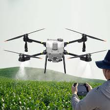
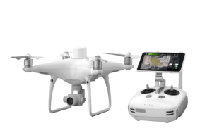
Hands-on Field Experience: Train on professional-grade gear like the DJI Matrice and Mavic RTK series.
Advanced Mapping & GIS: Learn digital photogrammetry, 3D modeling, and topographic mapping.
Flexible Locations: Join us at our Ikeja (Lagos), Jabi (Abuja), or Port Harcourt campuses.
Upcoming Session: Our Drone Pilot for Beginners to Professional course starts January 22, 2026. [Click here to reserve your spot!]
3. Top Safety Tips for Surveying in Nigeria
Safety in 2026 isn’t just about avoiding crashes; it’s about protecting your data and reputation.
Pre-Flight: The Geoinfotech Gold Standard
Check No-Fly Zones: Use the Geoinfotech Drone Fly Zone Map to identify restricted areas near airports, military barracks, and government buildings.
Calibrate Your IMU: Nigeria’s magnetic variances can cause drifting. Always calibrate at your specific takeoff site.
Heat Management: In the 35°C+ heat of a Nigerian afternoon, monitor battery temperatures to prevent mid-air power failures.
During the Mission: Data Integrity
The Overlap Rule: Maintain at least 70% frontal and 60% side overlap for high-quality 3D reconstructions.
GNSS Monitoring: Ensure a strong GPS/Galileo lock before takeoff for centimeter-level accuracy.
4. Why Certification is Your Best Career Move
High-paying contracts in Oil & Gas (NDDC), Agriculture (CBN projects), and Infrastructure now mandate certified drone operators. Training with Geoinfotech gives you a recognized Certificate of Completion and the skills to generate revenue immediately.