As Nigeria’s population continues its rapid ascent—projected to surpass 235 million in 2026—the pressure on our land resources has reached a boiling point. From the urban sprawl of Lagos and Kano to the agricultural heartlands of the Middle Belt, the “old way” of manual land administration is no longer sufficient.
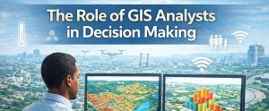
Geographic Information Systems (GIS) and Remote Sensing (RS) are the backbones of modern, data-driven decision-making. In this post, we explore why these tools are the ultimate game-changers for sustainable land-use planning in Nigeria today.
1. Monitoring Rapid Urbanization in Real-Time
Nigerian cities are expanding faster than traditional planners can track. Conventional surveying is often slow and costly. Remote Sensing uses high-resolution satellite imagery (like Sentinel-2 or Landsat 9) to provide a “bird’s-eye view” of urban expansion in cities like Ibadan, Port Harcourt, and Uyo.
Change Detection Analysis: Planners can now see exactly where informal settlements are springing up and where green spaces are being lost.
Proactive Zoning: This allows for data-backed zoning rather than reactive “firefighting” after structures are already built.
2. Eliminating the Chaos of “Double Allocation”
One of the biggest headaches in Nigerian land administration is the manual filing system, which often leads to conflicting land titles.
Digital Land Registries: Systems like the Abuja Geographic Information System (AGIS) and Lagos State e-GIS create a “Single Version of Truth.”
Unique Digital Footprints: By linking plots to precise GPS coordinates, the government can reduce land disputes by up to 40% and speed up the issuance of Certificates of Occupancy (C of O).
3. Precision Flood Mapping and Disaster Management
With the increased frequency of flash floods in 2025 and 2026, planning without environmental data is a recipe for disaster.
Hydrological Modeling: GIS allows planners to identify high-risk flood zones by analyzing Digital Elevation Models (DEMs).
Climate Resilience: This data is essential for the 2026 “Green City” mandates being adopted across the Federation to ensure new developments are built on safe, sustainable ground.
4. Smarter Infrastructure Placement
Where should the next hospital go? What is the best route for a new rail line in Lagos?
Through Multi-Criteria Evaluation (MCE), planners can layer data—population density, soil types, and proximity to utilities—to find the “Golden Site” for any infrastructure project. This ensures maximum ROI for government and private developers alike.
Comparison: Traditional vs. GIS-Driven Planning
| Feature | Traditional Planning | GIS & Remote Sensing (2026) |
| Data Speed | Months of field surveys | Real-time satellite & drone updates |
| Accuracy | High margin of human error | Precision within centimeters (RTK/GNSS) |
| Storage | Fragile paper archives | Secure, searchable cloud databases |
| Visualization | 2D static paper maps | 3D Digital Twins and simulations |
5. Boosting Internally Generated Revenue (IGR)
For state governments, land is a primary revenue source. Satellite-based property enumeration allows states to identify every building within their borders—even those “invisible” to traditional tax collectors. Integrating GIS with billing systems automates ground rent and property tax, funding the infrastructure the public deserves.
2026 Must-Have Skills for Nigerian Planners
Being “GIS-literate” is no longer optional. The industry has moved toward:
QGIS & ArcGIS Pro: The global standards for spatial analysis.
Google Earth Engine: For large-scale environmental monitoring.
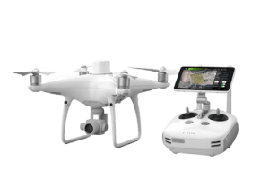
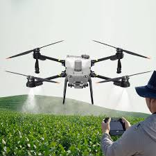
Drone Mapping: For high-resolution site planning and 3D modeling.