Document

How DGNSS and Drone Surveying are Revolutionising Land Surveying and the Mining Industry 

 1. Introduction

Surveying and mining are precision-driven industries where accuracy, efficiency, and safety are paramount. Traditionally, surveyors relied on tools like theodolites, total stations, and standalone GNSS, which were effective but limited by time, cost, and accessibility. Today, two disruptive technologies—Differential Global Navigation Satellite Systems (DGNSS) and Drone (Unmanned Aerial Vehicle, UAV) surveying—are reshaping how land is mapped, monitored, and managed.

These innovations are not only streamlining land boundary surveys, cadastral mapping, and urban planning, but are also revolutionizing the mining industry by improving exploration, production, and environmental compliance. Together, DGNSS and drone technologies form the backbone of the emerging era of “Smart Surveying” and “Digital Mining.”

2. Differential GNSS (DGNSS): Enhancing Positional Accuracy

2.1 Principle of DGNSS

DGNSS uses a network of ground reference stations to correct satellite-based GNSS signals. This reduces errors from atmospheric interference and satellite geometry, providing sub-meter to centimeter-level positioning accuracy compared to the 5–10 m accuracy of standalone GPS.

2.2 Applications DGNSS in Land Surveying

  • Cadastral Surveys: High-precision mapping for secure land tenure, reducing disputes.
  • Engineering Surveys: Used in roads, pipelines, dams, and estate development.
  • Environmental Studies: Mapping wetlands, floodplains, and erosion-prone areas.

2.3 Applications DGNSS in Mining

  • Mine Design & Planning: Accurate pit layouts and haul-road alignments.
  • Machine Guidance: Real-time GNSS for autonomous mining trucks and drilling rigs.
  • Safety: Precision in monitoring slope stability and blast zones.


3. Drone Surveying: Aerial Intelligence for Land and Mining

3.1 Concept and Technology of Drone

Drone surveying involves UAVs equipped with high-resolution cameras, LiDAR scanners, or multispectral sensors. These devices capture georeferenced images, which are processed into orthomosaics, 3D point clouds, and digital terrain/elevation models (DTMs/DEMs).

3.2 Applications of Drone in Land Surveying

  • Rapid Topographic Mapping: Surveying large parcels of land in hours instead of weeks.
  • Urban Planning and Estate Development: Producing 3D models for city expansion and real estate projects.
  • Environmental Monitoring: Vegetation cover analysis, flood mapping, and watershed studies.

3.3 Applications in Mining

  • Stockpile Volume Estimation: Precise volumetric analysis for inventory management.
  • Geological Exploration: Detecting surface features linked to mineralization.
  • Operational Monitoring: Real-time updates on mine progress and compliance reporting.
  • Risk Mitigation: Drone-based inspections of tailings dams, pit walls, and inaccessible areas.
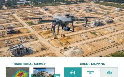
DGNSS and drone surveying in Nigeria revolutionizing land and mining projects with accuracy and efficiency

dgnss-drone-surveying-nigeria.jpg

4. The DGNSS–Drone Synergy

Individually, both technologies are powerful; combined, they provide a game-changing solution:

  • DGNSS provides Ground Control Points (GCPs) that enhance drone image georeferencing to centimetre accuracy.
  • Integrated workflows yield survey-grade orthophotos and 3D models.
  • This synergy enables digital twins of land parcels and mining sites, forming the basis for smart monitoring and AI-driven analytics.

Example: In an open-pit mine, drones map daily operations, while DGNSS ensures positional accuracy. This integration allows mine managers to calculate daily extraction volumes, optimize equipment usage, and monitor environmental impact with precision.

 5. Benefits and Innovations of Drones

5.1  For Land Surveying

  • Accuracy: In land surveying, drones can measure or acquire centimetre-level cadastral data for secure land tenure systems.
  • Efficiency: With drone surveys that previously took weeks,s are now completed in hours, and
  • Transparency: Drone creates high-resolution maps that support governance and land reforms.

5.2   For Mining

  • Operational Cost Savings: In mining, drone reduces manual labor and equipment downtime,
  • Enhanced Safety: Reduces human exposure to dangerous mining environments, and
  • Sustainability: Monitors reclamation, water management, and environmental compliance.

5.3   Innovative Trends of DGNSS and Drone

  • Drone + RTK/PPK GNSS Integration: Direct centimeter-level accuracy without extensive GCPs,
  • AI-Driven Analytics: Automated feature extraction (roads, stockpiles, vegetation),
  • UAV Swarms: Coordinated drones covering vast mine areas simultaneously, and
  • Digital Twins and Smart Mines: 3D virtual replicas for planning and simulation.
6. Global and Regional Perspectives

  • Globally: Mining giants in Australia, Canada, and South Africa are pioneering autonomous GNSS-guided trucks and drone monitoring to boost productivity.
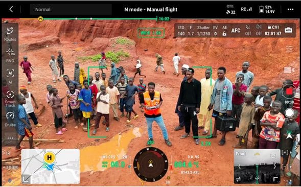
  • In Africa and Nigeria: UAVs are increasingly used for artisanal mining regulation, cadastral reform, and environmental monitoring. Nigerian universities and agencies are also piloting DGNSS infrastructure to support national land administration systems.

 7. Challenges and Limitations

Besides the benefits of DGNSS and drone they have challenges and limitations which are outlined as follows:

  • Regulatory Barriers: Strict airspace restrictions for drones in many countries,
  • High Initial Costs: Advanced UAVs and GNSS equipment require significant investment,
  • Skill Gaps: Need for specialized training in UAV piloting, GNSS processing, and GIS analysis, and
  • Data Management: Processing and storing large datasets from UAV surveys can be resource-intensive.


8. Future Viewpoint

The future of surveying and mining lies in automation, integration, and intelligence:

  • Autonomous Drones: AI-controlled UAVs conducting continuous real-time surveys,
  • 5G Connectivity: Enabling real-time GNSS corrections and live UAV video feeds,
  • Blockchain in Land Administration: Securing cadastral records linked with GNSS-based surveys, and
  • Sustainable Mining Practices: UAV-based reclamation monitoring and biodiversity assessment.


9. Conclusion

The integration of DGNSS and drone surveying marks a paradigm shift in land surveying and mining. Together, they provide the tools for a future defined by precision, efficiency, safety, and sustainability. What once took days of laborious fieldwork is now achievable in hours, with higher accuracy and richer insights.

As governments, surveyors, and mining corporations adopt these technologies, we are entering a new era of digital surveying and smart mining, the one that will fundamentally transform how land and natural resources are managed in the 21st century.


References

  • Baku, R. K., & Kumah, P. (2020). Application of Drone Technology in Mining Operations: A Case Study. Journal of Mining and Geology, 56(2), 123–135.
  • Enemark, S. (2010). Land Governance: Institutional and Policy Frameworks. FIG Congress, Sydney.
  • Wolf, P. R., & Ghilani, C. D. (2012). Elementary Surveying: An Introduction to Geomatics. Pearson Higher Education.
  • Olaleye, J. B., & Abiodun, A. (2018). Applications of GNSS and UAV in Modern Surveying Practice. Journal of Geomatics, 12(1), 45–59.
  • Petrov, M. (2021). UAV and DGNSS Integration for Mining Surveys. International Journal of Mining Science and Technology, 31(4), 567–579.
  • Tang, L., & Shao, G. (2015). Drone Remote Sensing for Forestry and Ecology. International Journal of Remote Sensing, 36(14), 1–23.

RECENT ACTIVITIES AND PROJECT...

URABN HEAT ISLAND EFFECT IN CALABAR MUNICIPAL

URABN HEAT ISLAND EFFECT IN CALABAR MUNICIPAL

ANALYZING URBANIZATION TRENDS IN KANO STATE, NIGERIA USING NIGHTTIME LIGHTS REMOTE SENSING DATA

ANALYZING URBANIZATION TRENDS IN KANO STATE, NIGERIA USING NIGHTTIME LIGHTS REMOTE SENSING DATA

COMPREHENSIVE OFFSHORE SURVEILLANCE AND MARITIME INFRASTRUCTURE MONITORING

COMPREHENSIVE OFFSHORE SURVEILLANCE AND MARITIME INFRASTRUCTURE MONITORING

Comprehensive Aerial Survey and Mapping for Golf Course Asset Management at Lakowe Golf Lake

Comprehensive Aerial Survey and Mapping for Golf Course Asset Management at Lakowe Golf Lake

Professional Drone Training Program for Enhanced Corporate Security Operations at Sahara Group

Professional Drone Training Program for Enhanced Corporate Security Operations at Sahara Group

Advanced Aerial Topographic Survey and Mapping for Land Development in Ogun State

Advanced Aerial Topographic Survey and Mapping for Land Development in Ogun State

Precision RGB and Thermal Imaging Revolutionizes Solar Infrastructure Inspection In Enugu

Precision RGB and Thermal Imaging Revolutionizes Solar Infrastructure Inspection In Enugu

Advanced Drone-Based Topographic Survey for Precision Land Development Planning

Advanced Drone-Based Topographic Survey for Precision Land Development Planning

Mapping the Future: Comprehensive Area Survey Transforms Land Development in Akure

Mapping the Future: Comprehensive Area Survey Transforms Land Development in Akure

Precision Topographical Survey and Mapping for Smarter Infrastructure Planning

Precision Topographical Survey and Mapping for Smarter Infrastructure Planning

Precision Drone Volumetric Surveys: How Purechem Industries Optimized Mineral Stockpile Management

Precision Drone Volumetric Surveys: How Purechem Industries Optimized Mineral Stockpile Management

Advanced Mapping & Environmental Survey for Ilubirin Property, Lagos Island

Advanced Mapping & Environmental Survey for Ilubirin Property, Lagos Island

Unveiling the Invisible: LiDAR Technology Transforms Terrain Analysis in Abeokuta North

Unveiling the Invisible: LiDAR Technology Transforms Terrain Analysis in Abeokuta North

 DETAILED AERIAL, LAND SURVEY AND GIS ANALYSIS FOR ADVANCED REAL ESTATE DEVELOPMENT

 DETAILED AERIAL, LAND SURVEY AND GIS ANALYSIS FOR ADVANCED REAL ESTATE DEVELOPMENT

Professional Drone Mapping and GIS Training For ETA-ZUMA Mining Company

Professional Drone Mapping and GIS Training For ETA-ZUMA Mining Company

Installation of Intelligent Traffic Lights

Installation of Intelligent Traffic Lights

Geological Report on a Mining/Exploration Survey

Geological Report on a Mining/Exploration Survey

Drone Survey and Mapping of Shaishen Foods Limited

Drone Survey and Mapping of Shaishen Foods Limited

Lidar Topographic Mapping Project

Lidar Topographic Mapping Project

Geophysical/hydrogeophysical Studies for Groundwater Development

Geophysical/hydrogeophysical Studies for Groundwater Development

Togo Digital Terrain Model Project

Togo Digital Terrain Model Project

Drone Mapping of Parts of Lome Rail Line for Graceland Energy Located at Lome Togo

Drone Mapping of Parts of Lome Rail Line for Graceland Energy Located at Lome Togo

Drone/land Survey of Pure-chem Industrial Limited, Ogun State.

Drone/land Survey of Pure-chem Industrial Limited, Ogun State.

Drone Inspection/survey of Southern Lake Estate, Chevron, Lekki, Lagos State

Drone Inspection/survey of Southern Lake Estate, Chevron, Lekki, Lagos State

Anniversary-Workshop on the Application of Remote Sensing and Drone Technology in GIS -Abuja

Anniversary-Workshop on the Application of Remote Sensing and Drone Technology in GIS -Abuja

Topographic Mapping of Oyo State

Topographic Mapping of Oyo State

Topographic Mapping of Part of the Local Government Areas in Oyo State

Topographic Mapping of Part of the Local Government Areas in Oyo State

Topographic Mapping of Part of Kwara, Ekiti and Kogi State Local Government Area

Topographic Mapping of Part of Kwara, Ekiti and Kogi State Local Government Area

Political Map of South West, Nigeria Located in Nigeria

Political Map of South West, Nigeria Located in Nigeria

Topographic Mapping of Parts of Niger State Located at Niger State, Nigeria

Topographic Mapping of Parts of Niger State Located at Niger State, Nigeria

Topographic Mapping of Part of Kwara, Ekiti, and Kogi State Local Government Area Located in Nigeria

Topographic Mapping of Part of Kwara, Ekiti, and Kogi State Local Government Area Located in Nigeria

Topographic Mapping of Part of Kwara State Local Government Area Located at Kwara State Nigeria

Topographic Mapping of Part of Kwara State Local Government Area Located at Kwara State Nigeria

Flood Analysis of Amuwo-odofin Orthophoto.

Flood Analysis of Amuwo-odofin Orthophoto.

Site Inspection Using Drone of Water Corporation Located at Oke-aro Agege

Site Inspection Using Drone of Water Corporation Located at Oke-aro Agege

24,000 meter Lome Rail Line for Drone Mapping, Graceland Energy Located at Lome, Togo

24,000 meter Lome Rail Line for Drone Mapping, Graceland Energy Located at Lome, Togo

10 Drone Inspection Traffic Signal in Lagos

10 Drone Inspection Traffic Signal in Lagos

Lagos October 1st Free GIS Training Workshop

Lagos October 1st Free GIS Training Workshop

Osun state parcel project

Osun state parcel project

Drone Mapping & Vectorization Of Abu-allied Farm

Drone Mapping & Vectorization Of Abu-allied Farm

Proposal for aerial deployment, tracking and monitoring of threats in victoria island phase 1 and ikoyi phase 2, nigeria

Proposal for aerial deployment, tracking and monitoring of threats in victoria island phase 1 and ikoyi phase 2, nigeria

Jabi Lake Mall Solar Inspection – Abuja

Jabi Lake Mall Solar Inspection – Abuja

Ground Control and Drone Survey for Mast 3D Modeling

Ground Control and Drone Survey for Mast 3D Modeling

Telecom Drone 3D and 2D Modeling of Cellsite

Telecom Drone 3D and 2D Modeling of Cellsite

Free GIS Spatial Analysis Training (Lagos Branch)

Free GIS Spatial Analysis Training (Lagos Branch)

800 Building Plots Aerial Capture and Delineation for Database. Greenfield Estate

800 Building Plots Aerial Capture and Delineation for Database. Greenfield Estate

100 Hectares Aerial Survey with Differential GPS of High Accuracy

100 Hectares Aerial Survey with Differential GPS of High Accuracy

Protected: Nigeria Crime Report and Dashboard

Protected: Nigeria Crime Report and Dashboard

Drone Survey and Mapping – Victoria Island  Copy

Drone Survey and Mapping – Victoria Island Copy

Akwa-Ibom 500 Hectares Drone Survey and Mapping in Nigeria

Akwa-Ibom 500 Hectares Drone Survey and Mapping in Nigeria

Ground Control Establishment – Republic of the Niger – Kano, Kastina, Jigawa, Kaduna

Ground Control Establishment – Republic of the Niger – Kano, Kastina, Jigawa, Kaduna

Drone Survey and Mapping – Victoria Island

Drone Survey and Mapping – Victoria Island

Control Point Establishment – DGPS

Control Point Establishment – DGPS

Land Survey – Northern Nigeria

Land Survey – Northern Nigeria

Biodiversity Mapping – Sweden

Biodiversity Mapping – Sweden

Flood Impact Mapping – United Kingdom

Flood Impact Mapping – United Kingdom

M and E GIS Dashboard for Control Establishment Project

M and E GIS Dashboard for Control Establishment Project

Geodatabase Management System Training For National Boundary Commission

Geodatabase Management System Training For National Boundary Commission

Nigeria Topographic Map – Project

Nigeria Topographic Map – Project

Abuja Training on Introduction to GIS

Abuja Training on Introduction to GIS

200 Hectares Land and Drone Survey – Lagos Nigeria

200 Hectares Land and Drone Survey – Lagos Nigeria

Inspection of 30 hectares drainage

Inspection of 30 hectares drainage

Drainage Drone Mapping and Surveying in Lagos Nigeria

Drainage Drone Mapping and Surveying in Lagos Nigeria

GIS Cadastral Mobile Application

GIS Cadastral Mobile Application

Abuja Topographical Map – HD GIS Mapping

Abuja Topographical Map – HD GIS Mapping

Ground Topography Survey (Lagos Island)

Ground Topography Survey (Lagos Island)

2.7km2 Topography Survey in Snake Island

2.7km2 Topography Survey in Snake Island

GIS Masterclass

GIS Masterclass

Sokoto Contour Map

Sokoto Contour Map

NDVI Vegetation Assessment in Lagos State

NDVI Vegetation Assessment in Lagos State

Lagos drone training master class

Lagos drone training master class

Ifako drone topographic survey and mapping

Ifako drone topographic survey and mapping

CMD Lagos 3D mapping aerial modeling

CMD Lagos 3D mapping aerial modeling

GIS and Drone Masterclass

GIS and Drone Masterclass

Drone aerial survey and mapping – Lagos Island _ Somolu

Drone aerial survey and mapping – Lagos Island _ Somolu

Covid-19 | Nigeria Data Visualisation

Covid-19 | Nigeria Data Visualisation

Benue Flood Analysis

Benue Flood Analysis

Aerial photography Ile-Ife Osun State

Aerial photography Ile-Ife Osun State

Kenya Forest Project

Kenya Forest Project

Tunsun Consultants Ltd

Tunsun Consultants Ltd

Introduction To Gis In Maritime at the National Boundary Commission

Introduction To Gis In Maritime at the National Boundary Commission

Training on GIS and Drone Mapping (batch-4 & 5)

Training on GIS and Drone Mapping (batch-4 & 5)

Osun Flood Mapping

Osun Flood Mapping

Lahass International Limited

Lahass International Limited

Linguistic Association of Nigeria

Linguistic Association of Nigeria

West African Indexing Services

West African Indexing Services

Lagos Ikeja Road Network Map

Lagos Ikeja Road Network Map

LASU Land Regularisation Portal

LASU Land Regularisation Portal

Lingua Plus International

Lingua Plus International

Lagferry Web Route

Lagferry Web Route

YOU MAY ALSO LIKE...

COURSES

Explore Geoinfotech courses and establish a strong foundation of knowledge and skills to be productive with the latest Technology.

Differential GPS (DGPS) Land Surveying Training

Professional 2 weekends ▪ Field Experience 5.0 (100% Practical) ▪ Exam & CertificateFree Software and AppsHands on Practical and Field…

Find out more

Drone Pilot for Beginners to Professional

The Drone Professional Training course is a comprehensive program designed to equip participants with the necessary skills and knowledge to operate drones effectively and safely in a professional setting.
Duration: 3 Weekends (Every Friday 2pm and Saturday 10am)
Package: Field Experience, 100% Hands-on practical, jotter, Biro and Software Others, Test, Exam and Certificate.

Find out more
Training Venue Available in,Lagos and Abuja100253Nigeria
+ Google Map

1000 University Student in Drone and GIS

This course is designed to equip university students with the essential knowledge and practical skills needed to become proficient in…

Find out more

Training on AutoCAD for Surveying and Mapping

Duration: 4 Weekends (Every Friday 2pm and Saturday 10am)
Package: Field Experience, 100% Hands-on practical, jotter, Biro and Software Others, Test, Exam and Certificate.

Find out more
Training Venue Available in,Lagos and Abuja100253Nigeria
+ Google Map