What’s the Difference and Which One Wins in the Field?
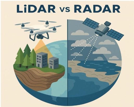
In the fast-evolving world of geospatial technology, surveyors, mappers, and remote sensing professionals have more powerful tools than ever before. Two of the biggest players: LiDAR and Radar. While they might sound strange, each serves a unique and crucial role in modern-day surveying.
So, which one is better? Or rather — when should you use which? Let’s break it down in a way that makes sense.
What is LiDAR?
LiDAR (Light Detection and Ranging) uses laser pulses to measure distances between a sensor and objects on Earth’s surface. It creates incredibly detailed 3D models, even distinguishing between tree canopies, ground, and buildings.
LiDAR Highlights:
- Uses laser light (infrared or near-infrared).
- Very high spatial resolution – cm-level accuracy.
- Great for Digital Elevation Models (DEMs), forestry, urban planning, archaeology, and coastal modeling.
- Often mounted on drones, airplanes, or vehicles.
Example Scenario:
A drone flies over a forest using LiDAR and maps the bare ground, even under thick canopy — revealing an ancient footpath used centuries ago.
Survey Instruments That Use LiDAR Technology
LiDAR technology powers a range of precision surveying instruments used across industries:
1. Aerial LiDAR Systems
- Mounted on drones (UAVs) or airplanes.
- Used for creating high-resolution Digital Elevation Models (DEMs) and 3D terrain maps.
- Examples: DJI Zenmuse L1, RIEGL VUX-1, Teledyne Optech ALTM series.
2. Mobile LiDAR Scanners
- Mounted on vehicles, often for highway mapping or city modeling.
- Combines LiDAR with GNSS and IMUs for dynamic scanning.
- Examples: Leica Pegasus:Two, Trimble MX9.
3. Terrestrial Laser Scanners (TLS)
- Tripod-based systems for static, high-detail scans of buildings, tunnels, and infrastructure.
- Often used in civil engineering, heritage documentation, and construction monitoring.
- Examples: FARO Focus 3D, Leica RTC360, RIEGL VZ-400i.
What is Radar?
Radar (Radio Detection and Ranging) works by bouncing radio waves off surfaces. It’s particularly good at seeing through clouds, fog, and vegetation, making it ideal for wide-area and weather-independent surveys.
Radar Highlights:
- Uses microwaves or radio waves.
- Works in all weather and day/night.
- Excellent for large-area monitoring, flood detection, ground movement, and subsurface scanning (with GPR).
- Commonly used in satellites (SAR/InSAR) and ground-based systems.
Example Scenario:
After a major earthquake, InSAR satellites use radar to detect subtle ground shifts in urban areas, helping emergency planners allocate resources.
Survey Instruments That Use Radar Technology
Radar is used in both surface and subsurface applications, and often deployed in weather-tolerant or wide-area survey systems:
1. Synthetic Aperture Radar (SAR) Satellites
- Mounted on satellites or aircraft.
- Enables InSAR (Interferometric SAR) for monitoring ground deformation, landslides, and urban subsidence.
- Examples: Sentinel-1 (ESA), TerraSAR-X (DLR), RADARSAT-2 (Canada).
2. Ground Penetrating Radar (GPR)
- Used for subsurface investigations — detects pipes, voids, and archaeological remains.
- Frequently used in geotechnical surveys, utility detection, and forensics.
- Examples: GSSI SIR 4000, Mala Easy Locator, IDS GeoRadar Stream DP.
3. Ground-Based SAR (GBSAR) Systems
- Installed at fixed locations to monitor slow-moving landslides, infrastructure, or dams.
- Provides high-resolution deformation monitoring over time.
- Examples: IDS GeoRadar IBIS-FM EVO, Reutech MSR series.
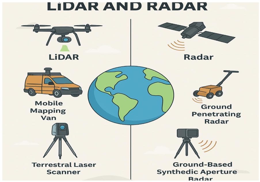
Head-to-Head Comparison: LiDAR vs Radar instruments
| Feature | LiDAR | Radar |
|---|---|---|
| Sensor Type | Laser pulses | Radio/microwave waves |
| Resolution | High (cm-level) | Moderate to low |
| Weather Tolerance | Limited (can be affected by fog/cloud) | Excellent (penetrates clouds, rain) |
| Vegetation Penetration | Good (with some limitations) | Excellent (can sense ground below canopy) |
| Subsurface Detection | No | Yes (GPR) |
| Platforms | Drones, aircraft, mobile | Satellites, aircraft, ground systems |
| Ideal Use | High-detail topography, urban, forests | Wide-area monitoring, underground scans |
When to Use Each One?
- Use LiDAR when:
You need precise elevation data, detailed 3D modeling, or are working in complex terrains like forests or cities. - Use Radar when:
You want to monitor deformation, map flood-prone zones, scan below the surface, or work in cloudy/rainy regions.
Can They Work Together?
Absolutely! Many high-end geospatial projects combine both:
- LiDAR gives the fine detail.
- Radar brings all-weather consistency and broader context.
Together, they create a complete, resilient mapping solution.


