When you open a map on your phone or scroll through satellite imagery online, you’re actually interacting with something more profound: spatial data. It’s the fuel behind Geographic Information Systems (GIS), and it answers not just what and why, but where.
What Is Spatial Data?
Spatial data, also called geospatial data, refers to information that has a geographic component. It is data that is tied to a specific location on the Earth. it tells you “where something is”, “What it is” and “What’s around it”. Spatial data is used to analyze and understand phenomena in relation to their spatial context.
Types of spatial data
There are two main types of spatial data: vector and raster.
Vector Data:
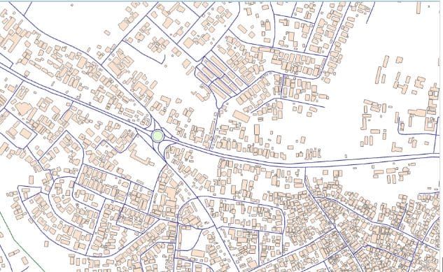
Vector data is like digital sketching. In simpler terms, it is drawing the World with Points, Lines, and Polygons. It represents features as:
- Points: A single coordinate pair. Used for things like trees, wells, or lamp posts.
- Lines: Connecting two or more points. Think of roads, rivers, or pipelines.
- Polygons: Closed shapes. These represent areas like parks, lakes, or city boundaries.
Each vector feature can have associated attribute data—a table that tells you more about it. For example, a point might represent a hospital, and its attributes could include name, capacity, and emergency services.

Raster Data:
Painting the World with Pixels
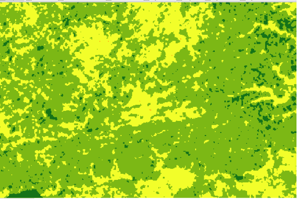
Raster data is a grid of cells (pixels), each with a value. It’s like a photo or heatmap, perfect for representing things that change continuously across space, like: Elevation, temperature, satellite imagery, land cover. Each pixel has a resolution—for instance, a 10-meter resolution means each pixel represents a 10×10 meter area on the ground.

Why Is Spatial Data Important?
- In urban planning to determine where to site infrastructures, analyze population density, road networks, and available land.
- It is used in navigation and transportation such as GPS systems, traffic apps and route optimization.
- Agriculture benefits from spatial data in precision farming, enabling better crop planning and resource management
- In environmental monitoring to track deforestation, urban sprawl, wide life habitats and assess climate change using satellite imagery.
- In Disaster Management to predict risks, plan excavations and coordinate emergency response efforts.
- In Business, location data is used to identify market gaps, optimize logistics and target customers more effectively.
Sources of Spatial Data?
- Government Portals: e.g., USGS, Bhuvan, OpenStreetMap.
- Remote Sensing: Satellites like Sentinel and Landsat offer high-quality raster data.
- GPS Devices: Field data collection for accurate location-based input.
- Drones: High-resolution aerial imagery for small to medium areas.
Working with Spatial Data
To explore spatial data effectively, you need tools or software such as QGIS, ArcGIS, Google Earth Engine, MapInfo, Erdas Imagine, Locus map etc.
Exploring spatial data is like putting on a new pair of glasses—you start to see the connections between people, places, and patterns. Whether you’re solving a local issue or studying global trends, spatial data is the compass that guides smart decisions.
If you are looking to harness the power of spatial data for your organization, Geoinfotech offers professional GIS solutions tailored to your needs. contact us at https://geoinfotech.ng/contact-geoinfotech-technology-contact-us/


