Technology is advancing quickly, and one of the most exciting developments is the combination of Geographic Information Systems (GIS) and Artificial Intelligence (AI). Together, they are changing the way we analyze locations and spaces, bringing new insights that were once hard to imagine.
What Are GIS and AI?
GIS is a system used to capture, store, and analyze data related to locations on Earth. It’s used in many fields, from city planning and environmental protection to navigation and transportation. However, as the amount of data we collect grows, traditional GIS systems are struggling to keep up. AI, particularly through machine learning (ML) and deep learning (DL), has the power to process large amounts of data, recognize patterns, and even make predictions. By combining AI with GIS, we can analyze spatial data in ways that were never possible before.
How AI Improves GIS
When AI is added to GIS, it unlocks many new possibilities. Here’s how AI enhances the capabilities of GIS:
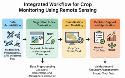
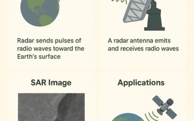
- Faster Data Analysis and Pattern Recognition: AI can quickly go through huge datasets and find patterns or unusual trends that might not be obvious to humans. This is especially helpful in areas like environmental monitoring, where AI can analyze satellite images to track changes in forests, urban areas, or agriculture. For example, AI can automatically sort through satellite images to see how land is being used or monitor the health of crops. These insights help predict agricultural productivity, track climate change, or even plan for natural disasters.
- Better Predictions: By combining GIS with AI, we can create models that predict future events more accurately. These models can forecast things like traffic trends, population growth, or environmental changes. City planners, for instance, can use these predictions to plan roads, optimize public transport, or prepare for natural disasters like flooding. In emergency situations, AI can help predict where a wildfire or hurricane will move next, giving officials valuable time to respond.
- Improved Image Recognition: AI is great at analyzing images and recognizing objects within them. For example, AI can process satellite or drone images to identify buildings, roads, and other objects. This is useful in everything from mapping cities to monitoring wildlife in nature reserves. In environmental protection, AI can automatically analyze aerial images to track illegal activities like deforestation or poaching.
- Real-Time Data Processing: With the rise of connected devices (the Internet of Things), we now collect real-time data from all sorts of sensors. AI helps process this live data, allowing for immediate responses to changing conditions. For example, in smart cities, real-time traffic data combined with AI can adjust traffic signals to reduce congestion. In other situations, AI can analyze weather or air quality data from sensors to give real-time updates.
Where AI-Enhanced GIS Is Making a Difference
The combination of AI and GIS is changing many industries. Here are some key examples:
- City Planning and Smart Cities: AI-enhanced GIS helps cities manage traffic, utilities, and air quality in real time.
- Agriculture: Farmers can use AI-powered GIS to monitor crops, predict yields, and make farming more efficient and sustainable.
- Environmental Protection: AI-GIS systems help track wildlife, monitor deforestation, and study climate change.
- Disaster Response: AI models help predict natural disasters, plan evacuations, and assess damage.
- Logistics: Companies use AI and GIS to optimize delivery routes, track shipments, and manage fleets.
Challenges and Things to Consider
While the mix of AI and GIS is very promising, there are some challenges. AI models rely on good-quality data, and sometimes spatial data is incomplete or outdated. Additionally, AI can be complex, making it hard for non-experts to fully understand how the results are generated.
There are also ethical concerns. Using AI to analyze location data could lead to privacy issues, especially when it involves monitoring public or private spaces. These concerns highlight the need for responsible use of the technology and clear rules to protect privacy.
The Future of GIS and AI
As AI continues to improve, its use in GIS will grow, becoming even more powerful and user-friendly. In the future, we can expect tools that provide real-time insights, make accurate predictions, and are easy to use even for non-technical people.
In the coming years, AI-enhanced GIS will become essential in fields like city planning, environmental conservation, and logistics. This new era of spatial analysis is just beginning, and it promises to help us solve some of the world’s most pressing challenges.
Conclusion
The combination of GIS and AI is opening up new possibilities for understanding the world around us. By bringing together the power of location-based data and the intelligence of AI, we are entering a new phase of spatial analysis that will allow for faster, smarter, and more accurate decisions. The future looks bright, and the potential for innovation is limitless.
Compiled and written by: Adesimisola Osikalu


