Raster data forms a core part of spatial analysis from satellite imagery to digital elevation models (DEMs). In this part of the series, we’ll explore what raster data is, how to load it into QGIS, and how to perform basic analysis and visualization.
What is Raster Data?
Raster data represents the world as a grid of cells (pixels), where each cell holds a value representing information such as reflectance, elevation, temperature, etc. Unlike vector data (points, lines, polygons), raster data is continuous and ideal for representing surfaces and phenomena that vary over space.
Examples of raster data include:
- Satellite imagery (e.g., Landsat, Sentinel)
- Digital Elevation Models (DEMs)
- Temperature or rainfall grids
- Land use/land cover classifications
How to Load Raster Data in QGIS
Method 1: Using the Browser Panel
- Open QGIS and locate the Browser panel on the left.
- Navigate to the folder containing your .tif or .img file.
- Drag and drop the raster file into the map canvas.
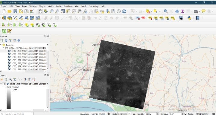
Understanding the Layer
Once added, the raster may appear in grayscale or coloured depending on its values.
- Single-band raster: Usually shows in grayscale
- Multi-band raster: (e.g., satellite image with RGB) can be rendered as a colour image
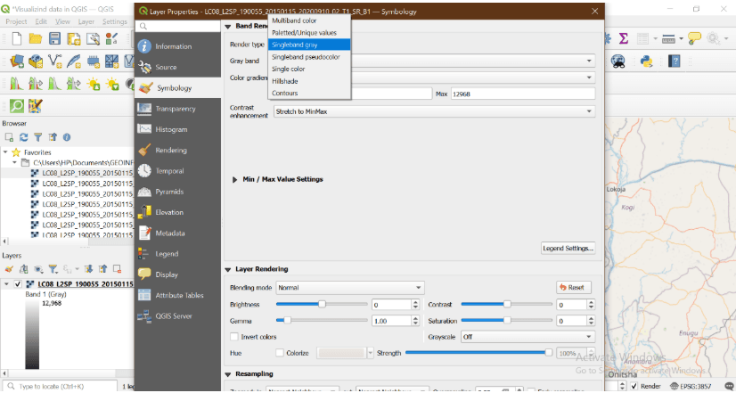
To check this:
- Right-click the layer → Properties → Symbology
- Choose Render type (e.g., Singleband gray, Multiband color)
Changing Raster Appearance
You can enhance the raster’s appearance by:
- Adjusting contrast enhancement (Stretch to MinMax or Histogram Equalize)
- Applying color ramps (e.g., terrain, magma, etc.)
- Setting no data values to make transparent areas clearer
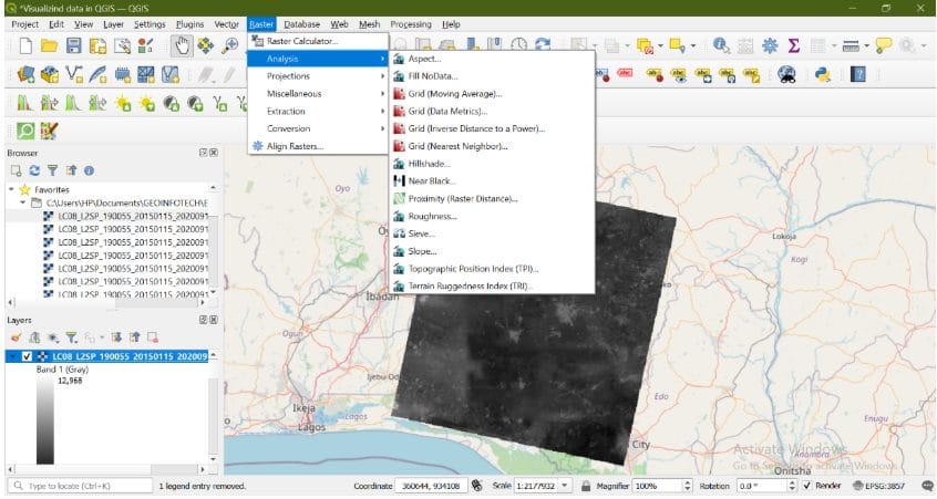
Basic Raster Operations in QGIS
You can also perform simple raster analyses:
- Raster Calculator: Perform math operations between raster layers
- Clip Raster by Mask Layer: Crop to a boundary shapefile
- Slope/Aspect/Contour (for DEMs): Use from Raster > Analysis
Example Use Case
Let’s say we’re working with a DEM for flood risk analysis in Lagos. We can load the DEM, visualize elevation with a colour ramp, and extract low-lying areas by applying filters in the raster calculator.
This kind of application makes raster data critical for decision-making.
Conclusion
Raster data unlocks an entirely different dimension of spatial analysis which is perfect for terrain modelling, remote sensing, and environmental monitoring. In the final post of this series, we’ll bring everything together and guide you through creating a complete map layout in QGIS ready for presentation, printing, or reporting.