Volcanoes, while spectacular, represent a serious geohazard capable of reshaping landscapes and disrupting societies in moments. Understanding, predicting, and mitigating volcanic eruptions require not only geological insight but also the integration of powerful geospatial technologies. Geographic Information Systems (GIS) and remote sensing have emerged as essential tools for real-time volcanic monitoring, risk assessment, and post-disaster recovery.
Why Volcanic Monitoring Is Evolving
Traditional monitoring methods—such as ground patrols and basic seismometers—have limited spatial coverage and reaction speed. As populations increasingly settle near volcanic zones, the margin for error narrows. That’s where the fusion of remote sensing, AI-driven analytics, and GIS platforms revolutionizes the science.
Modern volcanic surveillance isn’t just about seeing eruptions; it’s about understanding the precursors to them—magma chamber inflation, gas emissions, surface deformation, and heat anomalies. These subtle indicators are detectable through multi-source geospatial technologies, often before an eruption occurs.
Remote Sensing Technologies Powering Volcanology
| Sensor/System | Function |
|---|---|
| InSAR (Sentinel-1, ALOS-2) | Measures ground deformation with millimeter precision—ideal for detecting magma buildup. |
| MODIS (Terra/Aqua) | Detects volcanic hotspots, ash plumes, and thermal anomalies globally. |
| TROPOMI (Sentinel-5P) | Tracks volcanic gas emissions (e.g., SO₂), often used to gauge eruption likelihood. |
| Landsat & Sentinel-2 | High-resolution optical imagery for mapping lava flows and terrain changes. |
| ASTER | Thermal and topographic mapping; useful for pre/post-eruption landscape analysis. |
| VIIRS | Night-time thermal detection of hotspots over active craters or lava fields. |
These satellites provide real-time or near-real-time data accessible across the globe, enabling early detection of unusual volcanic behavior.
Ground-Based and UAV Technologies
In addition to satellites, ground instrumentation and drones play an essential role in high-resolution monitoring:
- Seismometers & GNSS stations detect deep tremors and micro-movements in the earth’s crust.
- Gas analyzers record emission composition, indicating magma proximity.
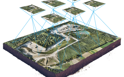
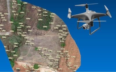
- Thermal drones and UAV photogrammetry capture centimeter-level visual and infrared data of volcanic craters, lava channels, and gas vents.
- Webcams provide constant visual feeds for public alerts and time-lapse analysis.
This network of sensors, when georeferenced and centralized via GIS, forms a comprehensive volcanic intelligence system.
GIS: The Nerve Center of Volcanic Risk Analysis
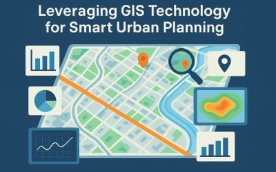
GIS integrates every data point—thermal readings, seismic activity, gas levels, land cover, population density—into spatially accurate, multi-layered maps. This empowers volcanologists, governments, and emergency managers to:
- Model lava flow paths using digital elevation models (DEMs)
- Predict ashfall patterns based on prevailing winds
- Create hazard zones and evacuation buffers
- Overlay schools, hospitals, and roads to assess vulnerability
- Coordinate emergency logistics and communications
GIS transforms raw data into actionable intelligence that can save lives and optimize response under pressure.
Post-Eruption: Recovery and Change Detection
After an eruption, GIS and remote sensing play a critical role in assessing environmental impact and guiding recovery:
- Vegetation loss and regrowth mapping
- Hydrological changes due to ash deposition
- Air and water quality monitoring
- Land suitability assessments for redevelopment or conservation
Long-term satellite records (e.g., from Landsat since the 1970s) allow comparative studies of pre- and post-eruption landscapes, supporting scientific research and informed policymaking.
Real-World Applications
- Iceland (Eyjafjallajökull 2010): GIS and satellite data modeled the ash cloud, helping redirect global air traffic during one of the largest modern disruptions.
- Hawaii (Kilauea 2018): UAVs and GIS were used to update lava flow maps daily, aiding community evacuations and emergency response.
- Indonesia (Mount Merapi): A robust GIS system combines live satellite feeds with local telemetry to generate daily risk bulletins for nearby villages.
What the Future Holds
As AI, machine learning, and satellite constellations evolve, GIS in volcanology will become even more predictive:
- AI-enhanced anomaly detection using deep learning from multi-sensor archives
- Augmented reality hazard visualization for planners and educators
- Digital twin models of volcanoes for simulating multiple eruption scenarios
- Crowdsourced geodata integrated into GIS for rapid community-level intelligence
Conclusion
The combination of volcanology, GIS, and remote sensing is not just a scientific breakthrough—it’s a civil defense strategy. Whether it’s preventing disaster, protecting infrastructure, or aiding post-eruption recovery, the spatial understanding these technologies offer is profound.
For professionals in disaster management, urban planning, environmental science, and geospatial intelligence, this is a vital frontier where tech and nature intersect.
#VolcanoMonitoring #GISForHazards #RemoteSensing #Geoinfotech #DisasterPreparedness #EarthObservation #Volcanology #SatelliteMonitoring #SmartMapping #GeospatialTechnology #UAVMapping #NaturalDisasterGIS #SentinelSatellites


