Geographic Information Systems (GIS) are transforming the real estate development industry by offering new ways to analyze and understand land, property values, and market trends. This technology helps developers, investors, and planners make smarter decisions by providing detailed maps and data about specific locations. With GIS, real estate development is becoming more efficient, data-driven, and environmentally friendly.
In this blog post, we’ll break down how GIS is changing real estate and the benefits it brings to the industry.
GIS and How Is It Used in Real Estate
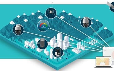
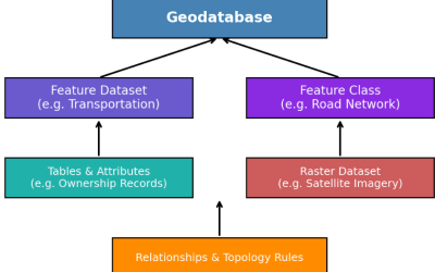
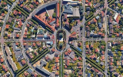
GIS is a tool that collects and analyzes geographic data. It creates visual maps showing things like land use, property boundaries, and local infrastructure. In real estate, GIS helps developers find the best locations for new projects, understand local markets, and ensure compliance with zoning laws.
By combining different types of data—such as population demographics, transportation routes, and natural features—GIS provides a comprehensive view that helps real estate professionals make informed decisions.
Keyways GIS Is Transforming Real Estate Development
Finding the Best Location
Choosing the right location for a real estate project is crucial. GIS makes this easier by allowing developers to analyze many factors at once. It can show where the best transportation routes are, which areas have schools or hospitals nearby, and where environmental risks (like flood zones) exist.
For example, if a developer is looking to build a shopping center, GIS can quickly identify which areas have good access to roads and high traffic flow, making the decision-making process faster and more accurate.
Understanding the Market
GIS helps developers understand real estate markets by mapping property values, housing demand, and population data. This allows them to spot trends and choose the right type of development for a given area.
For instance, GIS can show where a neighborhood is growing, what types of housing are in demand, and whether the area is more suited for luxury apartments or affordable housing. This helps developers plan projects that will succeed in the market.
Assessing Environmental Impact
Sustainable development is a growing priority, and GIS is useful in evaluating the environmental impact of new projects. It can analyze things like soil quality, water resources, and proximity to protected areas to ensure that development doesn’t harm the environment.
GIS can also help plan eco-friendly developments, such as solar-powered buildings, by finding the best locations with lots of sunlight. This supports greener projects that comply with environmental laws and benefit local ecosystems.
Navigating Zoning Laws
Zoning laws determine how land can be used, and GIS simplifies the process of understanding these regulations. Developers can use GIS to view zoning maps and check which areas are approved for commercial or residential development.
By using GIS, developers can avoid building in restricted zones, helping them stay compliant with local laws and avoid expensive delays.
Managing Risks
Real estate projects come with risks, like natural disasters or fluctuating markets. GIS helps developers assess risks by mapping areas prone to floods, wildfires, or earthquakes. It also allows developers to prepare for these risks by planning safe construction strategies.
In areas affected by climate change, GIS can even predict future risks, helping developers make long-term decisions that keep their investments safe.
Engaging the Community
When proposing new real estate projects, it’s important to get feedback from the community. GIS makes it easy to create visual presentations of development plans, showing how new buildings or neighborhoods will fit into the existing environment. These maps can be shared with local governments and community members to gather input, making it more likely that a project will get approval.
Benefits of GIS in Real Estate Development
Using GIS in real estate brings many benefits:
- Informed Decisions: GIS provides valuable data to help developers make better decisions.
- Cost and Time Savings: By streamlining tasks like site selection and zoning analysis, GIS saves both time and money.
- Risk Management: GIS helps identify potential risks early, allowing developers to plan for them.
- Better Communication: Visual maps created by GIS make it easier to communicate plans to investors, officials, and the public.
- Sustainability: GIS helps developers choose eco-friendly sites and build sustainable projects.
The Future of GIS in Real Estate
As technology continues to advance, GIS will play an even bigger role in real estate development. With the rise of AI and real-time data from connected devices, GIS will provide even more accurate insights into property conditions and market trends.
In the future, GIS could be essential in creating smarter, more efficient cities. From optimizing traffic flow to predicting housing trends, GIS will continue to drive innovation in real estate development.
GIS is changing the real estate development industry by offering powerful tools for analyzing locations, markets, and environmental factors. By using GIS, developers can make smarter, faster decisions, manage risks, and create sustainable projects that benefit both investors and communities. As this technology continues to evolve, its impact on real estate will only grow, opening up new opportunities for success in the industry.
Compiled and written by: Adesimisola Osikalu


