
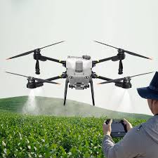
Have you ever wondered how farmers manage to monitor hundreds of hectares of crops without physically walking through every field? Imagine a farmer standing at the edge of a vast farm, worried about sections of crops turning yellow but unsure of the cause. Instead of spending days inspecting each area manually, the farmer launches a drone and receives detailed crop health data within minutes. This is the reality of crop monitoring in 2026.
WHY TRADITIONAL CROP MONITORING IS CHALLENGING
For many years, farmers relied on manual inspection to monitor crop health. While this method can be effective, it is time-consuming, labour-intensive, and sometimes inaccurate. Large farms make it difficult to detect problems early, and delays in identifying pests, diseases, or water stress can lead to significant yield loss. Modern agriculture now demands faster and more precise monitoring solutions.
1. Early Detection of Crop Health Issues
Drones equipped with advanced sensors can capture detailed aerial images that reveal crop health conditions that may not be visible to the human eye.
Drones help farmers by detecting:
- Plant stress caused by pests, diseases, or environmental factors
- Nutrient deficiencies across large fields
- Uneven growth patterns and overall vegetation health
HOW DRONES DETECT CROP PROBLEMS
Drones are not just flying cameras. They are equipped with special sensors and imaging technologies that allow farmers to “see” crop health from above, even before problems are visible on the ground.
Multispectral Sensors: Monitoring Overall Crop Health
Multispectral sensors capture light beyond what humans can see. Healthy plants reflect light differently from stressed or damaged crops.
These sensors help detect:
- Early plant stress
- Nutrient deficiencies
- Crop diseases and pest outbreaks
- Uneven plant growth
Thermal Imaging: Detecting Water and Irrigation Issues
Thermal cameras measure temperature differences across fields. Healthy, well-watered crops stay cooler, while dry or stressed crops appear warmer.
Thermal imaging helps detect:
- Drought-stressed crops
- Overwatered areas
- Poor irrigation distribution
- Leaks or blockages in irrigation systems
NDVI Imaging: Creating Crop Health Maps
NDVI (Normalized Difference Vegetation Index) uses light reflection to create colour-coded maps of vegetation health:
- 🟢 Green → Healthy crops
- 🟡 Yellow → Moderate stress
- 🔴 Red → Unhealthy or damaged crops
These maps allow farmers to quickly identify areas that need attention and track crop growth over time.
- High-Resolution Field Mapping: Providing Detailed Farm Insights
Drones capture high-resolution aerial images that can be stitched into detailed farm maps. These maps help farmers monitor field conditions and plan operations accurately.
High-resolution mapping can detect:
- Pest-affected areas
- Poor crop spacing or planting patterns
- Soil erosion or flooding risks
- Areas requiring fertiliser or pesticide application
2. PRECISION FARMING AND RESOURCE MANAGEMENT
In 2026, farming is becoming more data-driven. Drones provide accurate information that helps farmers apply resources only where they are needed.
Drone monitoring supports precision farming by:
- Identifying areas that require fertilisers or pesticides
- Monitoring irrigation patterns and detecting water stress
- Reducing waste by enabling targeted treatment instead of whole-field application
This approach not only increases productivity but also promotes sustainable farming by reducing chemical overuse and conserving water.

3. FASTER AND MORE EFFICIENT FIELD COVERAGE
One of the biggest advantages of drones is speed. A drone can survey large farmland within a short period compared to manual field inspection.
This efficiency helps farmers:
- Monitor crops more frequently
- Track seasonal changes and growth progress
- Make timely farming decisions based on real-time data
Frequent monitoring ensures that small issues are addressed before they become major agricultural problems.
THE GROWING IMPACT OF DRONE TECHNOLOGY IN AGRICULTURE
Drone technology is transforming agriculture by making crop monitoring more accurate, efficient, and accessible. The integration of drone data with modern farm management systems allows farmers to analyse trends, predict crop performance, and improve overall farm productivity. As technology continues to advance, drones are becoming an essential tool for modern agriculture.
CONCLUSION
Crop monitoring in 2026 is no longer limited to manual field inspections. Drones provide farmers with fast, reliable, and detailed insights that help improve crop health, increase yield, and support sustainable farming practices. Farmers who embrace drone technology are better positioned to make smarter decisions and manage their farms more effectively.
Adopting drone-based monitoring is not just a technological upgrade; it is a practical step toward the future of efficient and sustainable agriculture.
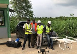
Visit us at Geoinfotech, Oluwalogbon House, Obafemi Awolowo Way, Ikeja, Lagos for a live demo of the 2026 DJI Agras series.


