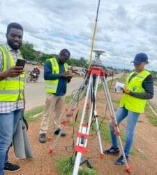
Buying land in Nigeria is a big investment. Whether you’re planning to build a home, start a business, or develop an estate, one thing stands between a safe investment and a potential disaster: a land surveyor.
Many land disputes in Nigeria could have been avoided if buyers had engaged qualified, licensed surveyors before paying for land. A land surveyor is the professional who measures and maps your land, defines the boundaries, and prepares the official survey plan recognized by the government. Without their work, your land documents may be rejected, your boundaries may be questioned, and in worst cases, you could lose the land entirely.
In this article, we’ll break down who land surveyors are, why they are essential in Nigeria, how to verify a genuine professional, typical costs, timelines, and practical tips to avoid scams. This is your complete everyday guide to Land Surveyors in Nigeria.
Who Exactly Is a Land Surveyor?
A land surveyor is a trained professional who measures land and prepares official maps called survey plans. These plans show the exact location, size, shape, and boundaries of a piece of land.
Think of a surveyor as the person who translates the land you see on the ground into official paper records that the government, banks, and courts can recognize. In Nigeria, only surveyors registered with the Surveyors Council of Nigeria (SURCON) are legally authorized to prepare and sign survey plans.
If a surveyor is not registered with SURCON, their plans are worthless at the land registry.
Why Land Surveyors in Nigeria Are So Important
In Nigeria, land ownership can be complicated. Families, communities, private sellers, and even government bodies may claim rights to the same land. Here’s what happens if you skip the survey process:
- Boundary disputes: Neighbors can accuse you of encroaching.
- Rejected titles: Your Certificate of Occupancy (C of O) or Governor’s Consent application can be denied without a registered survey plan.
- Government acquisition: You may lose land if it falls under planned projects (roads, pipelines, estates).
- Double sales: Unscrupulous sellers may sell the same land twice if boundaries are unclear.
Hiring a SURCON-registered land surveyor in Nigeria protects you against these risks. They confirm the land is truly available, free from encumbrances, and properly documented.
The Legal Framework Behind Surveying in Nigeria
Two institutions regulate surveying in Nigeria:
- Surveyors Council of Nigeria (SURCON): This is the professional regulatory body. They register surveyors, license companies, and publish tools to verify professionals.
- Office of the Surveyor-General of the Federation (OSGoF): The apex government mapping office responsible for national mapping standards, control points, and geospatial policies.
At the state level, Surveyors-General of each state handle survey plan registration and verification before a Certificate of Occupancy can be issued.
What Services Do Land Surveyors in Nigeria Provide?
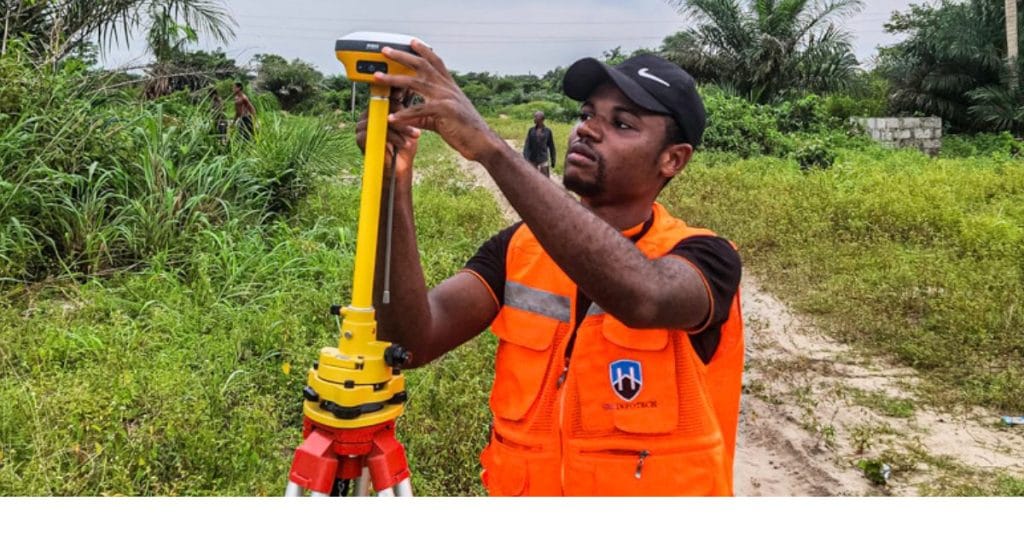
Land surveyors do more than just draw maps. Their services cover:
- Boundary/Cadastral Survey – Defines legal property boundaries and produces survey plans.
- Topographic Survey – Shows land features (slopes, trees, roads) used for construction design.
- Subdivision & Layout Design – Divides large land into smaller saleable plots.
- Construction Setting-Out – Marks where structures (buildings, roads) should be built on site.
- As-Built Survey – Verifies that what was built matches the design.
- Drone & Aerial Mapping – Creates orthophotos and 3D maps for estates, farmlands, and large projects.
- Geodetic Surveys – Establishes accurate coordinates for infrastructure projects.
Whether you’re buying one plot or developing 100 hectares, there’s a surveyor service that fits.
How to Verify a Land Surveyor in Nigeria
Sadly, many fraudsters pose as surveyors. To protect yourself:
- Ask for SURCON registration number. Every licensed surveyor has one.
- Check SURCON’s online verification portal. This confirms if they are genuine.
- Request previously registered plans. Ask for samples (with client info hidden).
- Insist they handle lodgement. Fake surveyors will only draw a plan, but won’t submit it to the land office.
- Check firm enlistment. Some firms are registered with SURCON, ask for their license documents.
If they cannot provide proof, walk away.
Step-by-Step: How a Land Survey Job Works in Nigeria
Here’s what to expect when you hire a surveyor:
- Engagement – You sign an agreement on fees, scope, and timelines.
- Site Visit/Reconnaissance – Surveyor inspects land and checks existing documents.
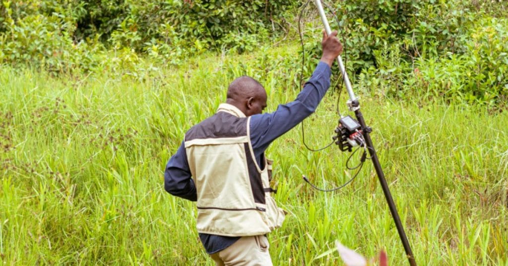
- Field Work – Using GNSS, total stations, or drones, they measure coordinates and mark boundaries.
- Drafting – Data is processed into a survey plan.
- Lodgement – The survey plan is submitted to the State Surveyor-General’s office for approval.
- Inspection – Government officers may inspect the land to verify boundaries.
- Approval & Collection – You receive a registered survey plan, often stamped and recognized by law.
How Long Does It Take?
- Small residential plots: 1–3 weeks (fieldwork and plan).
- Large estate or topographic surveys: Several weeks to months.
- Registration at government office: Varies by state, add 2–6 weeks (sometimes more).
Cost of Land Survey in Nigeria
Survey costs vary widely depending on location, plot size, and complexity. Here are general ranges:
- Small plot in rural areas: ₦100,000 – ₦300,000
- Urban plots (Lagos, Abuja, PH, etc.): ₦350,000 – ₦2,000,000+
- Topographic or subdivision surveys: ₦500,000 – millions for large estates
- Major infrastructure surveys: Negotiated, often tens of millions
Remember: costs include both professional fees and government registration fees. Always request a breakdown.
Common Scams in Land Surveying
Watch out for these traps:
- Fake survey plans: Forged stamps and signatures.
- Unregistered surveyors: They can’t lodge your plan.
- Sketches instead of real plans: Only registered survey plans are legally valid.
- Cheap shortcuts: Some operators charge very low but won’t follow through with registration.
Rule of thumb: if it sounds too good to be true, it usually is.
Tools Professional Land Surveyors Use Today
Modern surveyors in Nigeria use:
- GNSS/RTK receivers for accurate positioning
- Total stations for detailed measurements
- Drones for aerial mapping
- GIS & CAD software (QGIS, AutoCAD, ArcGIS)
- LiDAR & photogrammetry for 3D modeling
These tools ensure accuracy, speed, and digital deliverables useful for future projects.
How to Choose the Right Land Surveyor in Nigeria
When hiring, consider these tips:
- Verify SURCON registration.
- Check their experience in your state/local area.
- Make sure they handle lodgement.
- Ask for written contracts and cost breakdowns.
- Review their portfolio and references.
- Ensure they use modern tools for accuracy.
- Confirm timeline and deliverables (survey plan, digital files, boundary pillars).
Frequently Asked Questions (FAQ)
Q: Can I use a seller’s survey plan?
Only if it is a registered plan and still valid. Always verify at the land registry.
Q: Who lodges the survey plan?
Only a licensed SURCON surveyor can lodge it at the Surveyor-General’s office.
Q: How much does it cost to survey land in Lagos?
Expect ₦350,000 – ₦2 million depending on location and size.
Q: Do I need a survey plan to apply for C of O?
Yes, a registered survey plan is mandatory.
Why You Should Never Skip a Surveyor
Land in Nigeria is valuable but risky. Working with professional land surveyors in Nigeria is the safest way to protect your investment. They ensure your land boundaries are accurate, legally recognized, and safe from disputes or government claims.
At Geoinfotech, we provide SURCON-registered surveyors, modern tools (GNSS, drones, GIS), and end-to-end services, from boundary surveys to lodgement at the land registry.
Call us today on +234 816 322 2177
Lagos Office: Oluwalogbon House, Obafemi Awolowo Way, Alausa Ikeja
Abuja Office: Nigeria Reinsurance Corporation Building, Plot 784A Herbert Macaulay Way, North, Abuja


