Geographic Information Systems (GIS) have become essential to how we understand places, people, and patterns whether it’s for mapping population data, analyzing environmental change, planning infrastructure, or responding to disasters.
For many organizations, however, GIS tools have historically been expensive, complex, or tied to specific software vendors. That’s where QGIS comes in.
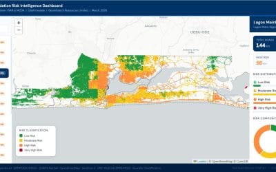
QGIS (Quantum Geographic Information System) is a free and open-source Geographic Information System used to view, edit, analyze, and visualize spatial data. It is one of the most widely used Geographic Information Systems (GIS) platforms available today.
It is used by professionals in government, research, engineering, logistics, and environmental fields, QGIS has gained recognition for its flexibility, robust capabilities, and cost-effectiveness. Unlike proprietary GIS tools, QGIS is available to everyone with no licensing fees and a constantly evolving feature set supported by a global user community.
What Can You Do with QGIS?
QGIS provides a full set of tools for working with spatial data. Some of its key capabilities include:
- Data Visualization: Display spatial data in the form of interactive maps, with full control over layer styling, labels, and symbology.
- Geospatial Analysis: Perform buffer analysis, overlay operations, spatial joins, and terrain modelling.
- Data Editing: Create and modify spatial features, attributes, and geometries using built-in digitizing tools.
- File Compatibility: Work with a wide variety of formats including Shapefiles, GeoJSON, KML, CSV, GeoTIFF, PostGIS, and more.
- Map Production: Build high-quality map layouts suitable for reports, presentations, or publication.
- Plugin Support: Extend QGIS functionality through a large library of free, community-developed plugins.
- Python Integration: Automate workflows and build custom tools using Python scripting.
Why Organizations Choose QGIS
Many organizations are adopting QGIS for reasons that go beyond cost savings. Here are some of the most common advantages:
- QGIS is open source and completely free to use. There are no annual fees, license limits, or proprietary restrictions.
- From small research teams to national-level infrastructure planning, QGIS scales well across different types of projects and user groups.
- It is regularly updated and i.e the platform benefits from continuous updates and improvements contributed by a global developer community. New features, bug fixes, and plugin enhancements are released frequently.
- Despite being free, QGIS offers spatial analysis, data editing, modeling, and cartographic features on par with commercial GIS tools.
Industries Actively Using QGIS
QGIS is used around the world in sectors such as:
- Urban and Regional Planning
- Environmental Monitoring and Conservation
- Public Health and Epidemiology
- Transportation and Logistics
- Agriculture and Land Management
- Utilities and Infrastructure
- Education and Research
- Humanitarian and Disaster Response
In Conclusion
QGIS stands out as a reliable, powerful GIS platform not just because it’s free, but because it meets the practical needs of modern spatial work. Whether you’re exploring maps for the first time or looking to build GIS capacity within your organization, QGIS offers a flexible starting point backed by a global user community.
This article is the first in our ongoing series designed to help professionals and teams understand and apply QGIS in real-world contexts.
In the next installment, we will walk through how to install QGIS and set up your first project including loading spatial data and exploring the interface.
📌 Next in the series: Installing and Visualizing data in QGIS
Stay tuned.