
Land surveying has always been a critical part of development in Nigeria. Whether it’s for real estate, road construction, mining, agriculture, or urban planning, understanding the land is always the first step. For years, surveyors have depended on manual tools and ground based equipment to map out terrain. But as projects get bigger, timelines get shorter, and accuracy becomes non-negotiable, the industry is turning to a more advanced solution which is drone mapping.
Why Traditional Surveying Methods Are No Longer Enough
For decades, land surveying in Nigeria has relied on total stations, GPS devices, and long hours of fieldwork. Surveyors often spend days, sometimes weeks navigating challenging terrain, battling unpredictable weather, and trying to cover large land areas manually. The process is not only time-consuming but can also expose workers to physical risks, especially in remote or difficult to access locations. Even with the best equipment, human error can still lead to gaps in data, inconsistencies, or inaccuracies that affect project planning, budgeting, and execution.
How Drone Mapping Is Changing the Game
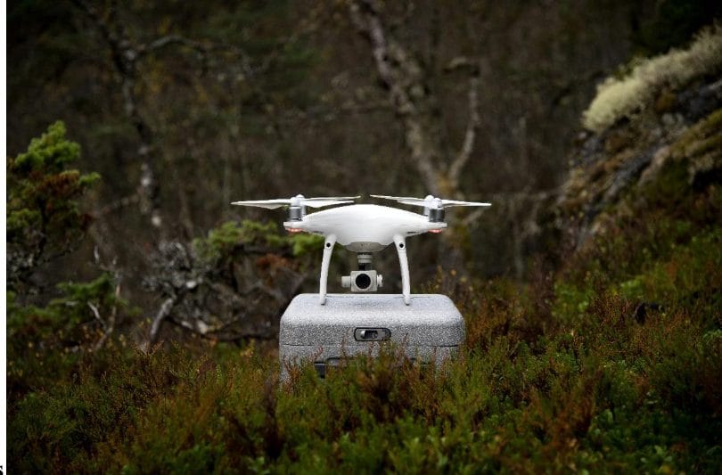
This is where drones, or UAVs (Unmanned Aerial Vehicles), have become a game changer. Equipped with high resolution cameras, advanced sensors, and powerful software, drones now allow surveyors to collect large volumes of highly accurate geospatial data quickly and safely. A drone can fly over hundreds of hectares in a matter of minutes, capturing detailed aerial imagery and generating precise digital models of the land. The data collected can be processed into 3D terrain models, contour maps, orthomosaic images, and point clouds that give engineers, architects, and planners an accurate, up-to-date view of the terrain.
What used to take weeks can now be completed in a few days or even hours. Drone mapping eliminates many of the delays associated with traditional methods. There’s no need to clear thick bush paths, hike over dangerous ground, or physically mark every boundary. Once the data is collected, processing can begin almost immediately, allowing decision-makers to access survey results much faster. For industries working under tight deadlines such as real estate development, road construction, or oil and gas exploration, this time savings can have a huge financial impact.
The Accuracy You Can Trust
Accuracy matters in surveying. Even a small miscalculation in land boundaries, elevation levels, or distances can lead to costly redesigns, legal disputes, or safety risks. Drone mapping offers centimeter-level precision that helps reduce these kinds of errors from the start. By having reliable, detailed, and comprehensive data early in the project, contractors and developers can plan more accurately, order materials more efficiently, and avoid unexpected surprises during construction.
Keeping Your Team Safe and also building Sustainability with Companies
In Nigeria, surveyors often work in areas that are physically challenging or hazardous, swamps, cliffs, thick forests, or unstable ground. Drone mapping dramatically reduces the need for ground crews to enter dangerous areas. Instead, drones collect data from above, keeping personnel out of harm’s way while still gathering complete information. For companies, this means fewer safety incidents, lower insurance risks, and a healthier, more protected workforce.
Drone mapping also plays a role in environmental monitoring and sustainable development. Before starting major projects, companies can assess potential environmental impacts using aerial data, identify sensitive areas, and plan accordingly. This helps companies meet regulatory requirements and avoid unnecessary environmental damage.
In recent years, more surveying firms, construction companies, and government agencies in Nigeria have adopted drone mapping as part of their operations. With advancements in drone technology, local expertise, and increasing regulatory support from the Nigerian Civil Aviation Authority (NCAA), the industry is rapidly growing. Licensed drone service providers are offering highly specialized solutions that combine both local knowledge and cutting-edge technology, giving Nigerian businesses a clear advantage as they compete on regional and global levels.
Drone Mapping Is Changing the Standard
Drone mapping isn’t just an upgrade, it’s changing the very foundation of how land surveying is done in Nigeria. It brings unmatched speed, safety, precision, and cost-efficiency to industries that rely on land data for success. For organizations that want to stay competitive, deliver better projects, and make smarter decisions, investing in drone mapping is no longer a luxury. It’s fast becoming the new standard.


