
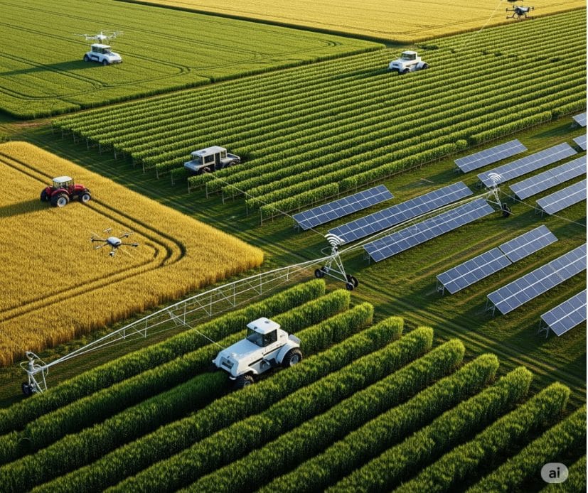
In the evolving landscape of global agriculture, optimizing productivity is a continuous pursuit, crucial for ensuring food security and economic resilience. A pivotal innovation in achieving this goal is Land Use Mapping, a powerful application leveraging the capabilities of Remote Sensing and Geographic Information Systems (GIS). This integrated approach provides a comprehensive and data-driven understanding of agricultural landscapes, enabling informed decision-making and significantly enhancing resource management.
Understanding the Role of Land Use Mapping in Agriculture
Land use mapping in agriculture involves the systematic collection, analysis, and visualization of spatial data to characterize and monitor agricultural land. This process goes beyond simple graphical representation, offering a profound understanding of various factors influencing agricultural productivity across diverse terrains and farming systems. It allows for a granular view of land characteristics and crop conditions that are often invisible to the naked eye.
The methodologies employed in modern land use mapping integrate the advanced capabilities of Remote Sensing and GIS:
Remote Sensing Technologies:
These technologies utilize advanced platforms such as satellites, drones, and aircraft to acquire critical data layers without physical contact with the land. Key data types include:
- Vegetation Health Assessment: Utilizing spectral indices like the Normalized Difference Vegetation Index (NDVI) to identify variations in plant vigor and stress levels. This enables early detection of issues that might impact yield.
- Thermal Analysis: Detecting temperature anomalies on the ground, which can indicate irrigation inefficiencies, water stress in plants, or even the presence of certain pests and diseases.
- Terrain and Hydrological Modeling: Generating precise digital elevation models (DEMs) to understand topography, drainage patterns, identify areas susceptible to erosion, and optimize irrigation and water retention strategies.
- Spectral Signature Analysis: Employing multispectral and hyperspectral sensors to gather detailed information about crop types, nutrient deficiencies, and the presence of specific pathogens or weeds based on their unique light reflectance characteristics.
Geographic Information Systems (GIS):
GIS platforms are sophisticated digital frameworks that serve as powerful environments for integrating, analyzing, and visualizing the vast amounts of remotely sensed data alongside other relevant spatial information. Through GIS, agricultural professionals can:
- Integrate Diverse Datasets: Combine various layers of information such as soil type maps, historical yield data, meteorological records, and farm infrastructure layouts to reveal complex interrelationships.
- Perform Spatial Analysis: Conduct advanced analytical operations to answer specific questions about the land, such as identifying optimal planting zones, assessing nutrient variability across fields, or determining the impact of different management practices over time.
- Generate Customizable Maps and Visualizations: Create intuitive and informative maps, charts, and 3D models that simplify complex data, making it accessible for decision-makers and field operators.
- Monitor Temporal Changes: Track changes in land cover, crop health, and environmental conditions over time, providing valuable insights for adaptive management and long-term planning.
Benefits of Implementing Advanced Land Use Mapping in Agricultural Operations
The strategic adoption of sophisticated land use mapping techniques offers numerous tangible advantages for agricultural stakeholders, from individual farmers to large-scale agribusinesses and governmental agencies:
- Enabling Precision Agriculture: Land use mapping is the bedrock of precision agriculture, allowing for highly targeted application of inputs such as fertilizers, water, and pesticides. This minimizes waste, reduces environmental impact, and optimizes resource utilization, leading to more sustainable farming.
- Optimized Resource Management: By providing detailed insights into spatial variability, mapping enables efficient allocation of precious resources like water and nutrients. It helps identify areas needing more attention versus those that are already performing well, leading to significant cost savings.
- Early Detection and Proactive Management: The ability to detect anomalies in crop health or environmental conditions at an early stage, often before they are visible to the naked eye, allows for timely and targeted interventions. This can prevent widespread problems like pest infestations or nutrient deficiencies, safeguarding potential yields.
- Enhanced Yield Forecasting and Strategic Planning: By analyzing historical performance data in conjunction with current conditions captured through remote sensing, land use mapping improves the accuracy of yield predictions. This supports better planning for harvesting logistics, storage, processing, and market engagement.
- Data-Driven Decision Support: Moving away from traditional methods of estimation and intuition, land use mapping provides objective, quantifiable, and spatially explicit information. This empowers farmers, agronomists, and policymakers to make more informed and strategic decisions regarding land use, crop selection, and agricultural policies.
- Promotion of Sustainable Farming Practices: By fostering efficiency in resource use and minimizing the application of chemicals, land use mapping contributes directly to more environmentally responsible and sustainable agricultural practices, aligning with global efforts towards ecological preservation.
- Increased Economic Viability: Ultimately, the combined benefits of efficiency, waste reduction, improved yields, and proactive problem-solving translate directly into enhanced economic returns and increased profitability for agricultural producers.
The Future of Farming is Mapped
As the agricultural sector faces increasing pressures from climate change, population growth, and resource scarcity, the role of advanced land use mapping will only grow in importance. It represents a paradigm shift towards a more intelligent, efficient, and sustainable approach to farming, empowering stakeholders with the knowledge needed to thrive in a complex world. Embracing these technologies is not just an option, but a strategic imperative for the future of food production.


