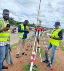
The construction and infrastructure sectors in Nigeria are booming—but so are the challenges: outdated site data, delayed surveys, inaccurate measurements, and costly rework. That’s where Geoinfotech’s drone solutions are stepping in to make a game-changing difference. By integrating drone technology with GIS and advanced spatial analytics, Geoinfotech is helping engineers, contractors, and developers work faster, smarter, and safer.
The Traditional Challenges in Construction
- Manual surveys take days or weeks to complete, delaying project timelines.
- Human error can result in miscalculations and design flaws.
- Inaccessible terrain can make ground surveys difficult or even dangerous.
- Lack of updated site data leads to uninformed decisions and construction delays.
The Drone-Powered Solution
At Geoinfotech, we use high-resolution UAVs (Unmanned Aerial Vehicles) equipped with GPS, RTK, and imaging sensors to deliver fast, reliable, and highly accurate data for construction and infrastructure projects.
Here’s how drones are changing the game:
- Topographic Surveying in Minutes, Not Weeks
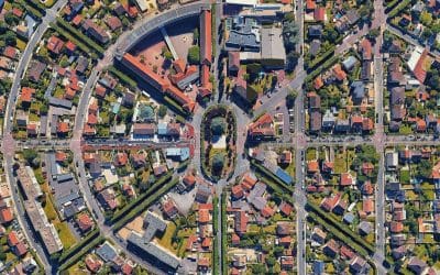
Using drones, we generate detailed topographic maps, 3D terrain models, and elevation data with centimeter-level accuracy. What used to take weeks with total stations can now be completed in a few hours—with more coverage and fewer errors.
- Progress Monitoring & Project Reporting
Want to track site progress without stepping foot on it? Our drones can fly scheduled missions to capture aerial imagery and video of your construction site. These visuals are then turned into progress reports for stakeholders, ensuring transparency and accountability.
- Volumetric Calculations for Earthworks
Drone photogrammetry enables quick and accurate volume measurements of stockpiles, cut-and-fill operations, and excavation sites. This helps construction teams optimize resources, avoid material shortages, and manage costs.
- Site Inspection and Safety Audits
Inspecting tall structures or hard-to-reach areas? Our drones provide a safe, non-intrusive way to inspect roofs, scaffolding, and bridges—reducing the risk of on-site accidents while delivering high-resolution visuals for analysis.
- BIM Integration and Smart Infrastructure
We also integrate drone data with Building Information Modeling (BIM) systems for smarter infrastructure planning and execution. This empowers developers to visualize site conditions, detect conflicts, and align construction phases more efficiently.
Why Work With Geoinfotech?
- Licensed drone pilots and survey engineers
- Quick turnaround time
- Precise data with RTK-enabled drones
- Affordable solutions tailored to your project scale
Ready to Elevate Your Next Construction Project?
Geoinfotech is proud to be at the forefront of Nigeria’s digital construction revolution. Our drone and geospatial services are helping infrastructure projects get off the ground—literally and figuratively.
Get in touch today to book a drone survey or learn how we can support your next build: Geoinfotech


