
The integration of drone data with ArcGIS Pro has revolutionized precision mapping, offering unparalleled accuracy and efficiency in various industries. This powerful combination provides professionals with the tools to capture, process, and analyze geospatial data, enabling informed decision-making for projects ranging from urban planning to agriculture and environmental monitoring. In this blog post, we explore the steps, benefits, and applications of integrating drone data with ArcGIS Pro.
Why Integrate Drone Data with ArcGIS Pro?
Drones equipped with advanced sensors, such as RGB cameras, LiDAR, and multispectral cameras, collect high-resolution imagery and 3D data. When integrated into ArcGIS Pro, these datasets can be processed into actionable information for:
- Enhanced Spatial Accuracy: High-resolution imagery from drones complements GIS datasets, improving the spatial accuracy of maps and analyses.
- 3D Visualization and Analysis: Drones capture terrain and structure data, which can be processed into 3D models within ArcGIS Pro.
- Time and Cost Efficiency: Rapid data collection and automated processing save time and reduce the costs associated with traditional mapping methods.
Steps to Integrate Drone Data with ArcGIS Pro
- In ArcGIS Pro, create a project using the Map template and sign in to your ArcGIS Online account if necessary.
- On the Imagery tab, in the Ortho Mapping group, click the New Workspace drop-down menu and select New Workspace.
- In the Workspace Configuration window, type a name for your workspace.
- In the Type drop-down menu, choose Drone.
- In the Basemap drop-down menu, choose Topographic.
- Click Next.
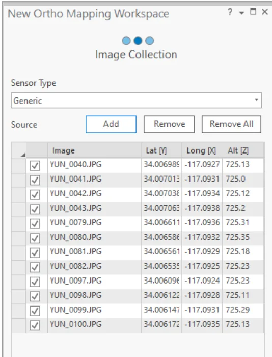
- In the Image Collection window, under the Sensor Type drop-down menu, choose Generic, as the imagery was collected with an RGB camera.
- Click the Add button to browse to and select the imagery folder.
- Make sure the Spatial Reference and Camera Model are correct. The default projection for the workspace is defined based on the latitude, longitude, and altitude of your images. This projection determines the spatial reference for your ortho products, including the orthomosaic and DEM. For this dataset, we’ll use the default projection. Click Next.
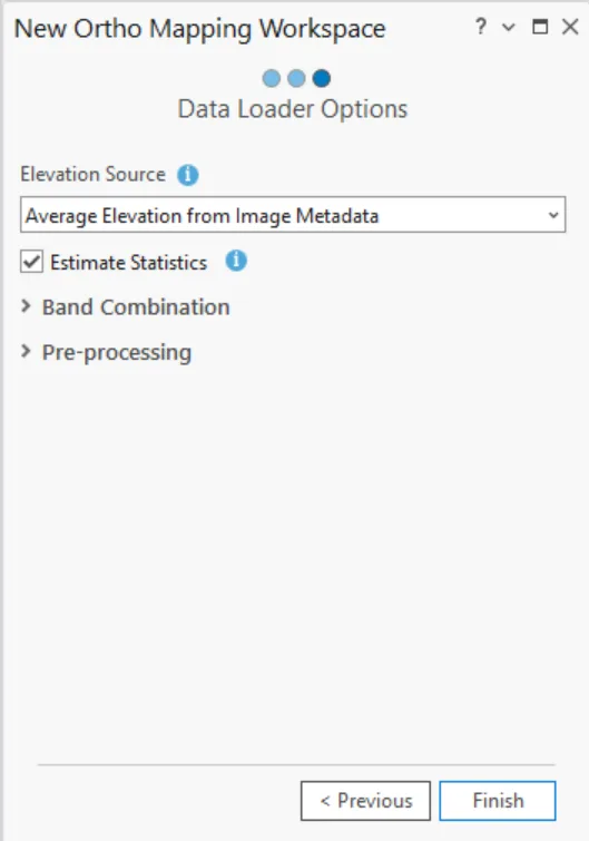
- Accept all default setting in the Data Loader window and click Finish.
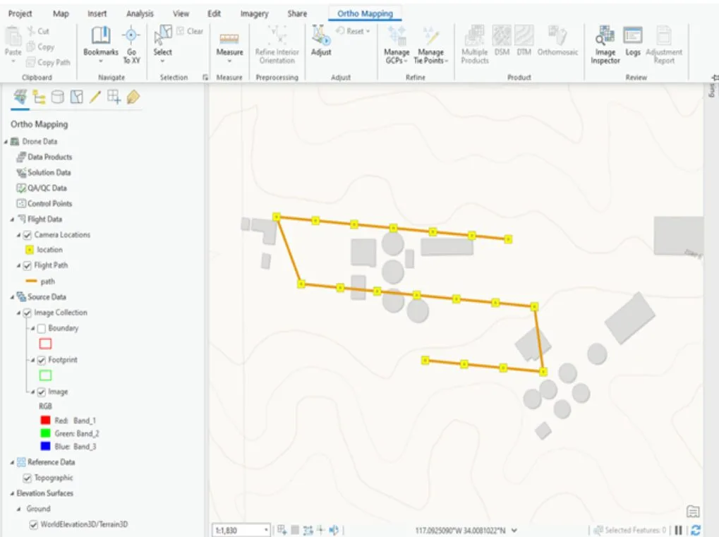
Once the Workspace has been created, the images, drone path, and image footprints will be displayed. An Ortho Mapping category has also been added to the Contents pane. The source imagery data and derived ortho mapping products will be stored here.
Applications of Drone Data in ArcGIS Pro
- Urban Planning
- Agriculture
- Environmental Monitoring
- Mining and Quarrying
Are you ready to unlock the full potential of drone data in ArcGIS Pro? Contact us to learn more about our drone mapping services, training programs, and GIS solutions!
Source: https://doc.arcgis.com/en/imagery/workflows/tutorials/create-drone-imagery-products-ortho-mapping.htm


