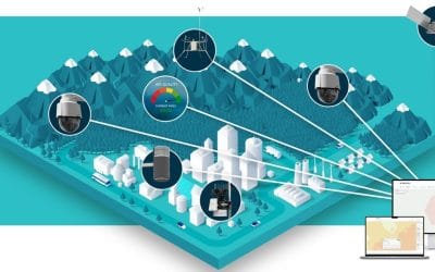
Geographic Information Systems (GIS) have evolved from being specialized tools for mapping and cartography into an essential technology across industries, particularly within the tech world. With the growing availability of high-quality geospatial data and the advancement of powerful computational tools, GIS has found its place in a wide range of applications that drive innovation, enhance decision-making, and improve user experiences. Today, geospatial technology is at the heart of many modern applications, from mobile apps to artificial intelligence (AI) solutions, offering tech companies and developers the ability to leverage location-based insights like never before.
What is GIS in the Tech World?
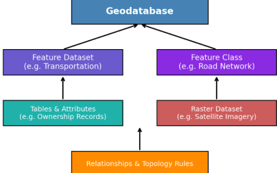
GIS is a system used to collect, store, analyze, manage, and visualize spatial data. In the tech world, it powers tools that deliver geospatial insights and location-based services through mobile apps, web platforms, cloud systems, and IoT devices. With advancements in data collection, such as remote sensing and GPS, GIS now enables tech companies to process large amounts of spatial data, creating sophisticated applications that map, visualize, and analyze geographic information in innovative ways.
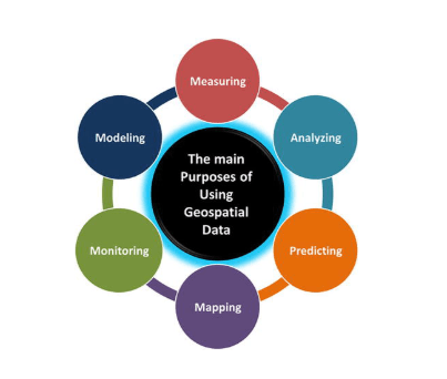
Key Examples of Geospatial Applications in the Tech World
Navigation and Mapping Applications
- Google Maps and Apple Maps are two of the most well-known examples of GIS-based applications. They combine geospatial data with real-time traffic information to provide users with directions, traffic updates, route optimization, and location-based services.
- These platforms use GPS data to track user movements and generate accurate maps, while also offering additional features such as street view, public transportation routes, and integration with local businesses (e.g., restaurants, hotels, and service providers).
- Key Features: Route planning, real-time traffic data, geospatial search, navigation, and location-based services
Geospatial Data Visualization
- GIS technology plays a key role in data visualization, helping to transform complex datasets into interactive, geospatially enriched visual representations. Tech companies like Mapbox and Leaflet provide developers with APIs and tools to integrate custom maps, visual analytics, and spatial data into web and mobile apps.
- For example, businesses can visualize sales performance, customer distribution, or climate patterns on a map, making it easier to derive insights and inform decision-making.
- Key Features: Interactive maps, data layers, heatmaps, and geospatial analytic
Location-Based Services (LBS)
- Many apps today offer location-based services (LBS) that utilize GIS to provide tailored user experiences. For example, Uber and Lyft rely on geospatial data to match riders with nearby drivers, optimize routes, and track real-time movement.
- Location-based features also power apps like Foursquare and Yelp, where users can check in, leave reviews, and discover nearby businesses based on their current location.
- Key Features: Real-time location tracking, geofencing, proximity alerts, and location-based recommendation
Augmented Reality (AR) and GIS
- GIS is playing an increasingly important role in the development of augmented reality (AR) applications. Platforms like Pokemon Go and Google Lens combine AR technology with geospatial data to create immersive experiences where digital elements are overlaid onto the real world based on location.
- For instance, in Pokemon Go, players use their mobile device’s GPS to find virtual creatures in the real world. Similarly, Google Lens utilizes geospatial and visual recognition data to offer information about objects and places in the user’s environment.
- Key Features: Geo-tagging, location-based AR content, interactive maps, and location-specific experiences.
Urban Planning and Smart Cities
- Smart city solutions, powered by GIS, are helping governments and businesses build more sustainable and efficient urban environments. Applications like Esri’s CityEngine and ArcGIS Urban allow urban planners to visualize city development, infrastructure projects, and traffic patterns in real time.
- These tools integrate geospatial data with city planning to optimize the design of public spaces, manage utilities, and monitor air quality. Smart traffic systems that adjust signals in real time to reduce congestion also rely heavily on geospatial data.
- Key Features: 3D urban modeling, traffic management, infrastructure planning, and environmental monitoring.

E-commerce and Supply Chain Management
- E-commerce giants like Amazon and Walmart use GIS in logistics and supply chain management to optimize inventory, distribution routes, and delivery processes. By mapping warehouses, transportation routes, and delivery areas, these platforms improve operational efficiency and delivery times.
- GIS-powered tools allow businesses to visualize their supply chain, track shipments in real time, and make data-driven decisions on warehouse placement and logistics network optimization.
- Key Features: Route optimization, inventory tracking, supply chain analytics, and logistics management.
Environmental Monitoring and Conservation
- GIS plays a critical role in environmental monitoring and conservation efforts. Platforms like Global Forest Watch use GIS to track deforestation, monitor biodiversity, and provide actionable insights for conservation initiatives.
- By analyzing satellite imagery and geospatial data, environmental organizations can track changes in ecosystems, identify at-risk areas, and respond quickly to environmental threats like wildfires, pollution, or habitat destruction.
- Key Features: Satellite imagery, ecosystem monitoring, real-time alerts, and environmental data visualization.
Disaster Management and Emergency Response
- GIS is also used extensively in disaster management and emergency response systems. During natural disasters like hurricanes, earthquakes, or floods, agencies like FEMA (Federal Emergency Management Agency) and the Red Cross use GIS to map disaster zones, assess damage, and direct resources to areas most in need.
- Apps like PulsePoint use geospatial data to alert nearby individuals of emergencies, such as heart attacks or fires, in real time, enabling faster response times.
Real Estate
- Real estate platforms such as Zillow and Redfin use GIS to provide users with detailed maps, property locations, neighborhood data, and market trends. By integrating spatial data, these platforms can give potential buyers insights into factors like property values, local amenities, and school ratings.
- Developers and real estate professionals use GIS to analyze market trends, identify prime locations for development, and predict future property values.
How to Build Geospatial Applications
Building geospatial applications typically involves several key steps, which include:
- Data Collection and Integration:
- The first step is gathering the necessary geospatial data. This could be anything from satellite imagery, GPS data, environmental data, or even user-generated location data from mobile devices. Many tech companies rely on APIs like Google Maps API, Mapbox, or OpenStreetMap to access this data.
- GIS Software and Tools:
- To process and analyze the data, developers use GIS software and platforms such as ArcGIS, QGIS, or MapInfo. These tools allow users to create interactive maps, perform spatial analysis, and integrate location-based features into applications.
- Frontend and Backend Development:
- On the frontend, developers use JavaScript libraries such as Leaflet, OpenLayers, or Mapbox GL JS to display and interact with maps. On the backend, developers integrate databases like PostGIS (an extension of PostgreSQL for spatial data) to store and query geospatial data.
- Geospatial Analysis:
- Once the data is integrated, it is analyzed using spatial analysis techniques such as buffer analysis, spatial joins, or heatmaps. These methods help uncover patterns, trends, or insights in the data, allowing businesses to make informed decisions.
- User Interface (UI) and Experience (UX):
- The user interface should allow users to interact with geospatial features seamlessly. This might include zooming in and out of maps, searching for specific locations, drawing routes, or filtering data based on location.
Conclusion
Geospatial technology is revolutionizing the tech world by powering location-based applications such as navigation, augmented reality, supply chain management, and disaster response. As geospatial data becomes more accessible, new opportunities for innovative solutions continue to emerge. For developers, integrating GIS into applications allows for the creation of interactive, data-driven, and location-aware solutions that enhance user experiences and provide valuable insights across industries. Whether building mapping apps, smart city solutions, or environmental monitoring systems, GIS is a powerful tool that boosts the functionality and relevance of tech products.


