
Map of Ikeja in Lagos State Using ArcGIS Pro and OpenStreetMap Data
Mapping a city’s road network is a critical step toward understanding its connectivity, transportation challenges, and accessibility. Lagos State, one of Africa’s largest and busiest urban regions has a complex road network that can be visualized and analyzed using GIS tools and open-source data.
In this blog post, we’ll walk you through what a road network map is, why it’s important, what data is needed to create one, and how to build it using ArcGIS Pro and OpenStreetMap data.
What is a Road Network Map?
A road network map is a visual representation of a region’s road infrastructure including major roads, highways, local streets, and their connections. It doesn’t just show roads as lines on a map, it reflects how those roads connect and how accessible different parts of a city are through the transportation network.
Why is a Road Network Map Important?
Road network maps are valuable for many reasons:
- Urban Planning: Help planners identify road gaps and plan new routes.
- Emergency Services: Improve response times by analyzing the fastest routes.
- Logistics & Transportation: Optimize delivery routes and reduce traffic bottlenecks.
- Public Services: Determine how accessible public facilities like hospitals and schools are.
- Research: Analyze traffic flow, commuting patterns, or urban expansion.
For Lagos, a city with constant traffic and rapid urban growth, a road network map helps to visualize and tackle these issues with data driven decisions.
Data You Need to Create a Road Network Map
To build a road network map of Ikeja in Lagos State, you’ll need the following:
- Road Network Data: You can get detailed, up-to-date road data from OpenStreetMap (OSM). It includes all road types such as highways, expressways, residential roads, service roads, and more.
- Administrative Boundary: This helps you clip or limit your road data to Ikeja in Lagos State alone. You can download it from platforms like: GADM, DIVA-GIS e.t.c
- GIS Software: You’ll need ArcGIS Pro (a professional GIS application by Esri) to process, clean, and visualize the data.
How to Create a Road Network Map of Ikeja in Lagos State using ArcGIS Pro
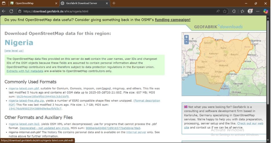
Step 1: Download Road Data from OpenStreetMap
- Go to Geofabrik Downloads.
- Download the Nigeria extract (usually a .osm.pbf file).
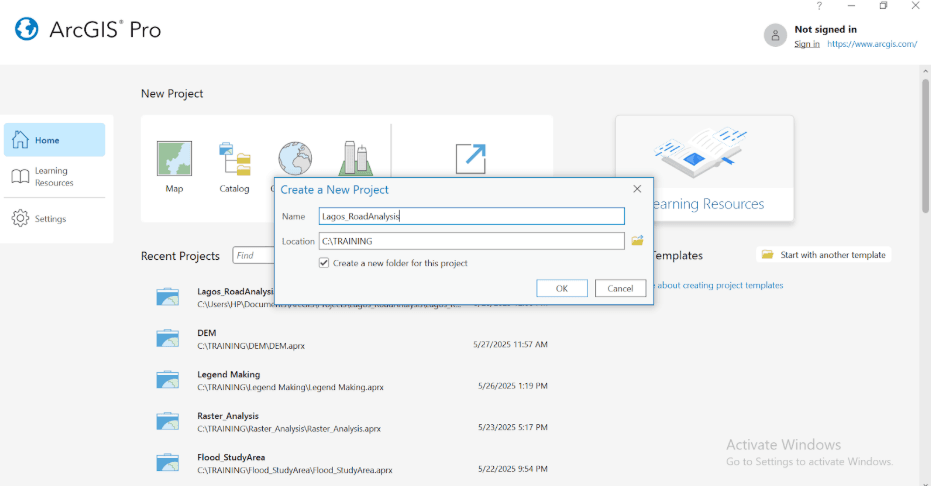
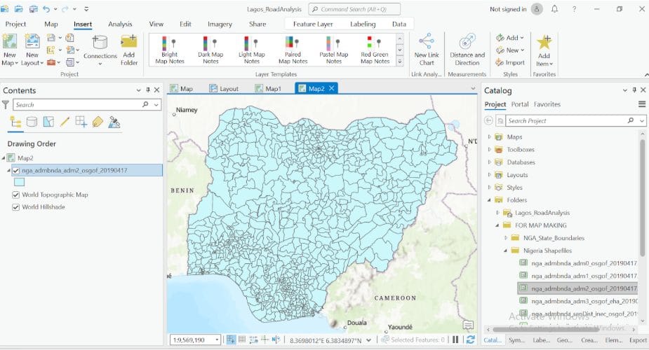
Step 2: Load OSM Data into ArcGIS Pro
- Open ArcGIS Pro and create a new project.
2. Add my Nigeria LGA boundary data
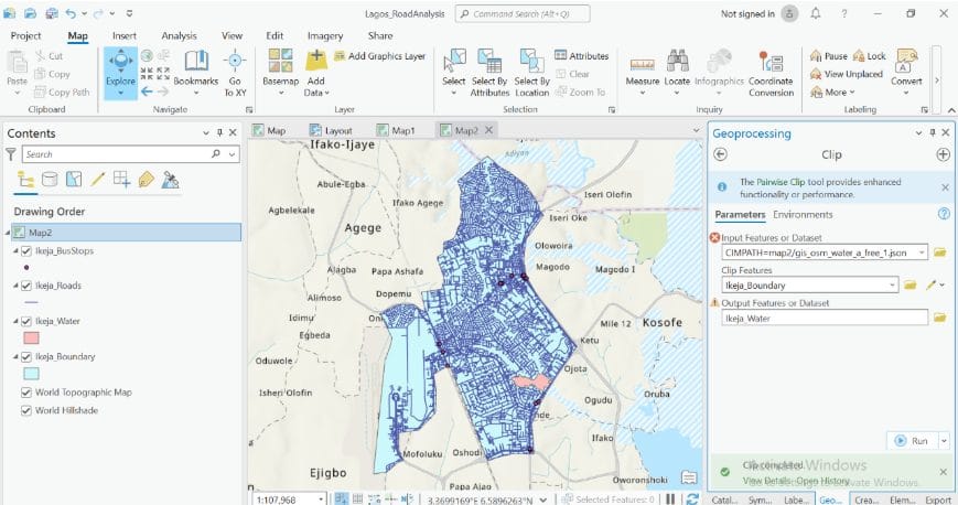
Step 3: Clip Roads to Ikeja LGA in LGA Boundary Data
- Extract my Ikeja local government in LGA boundary shapefile as a layer in your project.
Select by attribute > select Ikeja > export layer
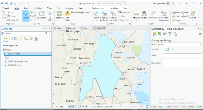
2. Add my OSM road data and use the Clip tool (Analysis > Tools > Clip) to extract only roads that fall within Ikeja, Lagos.
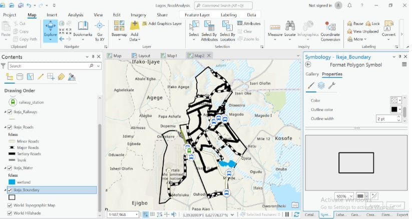
Step 4: Symbolize and Classify Roads
- In the Symbology pane, classify roads by type or highway attribute (e.g., motorway, trunk, primary, residential).
- Use different colors or line widths for each category:
- Tertiary roads: thick black
- Primary roads: green
- Secondary roads: dotted black
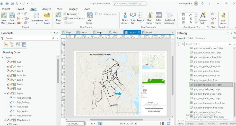
Step 5: Add Map Elements (Legend, Title, North Arrow)
- Go to Insert > Legend, North Arrow, and Scale Bar.
- Add a descriptive Title, e.g., “Road Network Map of Ikeja”
- Use the Layout View to design your map for printing or exporting.
Creating a road network map of Ikeja in Lagos State using OpenStreetMap and ArcGIS Pro is a powerful way to understand the city’s connectivity. This workflow gives you a strong foundation to analyze and visualize road systems.


