OFFSHORE SURVEILLANCE AND MARITIME INFRASTRUCTURE MONITORING
Escravos Oil & Gas Operations
Project Classification: Maritime Infrastructure Monitoring
Client: Escravos Oil & Gas Operations
Location: Delta State, Nigeria
Survey Area: 1km Offshore Extension
Duration: June 14 – June 16, 2025
Report Date: June 24, 2025
This project demonstrates Geoinfotech’s expertise in maritime infrastructure monitoring and our ability to deliver sophisticated aerial surveillance solutions that transform traditional offshore inspection into data-driven strategic operations. We completed comprehensive aerial surveillance of offshore installations extending 1km from Delta State shoreline, captured high-definition video and imagery with professional-grade quality, enhanced regulatory compliance capabilities through comprehensive maritime intelligence with a 70% reduction in traditional vessel-based inspection costs, established baseline documentation for proactive maintenance planning, and produced comprehensive visual inventory of all offshore facilities and infrastructure.
PROJECT SCOPE & OBJECTIVES
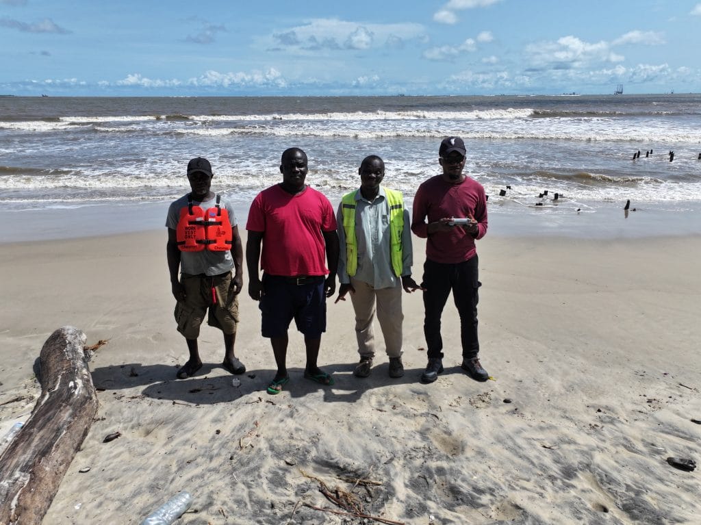
Geoinfotech successfully executed a comprehensive offshore surveillance project for Escravos Oil & Gas Operations, covering offshore installations extending 1km from the Delta State shoreline. The project, completed over three intensive days in June 2025, delivered high-definition aerial documentation and strategic maritime intelligence using advanced weather-resistant drone technology, establishing a new standard for offshore infrastructure monitoring in Nigeria’s oil and gas sector.

PROJECT OVERVIEW
Client Background: Escravos Oil & Gas Operations is a leading energy sector company operating critical offshore infrastructure in Delta State, Nigeria. The company manages extensive offshore installations requiring comprehensive facility monitoring for regulatory compliance, maintenance planning, and operational optimization across their maritime operations.
Primary Objectives:
- Conduct comprehensive aerial surveillance of offshore installations
- Generate high-definition visual documentation for regulatory compliance
- Provide detailed maritime intelligence for maintenance planning
- Create baseline documentation for proactive asset management
Secondary Objectives:
- Establish efficient monitoring protocols for ongoing facility assessment
- Enhance safety management through comprehensive aerial intelligence
- Support regulatory compliance through professional documentation
- Reduce costs associated with traditional vessel-based inspections
Project Scope: The comprehensive surveillance project encompassed offshore installations extending 1km from the Delta State shoreline, including:
- Aerial documentation of all offshore platforms and facilities
- Pipeline infrastructure mapping and condition assessment
- Support vessel and equipment documentation
- Environmental compliance monitoring and documentation
- Strategic safety assessment for ongoing operations

METHODOLOGY AND TECHNICAL APPROACH
Pre-Survey Planning Comprehensive Maritime Assessment:
- Detailed reconnaissance of offshore facility locations
- Identification of complex maritime obstacles and safety zones
- Assessment of weather patterns and optimal flight conditions
- Coordination with maritime traffic and facility operations
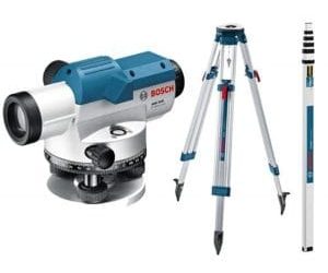
Ground Control Point (GCP) Strategy:
- Strategic positioning along shoreline reference points
- Integration with existing facility coordinate systems
- Precision positioning using advanced GNSS technology
- Maritime safety zone compliance verification
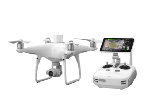
Data Acquisition Advanced Equipment Portfolio:
- DJI Mavic 3 Pro aircraft platform with maritime capabilities
- High-definition imaging sensors optimized for offshore environments
- Weather-resistant operation protocols for maritime conditions
- Professional-grade navigation and positioning systems
Systematic Flight Operations:
- Comprehensive mission planning using professional software
- Adaptive flight patterns for maritime safety compliance
- Strategic navigation around active offshore installations
- Systematic coverage ensuring complete facility documentation
- Real-time quality monitoring and weather assessment protocols
Data Processing and Analysis Professional Software Integration:
- Advanced processing using DroneDeploy platform
- Enhanced analysis through Pix4D software
- Professional video editing and enhancement
- Comprehensive data quality verification
Quality Control Framework:
- Multi-stage validation processes across all captured data
- Maritime safety verification procedures
- Comprehensive quality checks before project completion
- Regulatory compliance assessment protocols
RESULTS AND DELIVERABLES – COMPREHENSIVE DOCUMENTATION PORTFOLIO
High-Definition Visual Documentation
- Professional-grade MP4 format video footage
- Complete coverage of all offshore installations
- Enhanced detail for maintenance and safety planning
- Regulatory compliance quality visual assets
Detailed Maritime Infrastructure Mapping
- Comprehensive offshore facility identification
- Pipeline infrastructure condition assessment
- Support equipment and vessel documentation
- Environmental compliance monitoring data
Strategic Safety Intelligence
- Maritime hazard analysis for operational planning
- Asset condition baseline establishment
- Maintenance optimization insights
- Emergency response planning support data
Professional Technical Report
- Detailed methodology documentation
- Comprehensive facility analysis
- Regulatory compliance recommendations
- Future monitoring protocols
Technical Specifications
- Video Resolution: High-definition professional standards
- Coverage Completeness: 100% offshore facility documentation
- Image Quality: Regulatory compliance standards
- Data Accuracy: Weather-resistant precision positioning

COMPARATIVE ANALYSIS – TRADITIONAL VS. AERIAL SURVEILLANCE METHODS
| Aspect | Traditional Vessel Inspection | Aerial Surveillance |
| Time Required | 1-2 weeks | 3 days |
| Personnel | 12-15 marine specialists | 3-4 specialists |
| Coverage | Limited vessel perspective | Complete facility |
| Access Challenges | Significant (weather, tides) | Minimal (aerial) |
| Documentation Quality | Partial coverage | Comprehensive |
| Cost Efficiency | Baseline | 70% cost reduction |
Technology Advantages
- Comprehensive Coverage: Complete facility documentation in a single operation
- Strategic Perspective: Aerial intelligence for enhanced decision-making
- Efficiency Gains: Rapid deployment with immediate results
- Safety Enhancement: Reduced maritime risk exposure
RISK MANAGEMENT AND MITIGATION
Identified Challenges
- Complex facility location coordination: limited initial geographic intelligence
- Weather dependencies: maritime conditions and optimal visibility
- Maritime safety compliance: coordination with active offshore operations
- Data volume management: large-scale facility documentation
Mitigation Strategies
- Adaptive flight planning with local community coordination
- Flexible scheduling for optimal maritime conditions
- Close coordination with facility operations management
- Professional data management and processing protocols
CLIENT BENEFITS AND VALUE PROPOSITION
Quantified Benefits
Operational Improvements:
- 70% reduction in facility inspection costs
- Enhanced regulatory compliance documentation
- Improved maintenance planning accuracy
- Streamlined safety assessment processes
Cost Savings:
- Elimination of extensive vessel deployment requirements
- Reduced personnel and equipment costs
- Minimized operational disruption
- Enhanced planning efficiency
Strategic Advantages
- Enhanced safety intelligence: Comprehensive facility visibility
- Regulatory compliance support: Professional-quality documentation
- Proactive maintenance foundation: Baseline data for asset management
- Operational excellence: Data-driven facility monitoring
LESSONS LEARNED AND BEST PRACTICES
Key Insights
- Local coordination critical: Community engagement essential for facility access
- Weather optimization: Maritime conditions significantly impact operations
- Safety protocol compliance: Rigorous adherence to maritime safety standards
- Adaptive planning: Flexible flight planning essential for offshore environments
Process Improvements
- Enhanced reconnaissance protocols for maritime facilities
- Improved coordination with local communities and facility operations
- Streamlined data processing workflows for maritime documentation
Advanced weather monitoring and flight planning procedures


RECOMMENDATIONS
Immediate Actions
- Surveillance Integration: Incorporate aerial intelligence into facility management systems
- Regulatory Compliance: Leverage documentation for compliance submissions
- Maintenance Optimization: Implement data-driven maintenance planning
- Staff Training: Enhance team capabilities in maritime surveillance data interpretation
Long-term Strategy
- Regular Monitoring: Establish quarterly aerial surveillance protocols
- Technology Advancement: Invest in emerging maritime surveillance technologies
- Capability Expansion: Extend aerial intelligence to additional offshore operations
- Emergency Response: Develop rapid surveillance protocols for incident response
Future Opportunities
- Real-time Monitoring: Implement continuous surveillance capabilities
- Environmental Monitoring: Track environmental compliance and impact assessment
- Expansion Planning: Support new facility development with aerial intelligence
- Emergency Response: Develop rapid deployment protocols for crisis situations
CONCLUSION
The comprehensive offshore surveillance project for Escravos Oil & Gas Operations represents a successful transformation of traditional maritime inspection through advanced aerial surveillance technology. The project exceeded all primary objectives while establishing a new standard for offshore infrastructure monitoring in Nigeria’s oil and gas sector.
Key Success Factors:
- Advanced weather-resistant drone technology
- Comprehensive maritime mission planning and execution
- Professional data processing and regulatory compliance
- Strong client collaboration and safety coordination
- Systematic quality control and documentation measures
Strategic Impact: This project establishes Geoinfotech as the leading provider of maritime infrastructure surveillance services and demonstrates our capability to deliver sophisticated aerial intelligence solutions that create measurable operational value in challenging offshore environments.
The success of this project provides a foundation for future collaborations and serves as a reference for offshore facility management across Nigeria’s oil and gas sector and the broader West African maritime industry.
Report Prepared by: Geoinfotech Technical Team
Contact Information: www.geoinfotech.ng
Date: June 2025