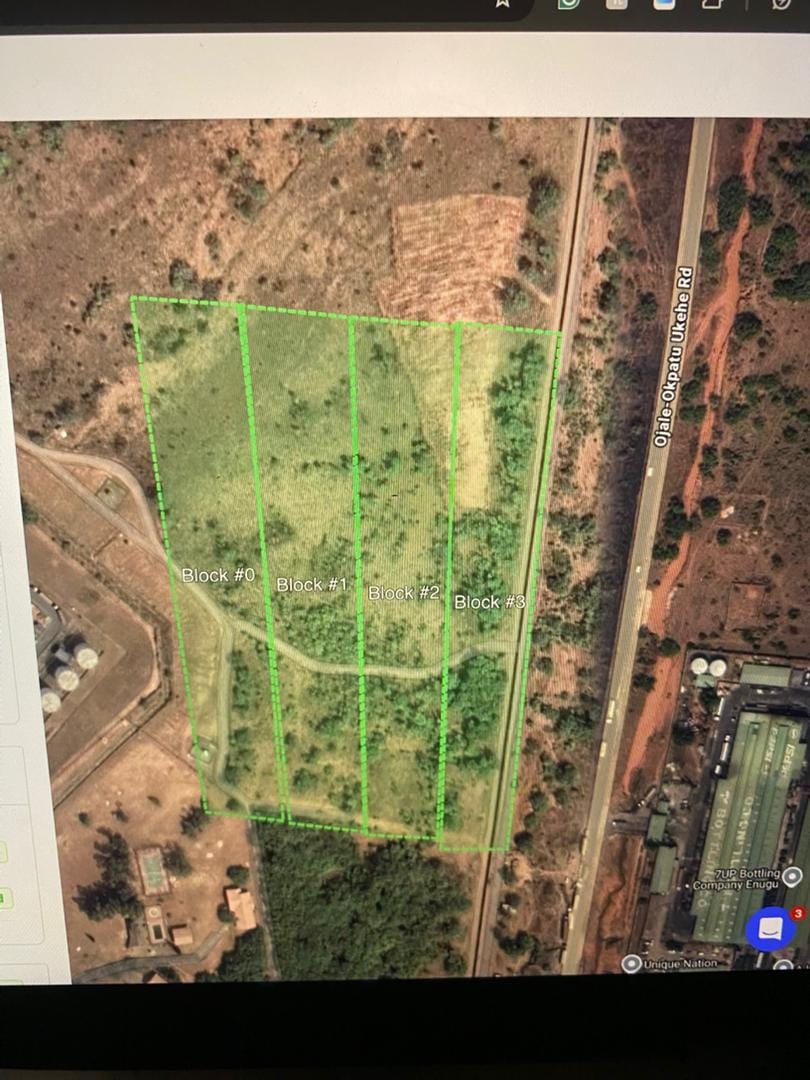
Geoinfotech successfully completed a specialized RGB and Thermal flight inspection at a 7.64-hectare solar facility in Ama-Ngwo, Udi LGA, Enugu State. This high-precision aerial assessment, conducted from May 6 to May 7, 2025, combined advanced imaging technologies to analyze solar panel performance, identify potential issues, and support maintenance planning for optimal energy production.
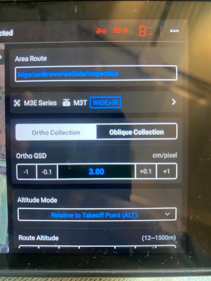
The inspection process employed a strategic approach utilizing both visible light and infrared spectrum analysis. Our technical team deployed specialized drone technology equipped with dual-sensor systems, capturing simultaneous RGB and thermal imagery across the entire solar installation. This innovative methodology allowed for comprehensive panel assessment without disrupting energy production operations, providing immediate insight into system performance and maintenance needs.
Data acquisition involved systematic grid patterns with precise flight parameters to ensure consistent image resolution and overlap across the facility. Our experienced drone pilots conducted multiple flight missions at varying heights and angles to capture both macro and micro details of the installation. The combination of high-resolution RGB imagery with thermal radiometric data provided a complete diagnostic picture of the solar array’s operational status.
Post-flight analysis utilized specialized photogrammetry software and thermal anomaly detection algorithms to process the collected data. Our technicians meticulously analyzed the imagery to identify panel defects, hotspots, connection issues, and other potential failures that could impact energy output. Advanced image classification techniques helped categorize and prioritize maintenance needs based on severity and potential production impact.
Deliverables included georeferenced orthomosaic maps, comprehensive thermal anomaly reports, panel efficiency assessments, maintenance priority charts, and a detailed technical document identifying specific panels requiring attention. Each element underwent rigorous quality control to ensure accuracy and actionable intelligence for the maintenance team at SITEAMRK.
This specialized inspection has equipped SITEAMRK with precise diagnostic information essential for targeted maintenance interventions, optimized repair scheduling, and improved overall system efficiency. The combination of visual and thermal assessment provides a comprehensive understanding of the solar facility’s health, potentially extending equipment lifespan and maximizing energy production.
Geoinfotech continues to lead in providing advanced geospatial solutions for renewable energy infrastructure, helping organizations like SITEAMRK leverage cutting-edge technology for improved asset management and operational efficiency. This successful project demonstrates our commitment to supporting sustainable energy initiatives through precision inspection services and data-driven maintenance strategies.