Make better decisions with accurate 3D maps and models
SURVEYING
SURVEYING
CONSTRUCTION
CONSTRUCTION
AGRICULTURE
AGRICULTURE
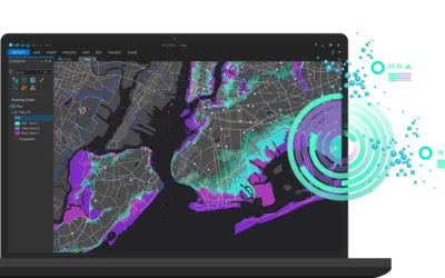
TELECOM
TELECOM
PUBLIC SAFETY
PUBLIC SAFETY
MINING
MINING
INSPECTION
INSPECTION

GEOGRAPHIC INFORMATION SYSTEM
We Create interactive maps to visualize and explore your data using various dynamic mapping software.
GEOGRAPHIC INFORMATION SYSTEM
- Geo-Spatial Analysis
- Web Mapping and Application
- Cartographic Mapping
- Data Sales
- Training
- More…
REMOTE SENSING
- Satellite Image Processing
- High Resolution Satellite Image Sales/Download
- Image Analysis of Digital Surface and Terrain Models (DSM, DTM) with precisions far higher than any other product.
- Training
- More…
GEO STORE
Download free and paid datasets, software, and maps. Get the best quality UAV (Drone) Products, GPS, Manuals, and other GeoTech Equipment.
Mission Planning
Data Acquisition
Area Mapping and Inspection
Data Analysis
Our Portfolio
Explore Recent Drone Projects


Our Blog
Read the latest from Geoinfotech
Downloading Survey, Drone, and GIS Software in Nigeria
Your Guide to Downloading Survey, Drone, and GIS Software in Nigeria In the ever-evolving fields of surveying, drone technology, and Geographic Information Systems (GIS), having the right software is crucial. Whether you're a surveyor, a drone enthusiast, or a GIS...

Essential Drone Operation Safety Tips
Drone Operation Safety Tips: Pre-Flight Checklist; always start with a pre-flight checklist. Check the memory card space of your drone. When flying outdoor always turn on vision sensor. Check your drone batteries, controller battery and phone/monitor battery. Check...

Emergency Response
What is Emergency Response? Emergency response refers to the actions taken by individuals, organizations, and authorities to address and mitigate the impacts of emergencies, disasters, or crises. This can include natural disasters such as hurricanes, earthquakes,...

ASSET INSPECTION
What Is Asset Inspection? Asset Inspection is the task of surveying or assessing the physical condition of an asset, to create data that can be used in the efficient and effective management (governance) of that asset over its life-cycle. Asset inspection is a process...
For any inquires call now
Contact us
Do you have any query?