Make better decisions with accurate 3D maps and models
SURVEYING
SURVEYING
CONSTRUCTION
CONSTRUCTION
AGRICULTURE
AGRICULTURE
TELECOM
TELECOM
PUBLIC SAFETY
PUBLIC SAFETY
MINING
MINING
INSPECTION
INSPECTION

GEOGRAPHIC INFORMATION SYSTEM
We Create interactive maps to visualize and explore your data using various dynamic mapping software.
GEOGRAPHIC INFORMATION SYSTEM
- Geo-Spatial Analysis
- Web Mapping and Application
- Cartographic Mapping
- Data Sales
- Training
- More…
REMOTE SENSING
- Satellite Image Processing
- High Resolution Satellite Image Sales/Download
- Image Analysis of Digital Surface and Terrain Models (DSM, DTM) with precisions far higher than any other product.
- Training
- More…
GEO STORE
Download free and paid datasets, software, and maps. Get the best quality UAV (Drone) Products, GPS, Manuals, and other GeoTech Equipment.
Mission Planning
Data Acquisition
Area Mapping and Inspection
Data Analysis
Our Portfolio
Explore Recent Drone Projects


Our Blog
Read the latest from Geoinfotech

Professional Consultants in Nigeria for Land Survey, Drone, or GIS Matters
Dealing with land issues in Nigeria can be tough because of property disputes, legal paperwork, and managing spatial data. Drones and Geographic Information Systems (GIS) have changed how we collect and use this data, making them essential for many industries. For...
Advancements in Drone Technology for Remote Sensing
Drones, also known as unmanned aerial vehicles (UAVs), have become a game-changer in the field of remote sensing with the use of specialized sensors like LiDAR (Light Detection and Ranging) and hyperspectral cameras. These advancements are transforming remote sensing...

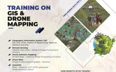
Top Companies for Drone, GIS and Survey training in Nigeria
In this blog post, we would be discussing about where you can professionally learn about Drones, GIS, and Surveying in Nigeria. Let’s briefly highlight the three major aforementioned subjects stated above before we proceed any further. What is a drone? A drone is an...
Top Places for GIS Analysis in Nigeria
GIS ANALYSIS IN NIGERIA What is GIS analysis? GIS (Geographic Information System) analysis is a powerful tool that helps us understand and interpret spatial data. It's like having a superpower that allows us to visualize and analyze complex relationships between...
For any inquires call now
Contact us
Do you have any query?