Make better decisions with accurate 3D maps and models
SURVEYING
SURVEYING
CONSTRUCTION
CONSTRUCTION
AGRICULTURE
AGRICULTURE
TELECOM
TELECOM
PUBLIC SAFETY
PUBLIC SAFETY
MINING
MINING
INSPECTION
INSPECTION

GEOGRAPHIC INFORMATION SYSTEM
We Create interactive maps to visualize and explore your data using various dynamic mapping software.
GEOGRAPHIC INFORMATION SYSTEM
- Geo-Spatial Analysis
- Web Mapping and Application
- Cartographic Mapping
- Data Sales
- Training
- More…
REMOTE SENSING
- Satellite Image Processing
- High Resolution Satellite Image Sales/Download
- Image Analysis of Digital Surface and Terrain Models (DSM, DTM) with precisions far higher than any other product.
- Training
- More…
GEO STORE
Download free and paid datasets, software, and maps. Get the best quality UAV (Drone) Products, GPS, Manuals, and other GeoTech Equipment.
Mission Planning
Data Acquisition
Area Mapping and Inspection
Data Analysis
Our Portfolio
Explore Recent Drone Projects


Our Blog
Read the latest from Geoinfotech
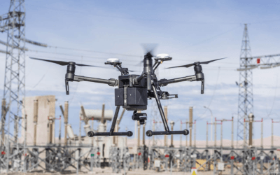
Drone Company in Lagos Nigeria
Geoinfotech Drone Surveying, Mapping, Inspection, or Surveillance company in Lagos Nigeria is an innovative and cost-efficient way to collect aerial data on projects in surveying, construction, agriculture, energy, and more. But in a fast-moving world, data needs to...
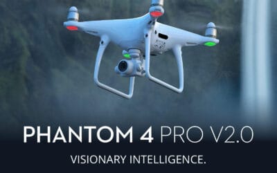
DJI Phantom 4 Pro V2.0 drone Price in Nigeria
The Phantom series from the Chinese manufacturer, DJI, is one of the most popular models of unmanned aerial vehicles. The Phantom 4 Pro V2.0 with four rotors (quadrocopter) and the freely-hanging camera is similar to the previous Phantom 4 version, however, DJI...
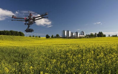
AGRICULTURAL DATA GATHERING THROUGH THE USE OF REMOTE SENSING DRONE TECHNOLOGY
The use of Unmanned Aerial Vehicles (UAV), geospatial analytical techniques, and remote sensing tools has been on the drive for big data science analysis on climatology and precision agriculture as well mapping out the pattern of rural settlement to help improve...
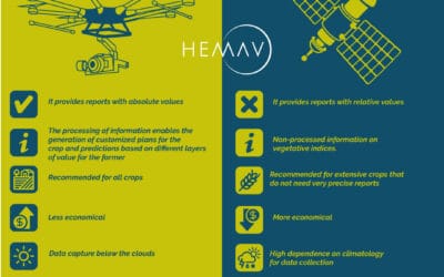
Drones vs Satellites
In recent times, drones have proven to be a reliable alternative when it comes to gathering information that would otherwise be provided by satellites in a faster and cheaper way. Typically, it's really not a question of "either/or" when it comes to deciding whether...
For any inquires call now
Contact us
Do you have any query?