Make better decisions with accurate 3D maps and models
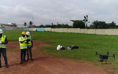
SURVEYING
SURVEYING
CONSTRUCTION
CONSTRUCTION
AGRICULTURE
AGRICULTURE
TELECOM
TELECOM
PUBLIC SAFETY
PUBLIC SAFETY
MINING
MINING
INSPECTION
INSPECTION

GEOGRAPHIC INFORMATION SYSTEM
We Create interactive maps to visualize and explore your data using various dynamic mapping software.
GEOGRAPHIC INFORMATION SYSTEM
- Geo-Spatial Analysis
- Web Mapping and Application
- Cartographic Mapping
- Data Sales
- Training
- More…
REMOTE SENSING
- Satellite Image Processing
- High Resolution Satellite Image Sales/Download
- Image Analysis of Digital Surface and Terrain Models (DSM, DTM) with precisions far higher than any other product.
- Training
- More…
GEO STORE
Download free and paid datasets, software, and maps. Get the best quality UAV (Drone) Products, GPS, Manuals, and other GeoTech Equipment.
Mission Planning
Data Acquisition
Area Mapping and Inspection
Data Analysis
Our Portfolio
Explore Recent Drone Projects


Our Blog
Read the latest from Geoinfotech

4 Top Tips for Interpreting Maps
4 Top Tips for Interpreting Maps Top Tips for Interpreting Maps Maps are symbolic depictions emphasizing relationships between elements such as objects, regions, or themes. Many maps are static, fixed to paper or hardcopy, or some other durable medium, while...

Survey activities required for M&E Dashboard for Smart City
Survey activities required for M&E Dashboard for Smart City Survey activities required for M&E Dashboard for Smart City 1. RECONNAISSANCE SURVEY FOR TOWN PLANNING Reconnaissance Survey is essential for screening through a survey that can be systematic or...

Using GPS Technology for Land Survey
Using GPS Technology for Land Survey Using GPS Technology for Land Survey GPS is the acronym for Global Positioning System. It is a highly accurate navigation system using signals from satellites to determine a location on the Earth’s surface, irrespective of...
6 Benefits of Drone Survey/ Mapping
6 Benefits of Drone Survey/ Mapping 6 Benefits of Drone Survey/ Mapping Drone surveying refers to using a drone, or unmanned aerial vehicle (UAV), to capture aerial data. An aerial survey is performed utilizing drones and unique cameras having downward-facing...
For any inquires call now
Contact us
Do you have any query?