Make better decisions with accurate 3D maps and models
SURVEYING
SURVEYING
CONSTRUCTION
CONSTRUCTION
AGRICULTURE
AGRICULTURE
TELECOM
TELECOM
PUBLIC SAFETY
PUBLIC SAFETY
MINING
MINING
INSPECTION
INSPECTION

GEOGRAPHIC INFORMATION SYSTEM
We Create interactive maps to visualize and explore your data using various dynamic mapping software.
GEOGRAPHIC INFORMATION SYSTEM
- Geo-Spatial Analysis
- Web Mapping and Application
- Cartographic Mapping
- Data Sales
- Training
- More…
REMOTE SENSING
- Satellite Image Processing
- High Resolution Satellite Image Sales/Download
- Image Analysis of Digital Surface and Terrain Models (DSM, DTM) with precisions far higher than any other product.
- Training
- More…
GEO STORE
Download free and paid datasets, software, and maps. Get the best quality UAV (Drone) Products, GPS, Manuals, and other GeoTech Equipment.
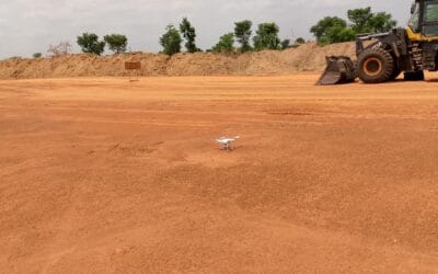
Mission Planning
Data Acquisition
Area Mapping and Inspection
Data Analysis
Our Portfolio
Explore Recent Drone Projects


Our Blog
Read the latest from Geoinfotech

Tips for Calibrating Your Drone’s Compass and IMU
Calibration is essential because it establishes a baseline for your drone's internal sensors, such as the gyroscope, accelerometer, and compass. Calibrating the compass and IMU (Inertial Measurement Unit) on a drone helps to ensure that the drone's flight controls are...

Companies that sell affordable drones in Nigeria
What Is a Drone? Drones are small or medium-sized unmanned aerial vehicles (UAV). They're unique in that they can drive remotely and autonomously, and they're capable of maintaining a controlled, sustained level of flight. The drone system combines robotics...

Leading Drone Service Provider in Nigeria
The fast growth of drone technology has created many new opportunities in different fields like farming, construction, and environmental monitoring. But, understanding the details of drone technology, rules, and uses can be difficult. If you need help with operating...
Aerial surveying and mapping
What is Aerial surveying and mapping? Aerial Surveying is the process of collecting geospatial data from aerial platforms such as airplanes, helicopters, balloons, and drones to create maps, 3D models, and other geospatial products. The collected data can be used to...
For any inquires call now
Contact us
Do you have any query?