Make better decisions with accurate 3D maps and models
SURVEYING
SURVEYING
CONSTRUCTION
CONSTRUCTION
AGRICULTURE
AGRICULTURE
TELECOM
TELECOM
PUBLIC SAFETY
PUBLIC SAFETY
MINING
MINING
INSPECTION
INSPECTION

GEOGRAPHIC INFORMATION SYSTEM
We Create interactive maps to visualize and explore your data using various dynamic mapping software.
GEOGRAPHIC INFORMATION SYSTEM
- Geo-Spatial Analysis
- Web Mapping and Application
- Cartographic Mapping
- Data Sales
- Training
- More…
REMOTE SENSING
- Satellite Image Processing
- High Resolution Satellite Image Sales/Download
- Image Analysis of Digital Surface and Terrain Models (DSM, DTM) with precisions far higher than any other product.
- Training
- More…
GEO STORE
Download free and paid datasets, software, and maps. Get the best quality UAV (Drone) Products, GPS, Manuals, and other GeoTech Equipment.
Mission Planning
Data Acquisition
Area Mapping and Inspection
Data Analysis
Our Portfolio
Explore Recent Drone Projects


Our Blog
Read the latest from Geoinfotech
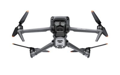
Where to Buy DJI Mavic 3 Pro Cine Premium Combo in Lagos, Nigeria (2026 Guide)
Where to Buy DJI Mavic 3 Pro Cine Premium Combo in Lagos, Nigeria (2026 Guide) If you’re searching for where to buy a DJI Mavic 3 Pro Cine Premium Combo in Lagos, Nigeria, you’re part of a growing number of professionals investing in high-end drones for mapping,...
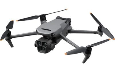
Where to Buy DJI Mavic 3 Pro Fly More Combo + RC in Lagos, Nigeria
Where to Buy DJI Mavic 3 Pro Fly More Combo + RC in Lagos, Nigeria (2026 Guide) If you’re searching for where to buy a DJI Mavic 3 Pro Fly More Combo in Lagos, Nigeria, you’re not alone. Demand for high-performance drones is rapidly increasing across industries such...
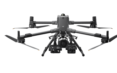
What is the Best Drone for Mapping Eko Atlantic? (Matrice 4E vs. Matrice 400)
Mapping a high-value, fast-developing area like Eko Atlantic City in Lagos requires precision, reliability, and cutting-edge aerial technology. If you're a drone pilot, surveyor, or geospatial professional, choosing the right drone can make or break your project. In...

Revolutionizing Nigerian Infrastructure Security: GEOSTORE’s Real-Time Drone Surveillance System
Operational monitoring of critical infrastructure such as oil pipelines, wellheads, and remote assets, requires timely and continuous visibility. Historically, traditional inspection methods have relied heavily on periodic field visits, which are severely limited by...
For any inquires call now
Contact us
Do you have any query?