Make better decisions with accurate 3D maps and models
SURVEYING
SURVEYING
CONSTRUCTION
CONSTRUCTION
AGRICULTURE
AGRICULTURE
TELECOM
TELECOM
PUBLIC SAFETY
PUBLIC SAFETY
MINING
MINING
INSPECTION
INSPECTION

GEOGRAPHIC INFORMATION SYSTEM
We Create interactive maps to visualize and explore your data using various dynamic mapping software.
GEOGRAPHIC INFORMATION SYSTEM
- Geo-Spatial Analysis
- Web Mapping and Application
- Cartographic Mapping
- Data Sales
- Training
- More…
REMOTE SENSING
- Satellite Image Processing
- High Resolution Satellite Image Sales/Download
- Image Analysis of Digital Surface and Terrain Models (DSM, DTM) with precisions far higher than any other product.
- Training
- More…
GEO STORE
Download free and paid datasets, software, and maps. Get the best quality UAV (Drone) Products, GPS, Manuals, and other GeoTech Equipment.
Mission Planning
Data Acquisition
Area Mapping and Inspection
Data Analysis
Our Portfolio
Explore Recent Drone Projects


Our Blog
Read the latest from Geoinfotech
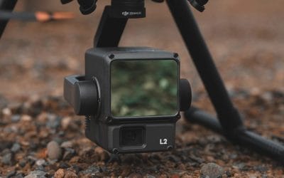
Elevate Precision Mapping with the DJI Zenmuse L2
Elevate Precision Mapping with the DJI Zenmuse L2: Now Available in Nigeria for ₦19,350,000 Nigeria’s geospatial and industrial sectors demand precision and efficiency in data collection. The DJI Zenmuse L2, priced at ₦19,350,000, is a state-of-the-art LiDAR and RGB...
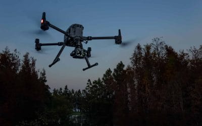
See Through the Night with the DJI Zenmuse H20N
See Through the Night with the DJI Zenmuse H20N: Now Available in Nigeria for ₦12,750,000 In Nigeria’s dynamic industries, from public safety to wildlife conservation, the ability to operate in low-light or nighttime conditions is critical. The DJI Zenmuse H20N,...
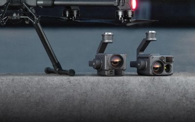
Aerial Precision with the DJI Zenmuse H20T
Unleash Aerial Precision with the DJI Zenmuse H20T: Now Available in Nigeria for ₦13,700,000 In today’s fast-paced world, industries across Nigeria demand cutting-edge technology to stay ahead. Whether you’re in public safety, infrastructure inspection, or...

Power Your DJI Matrice 4 Series with the 99Wh Intelligent Flight Battery
If you’re flying the DJI Matrice 4 Series (Matrice 4T or 4E), you’re operating a cutting-edge drone designed for enterprise-grade missions like surveying, inspections, and public safety. The DJI Matrice 4 Series Intelligent Flight Battery, priced at ₦380,000, is the...
For any inquires call now
Contact us
Do you have any query?