Make better decisions with accurate 3D maps and models
SURVEYING
SURVEYING
CONSTRUCTION
CONSTRUCTION
AGRICULTURE
AGRICULTURE
TELECOM
TELECOM
PUBLIC SAFETY
PUBLIC SAFETY
MINING
MINING
INSPECTION
INSPECTION

GEOGRAPHIC INFORMATION SYSTEM
We Create interactive maps to visualize and explore your data using various dynamic mapping software.
GEOGRAPHIC INFORMATION SYSTEM
- Geo-Spatial Analysis
- Web Mapping and Application
- Cartographic Mapping
- Data Sales
- Training
- More…
REMOTE SENSING
- Satellite Image Processing
- High Resolution Satellite Image Sales/Download
- Image Analysis of Digital Surface and Terrain Models (DSM, DTM) with precisions far higher than any other product.
- Training
- More…
GEO STORE
Download free and paid datasets, software, and maps. Get the best quality UAV (Drone) Products, GPS, Manuals, and other GeoTech Equipment.
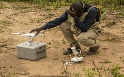
Mission Planning
Data Acquisition
Area Mapping and Inspection
Data Analysis
Our Portfolio
Explore Recent Drone Projects


Our Blog
Read the latest from Geoinfotech

Geoinfotech: Nigeria’s Most Experienced Drone Company with Over a Decade of Proven Leadership
In Nigeria’s rapidly expanding drone industry, true leadership is defined by experience, consistency, and operational credibility. While many drone operators have emerged in recent years, only a select few have sustained reliable operations over time. Geoinfotech...

Sky-High ROI: Drone Mapping for Real Estate Projects in Lagos (2026)
In the fast-paced Lagos real estate market, speed, precision, and reliable data are the new currency. Whether you’re developing a luxury high-rise in Ikoyi, managing a sprawling estate in Mowe-Ibafo, or sandfilling plots in Ibeju-Lekki, traditional ground surveys are...

The Future of Land Surveying
Introduction Land surveying has long been a cornerstone of development, providing the spatial framework for land ownership, infrastructure, urban planning, and environmental management. As the world enters an era shaped by rapid technological advancement, climate...
Top 10 Reasons to Become a Certified Drone Pilot in Nigeria
The use of drones, officially known as Unmanned Aerial Vehicles (UAVs), is expanding rapidly across Nigeria. From land surveying and agriculture to construction, oil and gas, security, and media production, drone technology has become a critical tool for data...
For any inquires call now
Contact us
Do you have any query?