Make better decisions with accurate 3D maps and models
SURVEYING
SURVEYING
CONSTRUCTION
CONSTRUCTION
AGRICULTURE
AGRICULTURE
TELECOM
TELECOM
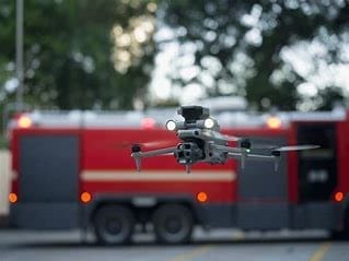
PUBLIC SAFETY
PUBLIC SAFETY
MINING
MINING
INSPECTION
INSPECTION

GEOGRAPHIC INFORMATION SYSTEM
We Create interactive maps to visualize and explore your data using various dynamic mapping software.
GEOGRAPHIC INFORMATION SYSTEM
- Geo-Spatial Analysis
- Web Mapping and Application
- Cartographic Mapping
- Data Sales
- Training
- More…
REMOTE SENSING
- Satellite Image Processing
- High Resolution Satellite Image Sales/Download
- Image Analysis of Digital Surface and Terrain Models (DSM, DTM) with precisions far higher than any other product.
- Training
- More…
GEO STORE
Download free and paid datasets, software, and maps. Get the best quality UAV (Drone) Products, GPS, Manuals, and other GeoTech Equipment.
Mission Planning
Data Acquisition
Area Mapping and Inspection
Data Analysis
Our Portfolio
Explore Recent Drone Projects


Our Blog
Read the latest from Geoinfotech
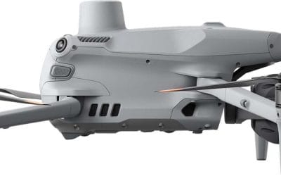
Where to Buy DJI Matrice 4E Enterprise Drone in Lagos Nigeria (2026 Guide)
Where to Buy DJI Matrice 4E Enterprise Drone in Lagos, Nigeria (2026 Guide) Searching for where to buy the DJI Matrice 4E Enterprise Drone in Lagos, Nigeria? This guide covers its key features, real-world applications, and the most reliable place to purchase an...
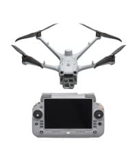
Where to Buy DJI Matrice 4T Thermal Drone in Lagos Nigeria | Price & Trusted Supplier
Where to Buy a DJI Matrice 4T Thermal Drone in Lagos, Nigeria Looking for where to buy a DJI Matrice 4T Thermal Drone in Lagos, Nigeria? This guide explains everything you need to know—from features and real-world applications to pricing expectations and how to...
Where to Buy DJI Matrice 4TD Thermal Drone for Dock 3 in Lagos Nigeria | Price & Trusted Supplier
Where to Buy a DJI Matrice 4TD Thermal Drone for Dock 3 in Lagos, Nigeria If you're searching for where to buy a DJI Matrice 4TD Thermal Drone for Dock 3 in Lagos, Nigeria, this guide covers everything you need—features, applications, pricing expectations, and where...
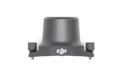
Where to Buy DJI Mavic 3 Enterprise RTK Module in Lagos Nigeria (Price & Trusted Dealers 2026)
Where to Buy DJI Mavic 3 Enterprise Series RTK Module in Lagos, Nigeria (2026 Guide) If you are searching for where to buy the DJI Mavic 3 Enterprise RTK module in Lagos, Nigeria, you are likely a professional who needs high-precision drone mapping and surveying...
For any inquires call now
Contact us
Do you have any query?