Make better decisions with accurate 3D maps and models
SURVEYING
SURVEYING
CONSTRUCTION
CONSTRUCTION
AGRICULTURE
AGRICULTURE
TELECOM
TELECOM
PUBLIC SAFETY
PUBLIC SAFETY
MINING
MINING
INSPECTION
INSPECTION

GEOGRAPHIC INFORMATION SYSTEM
We Create interactive maps to visualize and explore your data using various dynamic mapping software.
GEOGRAPHIC INFORMATION SYSTEM
- Geo-Spatial Analysis
- Web Mapping and Application
- Cartographic Mapping
- Data Sales
- Training
- More…
REMOTE SENSING
- Satellite Image Processing
- High Resolution Satellite Image Sales/Download
- Image Analysis of Digital Surface and Terrain Models (DSM, DTM) with precisions far higher than any other product.
- Training
- More…
GEO STORE
Download free and paid datasets, software, and maps. Get the best quality UAV (Drone) Products, GPS, Manuals, and other GeoTech Equipment.
Mission Planning
Data Acquisition
Area Mapping and Inspection
Data Analysis
Our Portfolio
Explore Recent Drone Projects


Our Blog
Read the latest from Geoinfotech

Drone Services in Lagos: Costs, Uses & Laws in 2025
Drone services in Lagos have evolved significantly, moving far beyond aerial photography; they now support critical operations in surveying, mapping, agriculture, infrastructure inspection, and construction monitoring. By 2025, drone technology will have become an...

How to Become a Certified Drone Pilot in Nigeria: Step-by-Step Guide
Drones are no longer just for photography enthusiasts—they have become vital tools in agriculture, construction, surveying, logistics, and security. In fact, as demand for drone services in Nigeria grows, the need for certified drone pilots is also rising. If you’ve...

WEB CONTENT FOR CADASTRAL SURVEYS
CADASTRAL SURVEYS A cadastral survey is the foundation of all property rights and land development. It is the precise process of measuring, mapping, and defining the legal boundaries of a parcel of land. This isn't just about drawing lines on a map; it's about...
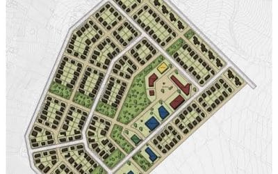
WEB CONTENT FOR LAYOUT SUBDIVISION
Building Lagos with Confidence A successful land development project starts with a flawless plan. Our specialized Layout Subdivision service converts survey data and conceptual designs into technically accurate, legally compliant, and highly detailed subdivision...
For any inquires call now
Contact us
Do you have any query?