
- This event has passed.
Professional Training on Training on QGIS (Cartographic Visualization, Geodatabases and Analysis)

Professional Training on Training on QGIS (Cartographic Visualization, Geodatabases and Analysis)
Professional 3 Days ▪ Training
5.0 ![]() (100% Practical) ▪ Certificate
(100% Practical) ▪ Certificate
Course Description:
Participants will gain a solid foundation in geospatial concepts, QGIS software, and practical skills to collect, analyze, and visualize geospatial data.
Participants will:
- Understand cartography, GIS, and mapping fundamentals
- Manage and analyze geographic data
- Create basic maps using QGIS
- Work with vector and raster datasets
- Raster intermediate-level skills in geospatial data analysis and visualization
- Apply geospatial techniques to real-world projects and programs
- Capacity to integrate geospatial data into existing workflows and systems
- Integrate and analyze data for informed decision-making
QGIS Modules
1. Installation overview and applications of Quantum GIS
2. Introduction to the Graphical User Interface
3. Data management and fundamentals
4. Introduction to Vector and Raster datasets, integrating and analyzing them
5. Spatial reference and projections
6. Working with Attribute tables
7. Creation of geodatabases
8. Understanding the 3 main types of geographical data (polygons, lines, and points)
9. Practice opening a variety of geographic data with QGIS and viewing
10. their attributes within QGIS
11. Importing Spreadsheets or CSV files
12. Data transformation
13. Basic Vector and Raster styling and Analysis
14. Perform basic map styling
15. Create and export a basic map as a static image file
16. Searching and downloading OpenStreetmap data
Award Of Certificate
Our Certificate is Recognized by Top Industries

Certificate of completion
![]() Advance GIS Mastering and Completion
Advance GIS Mastering and Completion
![]() Increased job opportunities and career prospects
Increased job opportunities and career prospects
![]() Higher client confidence and trust
Higher client confidence and trust
Courses Modules
What's Included in this Course
Free Software and Apps
Hands on Practical and Field Experience
Manual, Jotter and Biro
Test, Assessment and Exam
Certificate of Completion
Share this course
Related Courses

Weekend Class Training
The flexible weekend class allows working professionals and students to upskill efficiently while gaining immediately applicable knowledge for careers in surveying, agriculture, real estate, construction, environmental management, and related fields. [ninja_form...

The Real Estate Goldmine: Identifying Prime Investment Areas with Geospatial Intelligence
In today's fast-paced and competitive real estate market, identifying the right investment opportunities requires more than intuition, it requires the power of location intelligence. Discover how Geographic Information Systems (GIS), satellite imagery, demographic...

Drone Pilot for Beginners
Professional 3 Weekends ▪ Field Experience 5.0 (100% Practical) ▪ Exam & Certificate


Professional 6-7 Weekends ▪ Field Experience 5.0 (100% Practical) ▪ Exam & Certificate
The course AutoCAD for Land Surveying provides participants with practical skills for applying AutoCAD in survey analysis and plotting. Learners will gain hands-on experience in setting up and using AutoCAD software for survey data analysis, precise plotting, accurate...

Professional Drone Training Exam
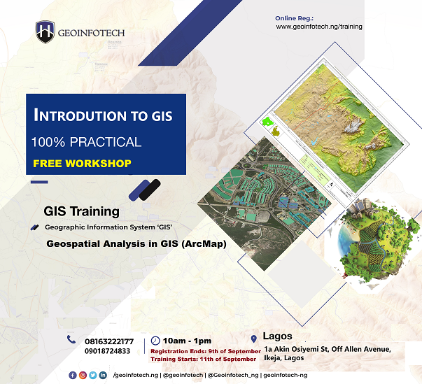
2021 Workshop: Geospatial Analysis in GIS (ArcMap) for Fire Services in Lagos
2021 Workshop on Geospatial Analysis in GIS (ArcMap) for Fire Services in Lagos This analysis helps us on why, where and how many fire services needed to be deployed in Lagos Nigeria. Multicriterial Analysis AHP | Suitability Analysis in GIS Click Here to...

UAV Drone Foundation Exam
Take the drone skills to new heights and train with the Experts at Geoinfotech. Advance your career in Drone Surveying, Photography, 3D Mapping. The next-gen digital learning solution In your own time, learn at your own pace–without taking any time off work....
![[Beginners to Advanced] Geographic Information System (ArcGIS Desktop and ArcGIS Pro)](https://geoinfotech.ng/wp-content/uploads/2020/07/GIS-Online-Training-Geoinfotech-1-1080x675.jpeg)
[Beginners to Advanced] Geographic Information System (ArcGIS Desktop and ArcGIS Pro)
Do you want to learn GIS as a professional with a proper guide online and procedures on executing GIS Projects/Tasks? This introductory course is for you. We have Introduced a step-by-step template, software installation, free data and manual to help you learn and...