Make better decisions with accurate 3D maps and models
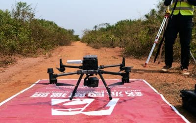
SURVEYING
SURVEYING
CONSTRUCTION
CONSTRUCTION
AGRICULTURE
AGRICULTURE
TELECOM
TELECOM
PUBLIC SAFETY
PUBLIC SAFETY
MINING
MINING
INSPECTION
INSPECTION

GEOGRAPHIC INFORMATION SYSTEM
We Create interactive maps to visualize and explore your data using various dynamic mapping software.
GEOGRAPHIC INFORMATION SYSTEM
- Geo-Spatial Analysis
- Web Mapping and Application
- Cartographic Mapping
- Data Sales
- Training
- More…
REMOTE SENSING
- Satellite Image Processing
- High Resolution Satellite Image Sales/Download
- Image Analysis of Digital Surface and Terrain Models (DSM, DTM) with precisions far higher than any other product.
- Training
- More…
GEO STORE
Download free and paid datasets, software, and maps. Get the best quality UAV (Drone) Products, GPS, Manuals, and other GeoTech Equipment.
Mission Planning
Data Acquisition
Area Mapping and Inspection
Data Analysis
Our Portfolio
Explore Recent Drone Projects


Our Blog
Read the latest from Geoinfotech

🌱 GIS in Agriculture Nigeria – Drone Mapping and Precision Farming Solutions
GIS in agriculture in Nigeria is transforming how farmers manage land, crops, and resources. By combining drone mapping in Nigeria, NDVI drone mapping in Lagos, and precision farming in Nigeria, agricultural businesses can reduce costs, boost yields, and improve...

How Drones Are Used in Agriculture: Transforming Farming Through Aerial Intelligence.
In the past, farming relied heavily on manual labour, observational experience, and traditional tools to monitor crops and manage fields. Today, drones, also known as unmanned aerial vehicles (UAVs), are redefining modern agriculture, bringing precision, speed,...
How Modern Land Surveying Guides Every Project in Lagos and Across Nigeria
If you’ve ever seen a new building rise, a road being constructed, or farmland divided for sale, a land surveyor was there before the first shovel touched the ground. In Nigeria, land surveying is the backbone of every successful project. The goal is straightforward:...

What Happened in Mokwa: A Simple Explanation
A Summary of the Flooding Incident at Mokwa On May 29, 2024, a devastating flash flood struck Mokwa town in Niger State, destroying 381 buildings and displacing many residents. The flood began around 6:00 AM and sent water as high as 4 meters rushing through the...
For any inquires call now
Contact us
Do you have any query?