Geoinfotech Training
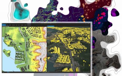
Introduction to GIS
Introduction to GIS
Unique solution for Land Surveyors and Civil Engineers on land development projects. In this course you will be introduced to Surveying using AutoCAD, you will learn the basics of how to apply surveying techniques, objects and databases, field measurement taken from the surveyor's instruments and processed into AutoCAD.
Skills to learn
Use the new GIS technology to solve spatial problems
GIS feature databases and non-spatial databases
Manage GIS projects from launch through to evaluation

Spatial Analysis using ArcGIS
Professional 2 Weekends ▪ Field Experience 5.0 (100% Practical) ▪ Exam & Certificate[dsm_blog_carousel include_categories="186,178,627,152,336,9,1" use_excerpt="off" use_date="off" use_author="off" slider_effect="coverflow" slider_effect_coverflow_depth="400"...

Managing Geospatial Data in ArcGIS
Professional 2 Weekends ▪ Field Experience 5.0 (100% Practical) ▪ Exam & Certificate [dsm_blog_carousel include_categories="186,178,627,152,336,9,1" use_excerpt="off" use_date="off" use_author="off" slider_effect="coverflow" slider_effect_coverflow_depth="400"...

Image analysis with ArcGIS
Professional 2 Weekends ▪ Field Experience 5.0 (100% Practical) ▪ Exam & Certificate[dsm_blog_carousel include_categories="186,178,627,152,336,9,1" use_excerpt="off" use_date="off" use_author="off" slider_effect="coverflow" slider_effect_coverflow_depth="400"...
Field data collection and management with ArcGIS
Professional 2 Weekends ▪ Field Experience 5.0 (100% Practical) ▪ Exam & Certificate[dsm_blog_carousel include_categories="186,178,627,152,336,9,1" use_excerpt="off" use_date="off" use_author="off" slider_effect="coverflow" slider_effect_coverflow_depth="400"...
![[Level 1] Remote Sensing and Google Earth Engine](https://geoinfotech.ng/wp-content/uploads/2021/01/WhatsApp-Image-2023-03-07-at-2.33.36-PM-2-1024x1024-e1688900517953-400x250.jpeg)
[Level 1] Remote Sensing and Google Earth Engine
Professional 4 Weekends ▪ Field Experience 5.0 (100% Practical) ▪ Exam & Certificate[dsm_blog_carousel include_categories="186,178,627,152,336,9,1" use_excerpt="off" use_date="off" use_author="off" slider_effect="coverflow" slider_effect_coverflow_depth="400"...
![[Level 2] Remote Sensing and Google Earth Engine](https://geoinfotech.ng/wp-content/uploads/2021/06/641eb7fa-4a9a-4edd-8138-e5687f3283cf-1080x809.jpg)
[Level 2] Remote Sensing and Google Earth Engine
Professional 4 Weekends ▪ Field Experience 5.0 (100% Practical) ▪ Exam & Certificate[dsm_blog_carousel include_categories="186,178,627,152,336,9,1" use_excerpt="off" use_date="off" use_author="off" slider_effect="coverflow" slider_effect_coverflow_depth="400"...

GEO-INNOVATION SUMMIT 2025: Fusing Geo-AI and Drones for Smarter Mapping
The GEO-INNOVATION SUMMIT brings together experts and innovators to explore the fusion of Geospatial Artificial Intelligence (Geo-AI) and drone technology for smarter, faster, and more sustainable mapping solutions. Attendees will gain insights into how AI driven...

Drone Pilot for Beginners
Professional 3 Weekends ▪ Field Experience 5.0 (100% Practical) ▪ Exam & Certificate [dsm_blog_carousel include_categories="186,178,627,152,336,9,1" use_excerpt="off" use_date="off" use_author="off" slider_effect="coverflow" slider_effect_coverflow_depth="400"...
![[Beginners to Intermediate] Geographic Information System (ArcGIS Desktop and ArcGIS Pro)](https://geoinfotech.ng/wp-content/uploads/2024/08/today4-1-400x250.jpg)
[Beginners to Intermediate] Geographic Information System (ArcGIS Desktop and ArcGIS Pro)
[dsm_blog_carousel include_categories="336,186,1,179,178,627" use_excerpt="off" use_date="off" use_author="off" slider_effect="coverflow" slider_effect_coverflow_depth="400" columns="2" centered_slides="on" navi_size="21" use_prev_icon="on" navi_color="#0a0a0a"...

Training on AutoCAD for Surveying and Mapping
Professional 4 Weekends ▪ Field Experience 5.0 (100% Practical) ▪ Exam & Certificate Our Certificate is Recognized by Top Industries Certificate of completion AutoCAD Mastering and Completion Increased job opportunities and career prospects Higher client...
Registration - Current Student
If you have enrolled for the training program, and section is ongoing, please click the Registration button
Login - Current Student
If you have enrolled and Registered for the training program, and section is ongoing, please click the login button
Upcoming Training