404
Oops!, that page can’t be found.
There are other options that might interest you below
Oops!, that page can’t be found.
There are other options that might interest you below
Search Results
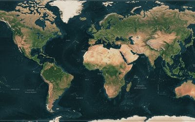
Exploring Sentinel-2: High-Resolution Earth Observation for Land Monitoring
Satellite imagery plays a crucial role in environmental monitoring, agriculture, disaster response, and land use planning. One of the most widely used Earth observation satellites is Sentinel-2, developed by the European Space Agency (ESA) as part of the Copernicus...
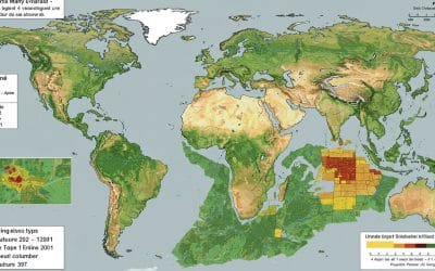
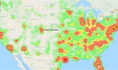
AGRICULTURAL SUITABILITY USING ARCGIS PRO
Agricultural suitability analysis is a crucial process in land-use planning, helping farmers, policymakers, and agricultural investors determine the most suitable locations for farming based on environmental, climatic, and soil-related factors. ArcGIS Pro provides...
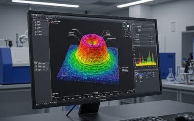
SURFACE ANALYSIS IN ARCGIS PRO: TECHNIQUES AND APPLICATIONS
Surface analysis in ArcGIS Pro is a powerful method for understanding terrain, landforms, and spatial patterns using digital elevation models (DEMs). It is widely used in geology, hydrology, urban planning, and environmental management. This post explores key surface...
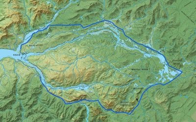
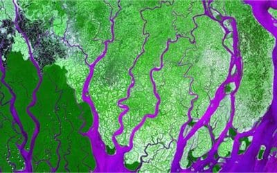
HYDROLOGICAL ANALYSIS IN ARCGIS PRO: Watershed Delineation and Stream Network Extraction
Hydrological analysis is essential for understanding watershed dynamics, managing water resources, and predicting flood risks. ArcGIS Pro offers a range of hydrology geoprocessing tools to perform terrain modeling, flow direction analysis, and watershed delineation....
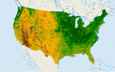
NDVI (Normalized Difference Vegetation Index): What It Is and How to Use It
Vegetation health assessment is a crucial part of environmental monitoring, precision agriculture, and land cover classification. One of the most widely used vegetation indices in remote sensing and GIS applications is the Normalized Difference Vegetation Index...
CHOOSING THE RIGHT VEGETATION INDEX FOR YOUR GIS PROJECT
Vegetation indices are essential tools in remote sensing and GIS for analyzing plant health, biomass, and land cover changes. However, choosing the right vegetation index depends on the specific goals of your project, the sensor data available, and the environmental...

COMMON GIS MISTAKES AND HOW TO AVOID THEM
Geographic Information Systems (GIS) have become essential tools for businesses, researchers, and organizations to analyze spatial data and make informed decisions. However, mistakes in GIS projects can lead to inaccurate results, inefficiencies, and costly errors. ...
HOW TO CHOOSE THE RIGHT GIS SOFTWARE FOR YOUR BUSINESS
Choosing the right GIS software for your business is crucial for effective spatial data management, analysis, and decision-making. With numerous options available, businesses must weigh the benefits of open-source solutions like QGIS against commercial platforms like...
HOW TO MAKE THEMATIC MAP SERIES IN ARCGIS PRO
Creating a thematic map in ArcGIS Pro involves symbolizing spatial data to highlight specific patterns or themes, such as population density, land use, or climate variations. Here's a step-by-step guide to help you design an effective thematic map: Prepare Your Data:...
CONTACT US