GET CERTIFIED TO BOOST YOUR PROFILE
100% Practical & Advance Learning
Explore Geoinfotech courses and establish a strong foundation of knowledge and skills to be productive with the latest Technology.
TRAINING PLAN
Choose your preferred training plan.
TRAINING PLAN
100% Practical's and Advance Learning Practice Geoinfotech Training
Explore Geoinfotech courses and establish a strong foundation of knowledge and skills to be productive with the latest Technology. Geoinfotech Training. Online training
UPCOMING TRAINING
Explore Geoinfotech courses and establish a strong foundation of knowledge and skills to be productive with the latest Technology.
SEARCH FOR YOUR PREFERED TRAINING
![]()
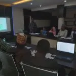
Weekend Class Training
The flexible weekend class allows working professionals and students to upskill efficiently while gaining immediately applicable knowledge for careers in…
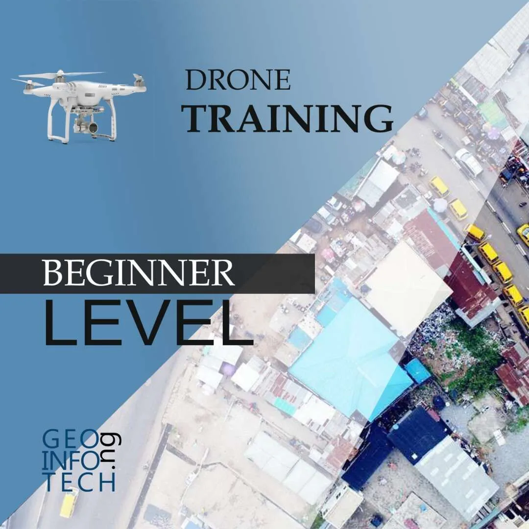
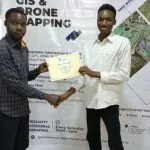
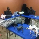
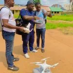
Drone Pilot for Beginners
The Drone Beginners Training course is a comprehensive program designed to equip participants with the necessary skills and knowledge to operate drones effectively and safely in a professional setting.
Duration: 3 Weekends (Every Friday 2pm and Saturday 10am)
Package: Field Experience, 100% Hands-on practical, jotter, Biro and Software Others, Test, Exam and Certificate.
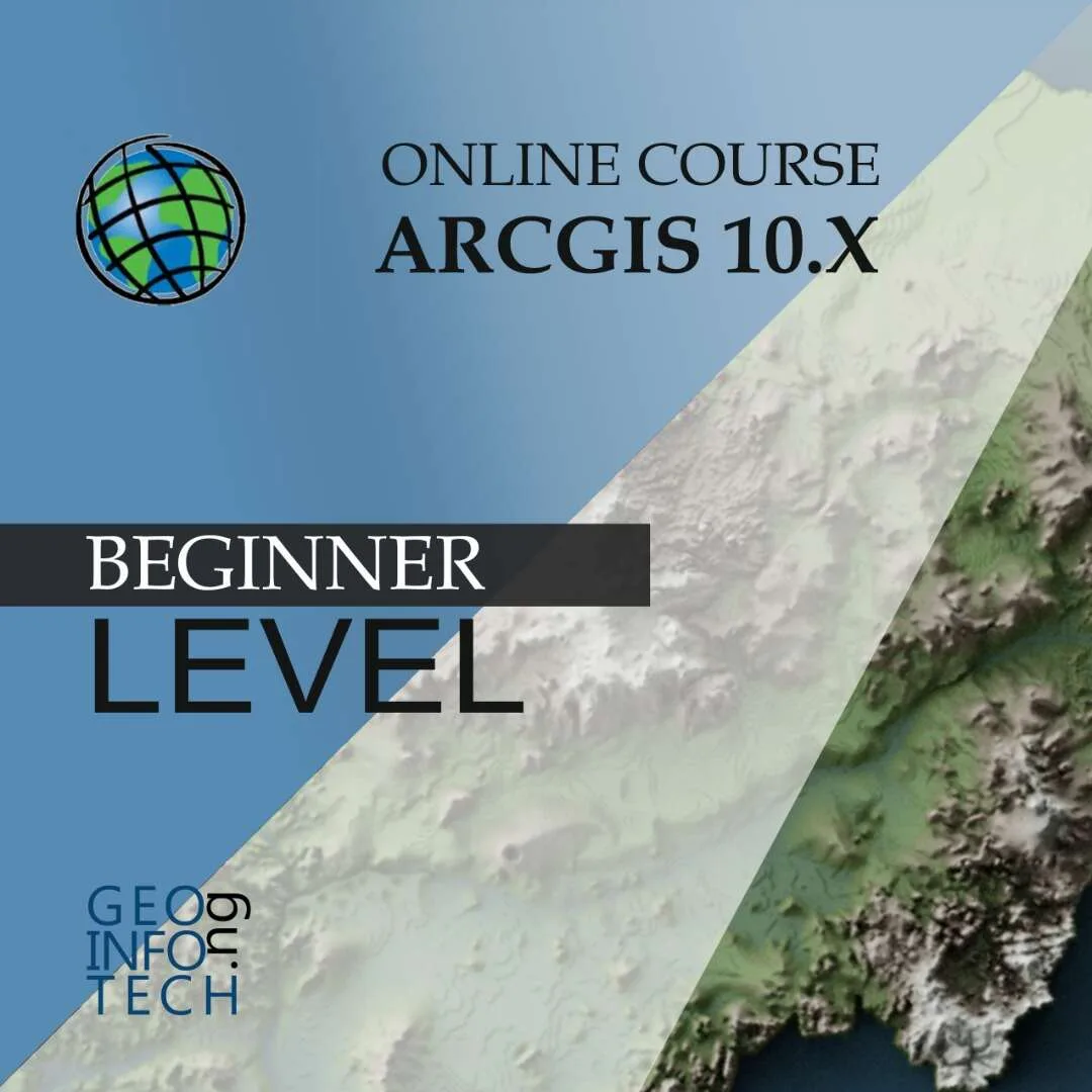
[Beginners to Advanced Class] Geographic Information System (ArcGIS Desktop and ArcGIS Pro)
This course will develop your skills in spatial data analysis, making maps application of Python, apply SQL as a standard language for accessing and manipulating databases.
Duration: 3 Weekends (Every Friday 2pm and Saturday 10am)
Package: Field Experience, 100% Hands-on practical, jotter, Biro and Software Others, Test, Exam and Certificate.
[Beginners to Intermediate] Geographic Information System (ArcGIS Desktop and ArcGIS Pro)
GIS principles and ArcGIS techniques are implemented in this course to simulate real-world features, explore patterns, and make better decisions.
Duration: 4 Weekends (Every Friday 2pm and Saturday 10am)
Package: Field Experience, 100% Hands-on practical, jotter, Biro and Software Others, Test, Exam and Certificate.
Drone Pilot for Beginners to Professional
The Drone Professional Training course is a comprehensive program designed to equip participants with the necessary skills and knowledge to operate drones effectively and safely in a professional setting.
Duration: 3 Weekends (Every Friday 2pm and Saturday 10am)
Package: Field Experience, 100% Hands-on practical, jotter, Biro and Software Others, Test, Exam and Certificate.
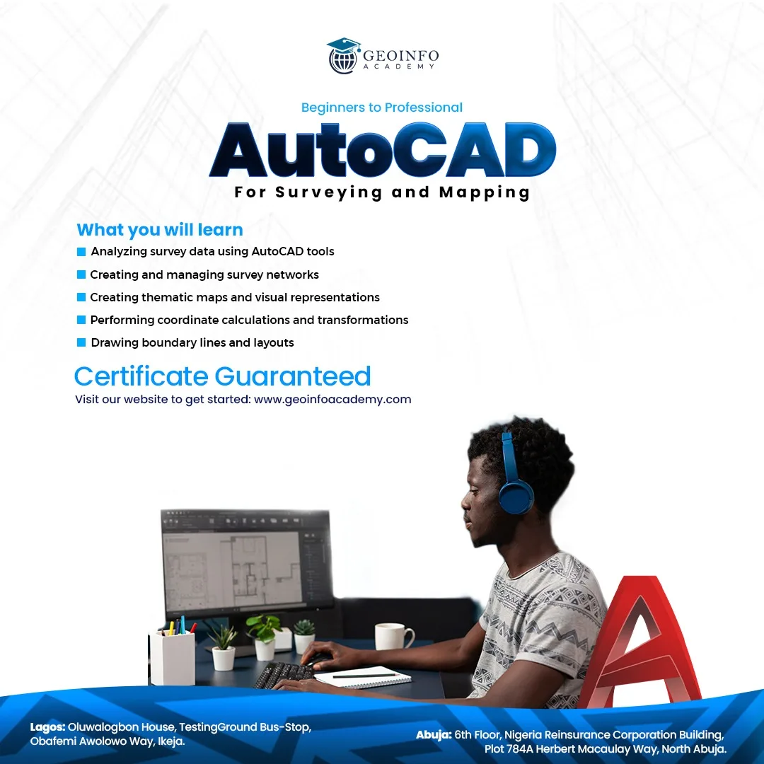
Training on AutoCAD for Surveying and Mapping
Duration: 4 Weekends (Every Friday 2pm and Saturday 10am)
Package: Field Experience, 100% Hands-on practical, jotter, Biro and Software Others, Test, Exam and Certificate.
Differential GPS (DGPS) Land Surveying Training
Professional 2 weekends ▪ Field Experience 5.0 (100% Practical) ▪ Exam & CertificateFree Software and AppsHands on Practical and Field…
ONLINE COURSE
Explore Geoinfotech courses and establish a strong foundation of knowledge and skills to be productive with the latest Technology.
 [Beginners to Advanced] AutoCAD for Land Surveying
The course AutoCAD for Land Surveying provides participants with practical skills for applying AutoCAD in...
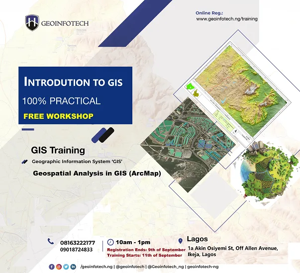
₦350,000.00 2021 Workshop: Geospatial Analysis in GIS (ArcMap) for Fire Services in Lagos
2021 Workshop on Geospatial Analysis in GIS (ArcMap) for Fire Services in Lagos This analysis...
Free- UAV Drone Foundation Exam
Take the drone skills to new heights and train with the Experts at Geoinfotech. Advance...
₦650,000.00 - [Beginners to Advanced] Geographic Information System (ArcGIS Desktop and ArcGIS Pro)
Do you want to learn GIS as a professional with a proper guide online and...
₦450,000.00
WHAT OUR CLIENTS SAY
We’re very passionate about our clients, the products we reel out and the services we render, as you can always count on us 24/7.

Quadree Akanni
The Polytechnic Ibadan, GEOGRAPHIC INFORMATION SYSTEM GIS
Satisfactory, The service rendered is up to standard
Mr Okunola Oriola
BSc LASU Lagos State, Introduction to GIS,
First of all, I want to thank all the team at Geoinfotech for the opportunity they have given us, I want to say this is not the end

Saleh Alhassan
Rice Farmers Association of Nigeria (RIFAN), Engineer, Excellent, The level of interaction is commendable

Ekele John
Everything about Geoinfotech s unique

Osunde O.M.Msc
OAU Senior Lec Faculty of Agric, Training in GIS and Remote Sensing
Geoinfotech is a spatial academic center where the interest of the students is a priority. The commitment of the tutors is unwavering irrespective of the student’s financial commitment. Having gone through the rudimentary training in spatial technology, I recommend the geoinfotech center for the real seekers of spatial knowledge.

Mr Banji Agbo
OAU Senior Lec Faculty of Agric, GIS and Remote Sensing, Doing such practical exposed me to the world of X -Y- Z coordinate system, mapping, image analysis, use of phyton, etc. Their tutors are very sound. They don't just train you to get certified. There training gave me insight into what my Ph.D. studies are focusing on at the moment.
Onyoh Moses
SURVEYOUR, NBC, Program: GIS in maritime
The training is quite timely and has deeply rooted me in GIS, I observe that the resource persons are sound and up to date
Augustine Michael
Electrician, Service was good and well structured, Training environment was very conducive

Genesis Ikaye
Corrosion Inspector
DRONE Survey and Mapping
Concise and direct, with flexible scheduling. Making students better control their learning pace and process.

MEZUE EMMANUEL CHEKWUBE
MSc ARCSST OAU, Introduction to GIS,
It was a great privilege training under Geoinfotech, their competent teachers made the training easy and fun and with level one GIS Training I can confidently carry out essential GIS Analysis. I am satisfied with your training and I also wish to continue on an Advance class

GODWIN DIMIKE
GEOLOGIST, National Boundary Commission, Program: GIS in maritime
The training has been very informative, the tutors took the time to explain especially more difficult tasks, it has been very enjoyable so far. There is a need to go further with more advanced aspects of the program.
The tutors are well-grounded on the program they have been really patient and listens to everyone's opinions

Mr Chibueze Nwaka
Environmentalist, Introduction to GIS,I want to thank everybody, I want to thank Mr. Yinka and Mr. Tope, they seem to understand to have been lenient to us, any time I call Mr. Tope or send a message he is always available. The only thing I want us to correct is about time, but every other thing has been fantastic
Mr Banji Agbo
OAU Senior Lec Faculty of Agric, GIS, and Remote Sensing, Geo - infotech company has really been of great help to remodel my carrier path in Agriculture. I had been aspiring to explore the use of GIS and Remote Sensing in Weed Management for a very long time. Thinking such innovative ideas may be unrealistic in Nigeria has always been a concern until I came across Geoinfotech.

ABBA ISMAIL
COMPUTER ANALYST, National Boundary Commission, Program: GIS in Maritime
The training is very interesting and educative, it helps to understand how ArcGIS work on the real-world map. The trainers are very good teachers, they help me understand what ArcGIS Means
SAMUEL TIJANI
Surveyor GEOGRAPHIC INFORMATION SYSTEM GIS, DRONE PILOT and Mapping, REMOTE SENSING R.S, Programming
The teachings are up to standard. Practicals and theories are fantastic.

Anietie Etuk
Surveyor
Training is good, Training is outstanding

Abubakar Lawal
Civil Engineer, The training is well presented and coordinated with the online services

Mr Oyetunde Folajin
Urban Planner, Drone Mapping, Federal College Of Education, Osiele Abeokuta
I thank God for giving me the opportunity to participate in the drone pilot and mapping with Geoinfotech. The classes were well arranged, the dos' and don'ts of COVID-19 were highly considered. My instructor is wonderful. Notwithstanding, I can boldly recommend you to the world at large. Thanks
"
Chijioke Oriala
GEOLOGIST, National Boundary Commission, Program: GIS in maritime
Excellent training session Post-training assessment of all the trainees to keep them abreast with the latest development in GIS. Good trainers with much knowledge of the subject matter

Dr Aliyu Nuhu
Lecturer University of Jos,
It was an excellent sessions

Anuoluwapo Opatoye
National Boundary Commission, program: GIS in Maritime
It's being educative.

Ikechukwu Ozoude
FORTRAN ENGINEERING COMPANY LIMITED, Civil/Structural Engineer.
I have acquired quite some good knowledge about GIS software and it's applicability since this training started, The training has been excellent since it started.

Abdullahi Bako Lawal
COMPUTER ENGINEER, Program: GIS in maritime
An excellent training. Young friendly instructors 👌👌👌. I'm really inspired with the level of achievement.

Ibrahim Sanusi
National boundary commission, Computer Analyst, (The overall training was superb, it been a while a learnt with ease. teach with professionalism and the content is rich) The service is top notch, they pay attention to every trainee to make sure everyone is carried along. Well drafted material and easy to understand.

Taiwo Tobi
University of Nigeria,
An extremely helpful and informative course. Training materials were well organized and provided good case studies. Instructor was extremely professional and pleasant to learn from. The training was also clear and well detailed.
The instructor was very easy to communicate with and very interesting with real life examples of the course materials.

Joy Etim
National Boundary Commission, Program: GIS in Maritime
The training is very impactful, interactive, informative and educative. Would appreciate and recommend more of this training in the very near future. The lecturers are very friendly and understanding which makes the training lively, interesting and simplified.
More grease to your elbow keep up the good work. Kudos.

Alahirah Calvin Yahaya
COMPUTER ANALYST, Program: GIS in maritime
The training was highly enriching. Because of the extensive nature of GIS. The trainers are highly capable.
Yusuf Ibrahim
Surveyor, National Boundary Commission,
The training is educative, interesting, interactive, and highly impressive with the tutor's potentials during the training.
Osunde O.M.Msc
OAU Senior Lec Faculty of Agric, Training in GIS and Remote Sensing
Geoinfotech is a spatial academic center where the interest of the students is a priority. The commitment of the tutors is unwavering irrespective of the student’s financial commitment. Having gone through the rudimentary training in spatial technology, I recommend the geoinfotech center for the real seekers of spatial knowledge.
GODWIN DIMIKE
GEOLOGIST, National Boundary Commission, Program: GIS in maritime
The training has been very informative, the tutors took the time to explain especially more difficult tasks, it has been very enjoyable so far. There is a need to go further with more advanced aspects of the program.
The tutors are well-grounded on the program they have been really patient and listens to everyone's opinions
Alahirah Calvin Yahaya
COMPUTER ANALYST, Program: GIS in maritime
The training was highly enriching. Because of the extensive nature of GIS. The trainers are highly capable.
Augustine Michael
Electrician, Service was good and well structured, Training environment was very conducive
Chijioke Oriala
GEOLOGIST, National Boundary Commission, Program: GIS in maritime
Excellent training session Post-training assessment of all the trainees to keep them abreast with the latest development in GIS. Good trainers with much knowledge of the subject matter
Taiwo Tobi
University of Nigeria,
An extremely helpful and informative course. Training materials were well organized and provided good case studies. Instructor was extremely professional and pleasant to learn from. The training was also clear and well detailed.
The instructor was very easy to communicate with and very interesting with real life examples of the course materials.
Anietie Etuk
Surveyor
Training is good, Training is outstanding
Yusuf Ibrahim
Surveyor, National Boundary Commission,
The training is educative, interesting, interactive, and highly impressive with the tutor's potentials during the training.
SAMUEL TIJANI
Surveyor GEOGRAPHIC INFORMATION SYSTEM GIS, DRONE PILOT and Mapping, REMOTE SENSING R.S, Programming
The teachings are up to standard. Practicals and theories are fantastic.
Quadree Akanni
The Polytechnic Ibadan, GEOGRAPHIC INFORMATION SYSTEM GIS
Satisfactory, The service rendered is up to standard
Saleh Alhassan
Rice Farmers Association of Nigeria (RIFAN), Engineer, Excellent, The level of interaction is commendable
Mr Oyetunde Folajin
Urban Planner, Drone Mapping, Federal College Of Education, Osiele Abeokuta
I thank God for giving me the opportunity to participate in the drone pilot and mapping with Geoinfotech. The classes were well arranged, the dos' and don'ts of COVID-19 were highly considered. My instructor is wonderful. Notwithstanding, I can boldly recommend you to the world at large. Thanks
"
Mr Banji Agbo
OAU Senior Lec Faculty of Agric, GIS, and Remote Sensing, Geo - infotech company has really been of great help to remodel my carrier path in Agriculture. I had been aspiring to explore the use of GIS and Remote Sensing in Weed Management for a very long time. Thinking such innovative ideas may be unrealistic in Nigeria has always been a concern until I came across Geoinfotech.
ABBA ISMAIL
COMPUTER ANALYST, National Boundary Commission, Program: GIS in Maritime
The training is very interesting and educative, it helps to understand how ArcGIS work on the real-world map. The trainers are very good teachers, they help me understand what ArcGIS Means
Mr Okunola Oriola
BSc LASU Lagos State, Introduction to GIS,
First of all, I want to thank all the team at Geoinfotech for the opportunity they have given us, I want to say this is not the end
Genesis Ikaye
Corrosion Inspector
DRONE Survey and Mapping
Concise and direct, with flexible scheduling. Making students better control their learning pace and process.
Dr Aliyu Nuhu
Lecturer University of Jos,
It was an excellent sessions
Ekele John
Everything about Geoinfotech s unique
Abubakar Lawal
Civil Engineer, The training is well presented and coordinated with the online services
Ikechukwu Ozoude
FORTRAN ENGINEERING COMPANY LIMITED, Civil/Structural Engineer.
I have acquired quite some good knowledge about GIS software and it's applicability since this training started, The training has been excellent since it started.
MEZUE EMMANUEL CHEKWUBE
MSc ARCSST OAU, Introduction to GIS,
It was a great privilege training under Geoinfotech, their competent teachers made the training easy and fun and with level one GIS Training I can confidently carry out essential GIS Analysis. I am satisfied with your training and I also wish to continue on an Advance class
Mr Chibueze Nwaka
Environmentalist, Introduction to GIS,I want to thank everybody, I want to thank Mr. Yinka and Mr. Tope, they seem to understand to have been lenient to us, any time I call Mr. Tope or send a message he is always available. The only thing I want us to correct is about time, but every other thing has been fantastic
Ibrahim Sanusi
National boundary commission, Computer Analyst, (The overall training was superb, it been a while a learnt with ease. teach with professionalism and the content is rich) The service is top notch, they pay attention to every trainee to make sure everyone is carried along. Well drafted material and easy to understand.
Joy Etim
National Boundary Commission, Program: GIS in Maritime
The training is very impactful, interactive, informative and educative. Would appreciate and recommend more of this training in the very near future. The lecturers are very friendly and understanding which makes the training lively, interesting and simplified.
More grease to your elbow keep up the good work. Kudos.
Mr Banji Agbo
OAU Senior Lec Faculty of Agric, GIS and Remote Sensing, Doing such practical exposed me to the world of X -Y- Z coordinate system, mapping, image analysis, use of phyton, etc. Their tutors are very sound. They don't just train you to get certified. There training gave me insight into what my Ph.D. studies are focusing on at the moment.
Abdullahi Bako Lawal
COMPUTER ENGINEER, Program: GIS in maritime
An excellent training. Young friendly instructors 👌👌👌. I'm really inspired with the level of achievement.
Anuoluwapo Opatoye
National Boundary Commission, program: GIS in Maritime
It's being educative.
Onyoh Moses
SURVEYOUR, NBC, Program: GIS in maritime
The training is quite timely and has deeply rooted me in GIS, I observe that the resource persons are sound and up to date
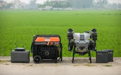
Where to Buy the DJI Agras T50 Generator in Lagos, Nigeria
Quick Summary Looking for where to buy the DJI Agras T50 Generator in Lagos, Nigeria? This guide...
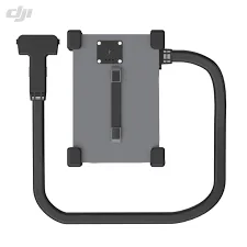
Where to Buy DJI Agras T50 Charging Station in Lagos, Nigeria | Genuine DJI Agricultural Drone Accessories
Quick Summary Looking for where to buy the DJI Agras T50 Charging Station in Lagos, Nigeria? This...
Where to Buy BS65 Intelligent Battery Station in Lagos, Nigeria | DJI Enterprise Charging Station
Where to Buy the BS65 Intelligent Battery Station in Lagos, Nigeria Quick Summary Looking for...