404
Oops!, that page can’t be found.
There are other options that might interest you below
Oops!, that page can’t be found.
There are other options that might interest you below
Search Results

Natural Resource Management
Managing the interactions between people and natural environments is the focus of natural resource management (NRM). It integrates conservation of biodiversity, land use planning, water management, natural heritage management, and the long-term viability of sectors...

Emergency Response
What is Emergency Response? Emergency response refers to the actions taken by individuals, organizations, and authorities to address and mitigate the impacts of emergencies, disasters, or crises. This can include natural disasters such as hurricanes, earthquakes,...
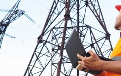
ASSET INSPECTION
What Is Asset Inspection? Asset Inspection is the task of surveying or assessing the physical condition of an asset, to create data that can be used in the efficient and effective management (governance) of that asset over its life-cycle. Asset inspection is a process...

Precision Agriculture
The science of enhancing agricultural yields and supporting management choices with advanced sensor and analysis technologies is known as precision agriculture, or PA. The world has embraced PA, a novel idea that promises to boost output, cut down on labor costs, and...

Geospatial Survey Data Collection Methods
What is Geospatial Survey? A geospatial survey is a methodical process of collecting, analyzing, and interpreting spatial data related to the Earth's surface and its features. It involves the use of various technologies and tools to capture, store, manipulate,...

Aerial Mapping Applications
What is Aerial Mapping? Aerial mapping is the process of capturing images and data from above using aircraft, drones, or other flying objects. This data can then be used to create maps, 3D models, and other geospatial products. Aerial mapping has a wide range of...

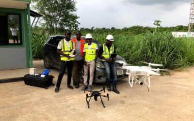
AERIAL SURVEYING AND MAPPING
Aerial surveying and mapping involve capturing images or data from elevated platforms, such as airplanes or drones, to create detailed and accurate maps of landscapes, infrastructure, or natural resources. This technology is crucial for various industries, including...
COMPANIES THAT REPAIR IN DRONES IN NIGERIA
Assessing companies specializing in drone repair can present unique challenges due to the evolving technology and the expertise required. Understanding drone models, technicians' qualifications, and repair parts' quality are crucial in evaluating these service...
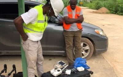
AERIAL SURVEY AND MAPPING
In Geoinfotech, Aerial surveying and mapping is the process of collecting geospatial data from aerial platforms such as airplanes, helicopters, balloons, and drones. In Geoinfotech The data collected can be used to create maps, 3D models, and other geospatial...
CONTACT US