404
Oops!, that page can’t be found.
There are other options that might interest you below
Oops!, that page can’t be found.
There are other options that might interest you below
Search Results

Leading Drone Service Provider in Nigeria
The fast growth of drone technology has created many new opportunities in different fields like farming, construction, and environmental monitoring. But, understanding the details of drone technology, rules, and uses can be difficult. If you need help with operating...
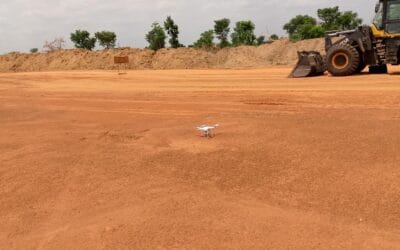
Aerial surveying and mapping
What is Aerial surveying and mapping? Aerial Surveying is the process of collecting geospatial data from aerial platforms such as airplanes, helicopters, balloons, and drones to create maps, 3D models, and other geospatial products. The collected data can be used to...
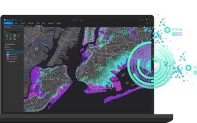
Downloading Survey, Drone, and GIS Software in Nigeria
Your Guide to Downloading Survey, Drone, and GIS Software in Nigeria In the ever-evolving fields of surveying, drone technology, and Geographic Information Systems (GIS), having the right software is crucial. Whether you're a surveyor, a drone enthusiast, or a GIS...

Essential Drone Operation Safety Tips
Drone Operation Safety Tips: Pre-Flight Checklist; always start with a pre-flight checklist. Check the memory card space of your drone. When flying outdoor always turn on vision sensor. Check your drone batteries, controller battery and phone/monitor battery. Check...
GIS IN TRANSPORT, HEALTH AND AGRICULTURE
GIS IN TRANSPORTATION One of the main pillars of any nation's economy is the transportation sector. Transport systems facilitate the movement of goods and people as they engage in social and economic activities. The majority of jobs have been automated, both in the...

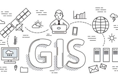
FUNDAMENTAL KNOWLEDGE OF GIS
Technology, geography, and cartography are all combined in the exciting topic of geographic information systems (GIS). No qualification is required to learn, there are no stringent formal requirements to begin studying GIS, it is accessible to anyone who is eager to...

The Growing Relevance of GIS in an Evolving World
In today's interconnected world, Geographic Information Systems (GIS) have emerged as powerful tools for understanding and analyzing spatial data. Whether it's planning infrastructure projects, managing natural resources, or responding to emergencies, GIS plays a...
GIS IN THE HEALTH SECTOR
Over the past few decades, the growing use of Geographic Information Systems (GIS) technology has changed health and human services (HHS) and opened the eyes of researchers, public health experts, staff members of hospitals and health systems, and the general people...
GIS in Nigeria: Demand, Accuracy, and Education
Introduction Geographic Information System (GIS) services play a vital role in various sectors worldwide, offering powerful tools for spatial analysis, mapping, and decision-making. However, in Nigeria, the demand for GIS services has not reached its full potential....
CONTACT US