Search for the training you need
At Geoinfotech, we’re committed to supporting your training in geoinformatics and related technologies.
Whether you’re brand-new to ArcGIS, Drone, Surveying and Mapping or a seasoned GIS professional who wants to master the latest technology, we have resources to help you achieve your goals

Physical Training
At Geoinfotech we offer extensive hands-on practical training and field experience for individuals, group or for organizations. Register to explore our courses on Drone, GIS, Remote Sensing, GPS, Python development, advanced analysis tools, and many more.

Online Traning
Explore Geoinfotech's online training platform, at home or anywhere you are on Drone, GIS, Remote Sensing, GPS, Python development, advanced analysis tools, and many more. We have developed our online platform to be responsive for easy navigation and professionally recorded for better understanding.
No Results Found
The page you requested could not be found. Try refining your search, or use the navigation above to locate the post.

The Future of GIS & Remote Sensing: Are We Replacing Analysts with AI
The Rise of AI in GIS & Remote Sensing—Will Analysts Become Obsolete? For years, GIS and...
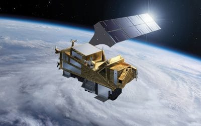
Exploring Sentinel-5: Monitoring Air Quality with Advanced Satellite Technology
Air pollution and climate change are two of the most pressing environmental challenges of our...
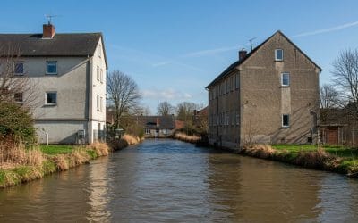
FLOOD RISK ANALYSIS IN ARCGIS PRO
Flood risk analysis in ArcGIS Pro helps identify flood-prone areas using Digital Elevation Model...
SERVICE LIST
We take your industry to the next level. Support Service Geoinfotech

Drone (Survey, Inspection, Surveillance, and Mapping)

Geographic Information System

Land Surveying

Remote Sensing and Satellite Mapping

Hydrographic Survey (Bathymetry)

Geophysical Survey

Training (Beginners to Advance / Professional)

GeoStore (Buy Products) Hardware / Software