Search for the training you need
At Geoinfotech, we’re committed to supporting your training in geoinformatics and related technologies.
Whether you’re brand-new to ArcGIS, Drone, Surveying and Mapping or a seasoned GIS professional who wants to master the latest technology, we have resources to help you achieve your goals

Physical Training
At Geoinfotech we offer extensive hands-on practical training and field experience for individuals, group or for organizations. Register to explore our courses on Drone, GIS, Remote Sensing, GPS, Python development, advanced analysis tools, and many more.

Online Traning
Explore Geoinfotech's online training platform, at home or anywhere you are on Drone, GIS, Remote Sensing, GPS, Python development, advanced analysis tools, and many more. We have developed our online platform to be responsive for easy navigation and professionally recorded for better understanding.

Getting Around in Nigeria’s Criminal Environment: Revealing the Current Crime Rate
Despite its wealth of culture and diversity, Nigeria is not without its difficulties. The crimes...
How Geoinfotech surveyors work with the principles of GIS
How Geoinfotech surveyors work with the principles of GIS Geoinfotech Surveyors work with the...

How to fill training certificate form
How to fill training certificate form Step 1. Goto our website www.geoinfotech.ng Step 2....
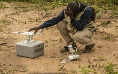
Top 10 Reasons to Become a Certified Drone Pilot in Nigeria
The use of drones, officially known as Unmanned Aerial Vehicles (UAVs), is expanding rapidly...
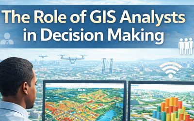
From Data to Decisions: The Role of GIS Analysts in Modern Organizations
Organizations today generate vast amounts of data from population records, infrastructure systems,...

Empowering the Future: How GeoinfoAcademy is Training the Next Generation of Geospatial Professionals
Introduction Geospatial data has become a critical resource in today’s data-driven economy. From...
SERVICE LIST
We take your industry to the next level. Support Service Geoinfotech

Drone (Survey, Inspection, Surveillance, and Mapping)

Geographic Information System

Land Surveying

Remote Sensing and Satellite Mapping

Hydrographic Survey (Bathymetry)

Geophysical Survey

Training (Beginners to Advance / Professional)

GeoStore (Buy Products) Hardware / Software