

Search for the training you need
At Geoinfotech, we’re committed to supporting your training in geoinformatics and related technologies.
Whether you’re brand-new to ArcGIS, Drone, Surveying and Mapping or a seasoned GIS professional who wants to master the latest technology, we have resources to help you achieve your goals

Physical Training
At Geoinfotech we offer extensive hands-on practical training and field experience for individuals, group or for organizations. Register to explore our courses on Drone, GIS, Remote Sensing, GPS, Python development, advanced analysis tools, and many more.

Online Training
Explore Geoinfotech's online training platform, at home or anywhere you are on Drone, GIS, Remote Sensing, GPS, Python development, advanced analysis tools, and many more. We have developed our online platform to be responsive for easy navigation and professionally recorded for better understanding.
SERVICE LIST
We take your industry to the next level. Support Service Geoinfotech

Drone (Survey, Inspection, Surveillance, and Mapping)

Geographic Information System

Land Surveying

Remote Sensing and Satellite Mapping

Hydrographic Survey (Bathymetry)

Geophysical Survey

Training (Beginners to Advance / Professional)

GeoStore (Buy Products) Hardware / Software
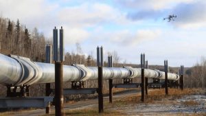
Pipeline Surveillance and Asset Protection in Port Harcourt: Aerial, Satellite and GIS Monitoring by Geoinfotech
Oil and gas pipelines extend across large areas. They pass through creeks, farmland, settlements,...

Additional AutoCAD Topics to Explore
Introduction Learning AutoCAD involves more than understanding drawing commands. You also need the...

AutoCAD for Surveying Training
Introduction AutoCAD is an important tool for professionals who work with technical drawings,...

APPLICATIONS OF DRONE-BASED QUARRY MAPPING, ADVANTAGES AND CHALLENGES
1. Introduction Drone-based quarry mapping refers to the use of Unmanned Aerial Vehicles (UAVs),...

Drone-Powered Agriculture in 2026: Monitor, Manage, and Maximize Farm Productivity.
Introduction Drone-powered agriculture refers to the application of Unmanned Aerial Vehicles...

THE COMPLETE GUIDE TO REDUCING PROJECT RISK WITH SURVEYING, DRONE MAPPING, AND GIS
Project risks can quietly derail timelines, inflate costs, and compromise safety if they are not...