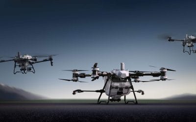
The Drone Professional Training course is a comprehensive program designed to equip participants with the necessary skills and knowledge to operate drones effectively and safely in a professional setting. Drones, also known as unmanned aerial vehicles (UAVs), have become increasingly prevalent across various industries, including photography and videography, agriculture, surveying and mapping, inspection and maintenance, and public safety. This course aims to bridge the gap between theoretical knowledge and practical expertise, enabling participants to excel in the rapidly expanding field of drone technology.
Course Highlights:
Comprehensive theoretical knowledge of drone technology and operations.
In-depth understanding of drone regulations and safety protocols.
Hands-on training in drone piloting, aerial photography, and data collection.
Exploration of advanced drone technologies and emerging industry trends.
Real-world case studies and practical exercises to enhance learning.
Operate drones confidently in complex environments
Increased job opportunities and career prospects
Higher client confidence and trust
l
Courses Modules
1. Introduction
A. Different Terminologies B. Classification of Drones Based on Structure C. Part of Drone System D. Drone Types
2. Drone Regulations In Nigeria (NCAA Requirement and Registration)
A. No-Fly Zones 00 B. How to Unlock No-Fly Zones 00
3. Drone Application In Different Profession
A. Professional Drone Flying Techniques
4. Drone Manual Flight Control and Automatic Flight Operation (Take off and Return)
A. Drone Apps and Software Setup B. Power Up and Getting Into Drone Apps
5. Professional Camera Settings and Functions
A. Aerial Inspection (Photography and Video) B. Professional Photo and Video Capture
6. Drone Calibration Setting
A. Drone Calibration B. Camera Calibration C. Controller Calibration
7. Drone Safety and Pre-Fight Checklist
A. Reconnaissance Survey B. Weather Forecast
8. Drone Mission Planning
A. Drone Data Extraction
9. Overview of Drone Remote Sensing
A. Understanding Drone Remote Sensing Sensors
Upon completion of the Drone Professional Training course, participants will possess the expertise required to operate drones safely and effectively in a professional capacity. They will be well-versed in the legal and regulatory frameworks governing drone operations and will have the practical skills to undertake various drone-related tasks in their respective industries. This course opens up exciting career opportunities in fields such as aerial photography, agriculture, infrastructure inspection, surveying, and many more.
2021 Workshop on Geospatial Analysis in GIS (ArcMap) for Fire Services in Lagos This analysis helps us on why, where and how many fire services needed to be deployed in Lagos Nigeria. Multicriterial Analysis AHP | Suitability Analysis in GIS Click Here to...
Take the drone skills to new heights and train with the Experts at Geoinfotech. Advance your career in Drone Surveying, Photography, 3D Mapping. The next-gen digital learning solution In your own time, learn at your own pace–without taking any time off work....
Do you want to learn GIS as a professional with a proper guide online and procedures on executing GIS Projects/Tasks? This introductory course is for you. We have Introduced a step-by-step template, software installation, free data and manual to help you learn and...
Drones are Unmanned Aerial Vehicles used for many different functions, ranging from monitoring climate change to carrying out search operations after natural disasters, photography, filming, agriculture and delivering goods.
Flying a drone can be very exciting but, at the same time, it isn’t really that easy and simple, especially for those who are first-time flyers.
Being a beginner can be a good excuse to fly badly for a while till you can find your footing.
Here are 7 tips that are sure to help you improve your drone flying skills.
Take a training course: Let’s face it, there are some things you just can’t do on your own or learn online. You’d need to attend a physical class with instructors who will take you on a step-by-step basis. It is so much easier to learn to fly a drone when you have someone directing you on what to do. Taking a course is a sure way to improve your skills in a very short time to the point that you can go from beginner to expert in a hurry without too many growing pains.
We offer two phases of Drone Pilot Training- Beginner and Professional. The beginners class is a good place to start if you have no prior knowledge of how to fly a drone. Check out our drone pilot training courses here.
Practice with a small and cheaper drone: Controlling a smaller drone is easier because of how light they are. It is also more economical as bigger drones are more expensive and power-intensive. Smaller drones may not be the easiest to pilot but you don’t want to end up losing a lot of money if your expensive drone crashes. Our Geostore offers drones from as low as ₦120,000.
Don’t just dive into photography. Be patient to learn the basics of flying the done first, making it stable, landing etc. Forget about photography at first even if that is your sole purpose of learning.
4. Watch Training Videos online. Search for a great drone training video and use it as a guideline for how you fly your drone or to augment what you are being taught. You can also read through articles and manuals like our ‘Introduction to drone piloting’ manual. You can watch drone-flying content on our YouTube Channel
Make friends who share your interest in drones. This is a great way to learn new skills, as you watch what others are practising, and ask them questions about how they are able to do certain things. It’s also a good way to keep yourself motivated to advance your own skills when you see others learning and progressing as well. You can get this at your training centre as well.
Learn one step at a time. You don’t have to start doing difficult aerial manoeuvres and tricks that only the experts can easily pull off. There is also no reason for you to take the drone 50 feet up in the air the moment you take it out of the box. Start slowly, with time you too can learn all the tricks you see online.
Try to Fly around in a perfect circle: This is a great way for you to instantly improve your drone piloting skills. It can be difficult to do for a lot of beginners but we recommend that you try to find a point of interest such as a house or a pole and try to make that the centre of the circle.
It is important to know your main reason for learning how to fly a drone. Have a goal and let all your actions lead to the achievement of that goal. It is possible to learn more than the basics of flying a drone in a short time if you put your mind to it.
GIS fundamental principles and ArcGIS techniques are implemented in this course. You can work with GIS maps, explore data, and analyze maps and data. Learn and Develop your skills in making maps. GIS Beginners Class
Course Highlights:
Use the new GIS technology to solve spatial problems
GIS feature databases and non-spatial databases.
Manage GIS projects from launch through to evaluation.
2021 Workshop on Geospatial Analysis in GIS (ArcMap) for Fire Services in Lagos This analysis helps us on why, where and how many fire services needed to be deployed in Lagos Nigeria. Multicriterial Analysis AHP | Suitability Analysis in GIS Click Here to...
Take the drone skills to new heights and train with the Experts at Geoinfotech. Advance your career in Drone Surveying, Photography, 3D Mapping. The next-gen digital learning solution In your own time, learn at your own pace–without taking any time off work....
Do you want to learn GIS as a professional with a proper guide online and procedures on executing GIS Projects/Tasks? This introductory course is for you. We have Introduced a step-by-step template, software installation, free data and manual to help you learn and...
In line with the current Lagos state government’s desire to develop tech shrewd students across the state. The Lagos state partners with the US consulate on a drone soccer challenge for students across the state to boost their skills and expose them to best international practices.
Mrs. Folasade Adefisayo the Commissioner for Education disclosed this at the STEAM (Science, Technology, Engineering, Arts and Mathematics) UP Lagos Drone Training Initiative and Soccer Game Grand finale held at Government Senior College Hall Agege.
She further stated that the program is part of the Lagos State Government strategy to promote science, technology, engineering, arts, and mathematics education as it is the future of the tech economy, this she expressed by saying:” These various efforts by the government will greatly impact the learning of our students and spur their interest in technology”
Mrs. Adefisayo further encouraged the students to maximize the opportunities the program affords as it will influence their future positively, emphasizing that success comes only through hard work.
She also appreciated the US Consulate for partnering with the state government in engaging and training the student on Drone technology, stating that, it will nurture and unleash the student’s great potential, creativity, critical thinking among other 21st century skills.
She concluded by assuring the students that the state government will continue to provide an enabling for them in order to achieve their diverse aspirations.
Also speaking Ms. Adetola Salau, Senior Special Assistant to the Governor on Education disclosed that the program has exposed students to drone applications and their utilization, solar panel assembly, artificial intelligence, cell phone and laptop repair, weather balloon technology among other tech applications.
She also explained that over 500 students and 50 teachers have so far benefitted from the training program and it’s expected to cut across all schools in the state.
She further disclosed that the Drone soccer challenge is the first of its kind in Africa and the student response has been interesting.
Also speaking on the occasion was The Head of Public Affairs, US Consulate Mr. Stephen Ebelli who commended the state Government for the partnership and expressed the possibility of the long-term benefit to train the students to be tech engineers, this he expressed thus:”Our focus is on the younger generation, we had wonderful cooperation and collaboration with the Lagos State Government and this partnership will no doubt yield positive dividends in the nearest future”.
The winners of the Drone Soccer Challenge were also affirmed by Mr. Stephen Ebelli. They also stated that a STEAM Laboratory will be set up in their schools. Furthermore, the overall winner will be representing the nation on the global stage in the United States of America.
At the end of the Drone Soccer Competition, Ijaiye Housing Senior Grammar School (Pace Setter Team) emerged as champion beating Alimosho Senior Grammar School (Alisgram Team) and Abesan Senior High School (Alpha Team) to the second and third positions respectively.
The event had stakeholders and guests which includes the Chairman, House Committee on Science and Technology, Hon. Lanre Afinni, Permanent Secretary, Ministry of Education, Mr. Abayomi Abolaji, Tutor General/Permanent Secretary, Education District 1, Mrs. Titilayo Solarin, Senior Special Assistant to the Governor on Development Planning and Partnerships, Miss. Ayisat Agbaje, Senior Special Assistant to the Governor on Science and technology, Mr. Saheed Balogun, alongside other notable elite.
Geoinfotech is a map design company in Lagos, Abuja, Nigeria. With highly skilled cartographers and Map analysts who carefully create maps from the various spheres of inspired maps across Nigeria.
What is a Map Design:
An aggregate of all the thought processes that cartographers go through during the abstraction phase of the cartographic process is referred to as a Map Design.
It is important to note as a cartographer that including the right design principles leads to a constructive map layout.
At Geoinfotech we make sure this layout is well detailed in a way that our drone pilot operators gain first-hand information about changes in zone boundaries
As you zoom in on the constructive software map provided at Geoinfotech, you could see more detail is added to the map to show the locations of individual power stations. Different map symbols are used to indicate the different types of power plants (nuclear, oil, coal, gas, wind, solar, etc.).
A great Map Design should include:
A good display with waterproof and tear-resistant material
A good map should also possess popping matching colors
It should portray recreational features, roads, and trails for a broad audience
Clearly labeled topographic features to discern elevation contours
Elements of a Great Map Design
Title
Scale Indicator
Orientation
Border
Legend
Map Credit
Locator Map
Top-Notch Graphical design
Visual Hierarchy
And most importantly its purpose
Geoinfotech Maps
When creating Maps at Geoinfotech, we look at how best we can make maps, we look at what makes a map great. We also weigh its effectiveness at meeting goals. This map also went above and beyond in detail. Look closely and you can see stairways to overpasses.
Included in our Maps are detailed representations of the different land classifications in the region and of the many features present in these areas including campgrounds and different accesses.
The objective of our map is centered on the target group of users, the way we work with the map, the volume of conveyed information according to the client’s preference. Our Map Designs are available and give cartographic literacy for many possible user categories such as:
The school category, where students make use of school wall maps and atlases.
The professional category, where experts from offices use scientific maps with specialized content, including administrative maps, topographic maps, and cadastral maps.
General public category, where maps are used for tourists, road maps, maps of social gatherings, maps of the training venue, etc.
Government category where maps are needed to know refugee camps, government building structure
Geoinfotech Maps are very detailed enough to contain travel information. Rivers are represented through the use of differential tapering and the elevation changes on the mountain are clearly depicted through extensive hill shading.
This map is clear and effective as its purpose is easy to interpret and understand. The map shows its data in a very effective and organized way. The map also includes a scale, legend, and title which are key components of a good map.
Learning these map-making basics will help to get you on your way. Once you’ve learned the fundamentals, you can start exploring map-based platforms and complex maps.
Want to see our maps and know how you could acquire one? Here’s a sneak peek: