Search for the training you need
At Geoinfotech, we’re committed to supporting your training in geoinformatics and related technologies.
Whether you’re brand-new to ArcGIS, Drone, Surveying and Mapping or a seasoned GIS professional who wants to master the latest technology, we have resources to help you achieve your goals

Physical Training
At Geoinfotech we offer extensive hands-on practical training and field experience for individuals, group or for organizations. Register to explore our courses on Drone, GIS, Remote Sensing, GPS, Python development, advanced analysis tools, and many more.

Online Traning
Explore Geoinfotech's online training platform, at home or anywhere you are on Drone, GIS, Remote Sensing, GPS, Python development, advanced analysis tools, and many more. We have developed our online platform to be responsive for easy navigation and professionally recorded for better understanding.
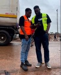
What Happened in Mokwa: How Drone and GIS Technology were used to uncover the source, extent and solution to the devastating Mokwa Flood
A Summary of the Flooding Incident at Mokwa On May 29, 2024, a devastating flash flood...
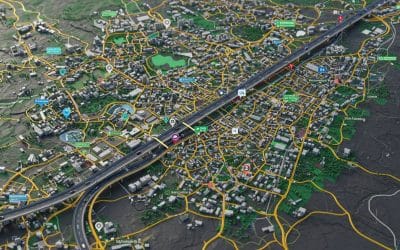
How to Create a Road Network
Map of Ikeja in Lagos State Using ArcGIS Pro and OpenStreetMap Data Mapping a city’s road network...
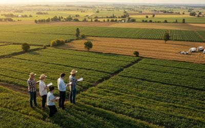
Remote Sensing in Agriculture: Beyond Crop Health to Food Security Planning
In the age of climate Variability and increasing global food demand, agriculture is no longer a...
Total Station vs. GNSS: Which is the Ultimate Winner for Nigerian Surveyors in 2026?
In the Nigerian surveying landscape, choosing between a Total Station and a GNSS (Global...
Must-Have Professional Surveying Tools for the Lagos Surveyor in 2026
Surveying in Lagos isn't just a job; it’s an extreme sport. From navigating the high-traffic...

Mapping the Future: How GIS is Revolutionizing Land Administration in Nigeria
Land is Nigeria’s most valuable asset. From the bustling tech hubs of Ikeja to the expanding...
SERVICE LIST
We take your industry to the next level. Support Service Geoinfotech

Drone (Survey, Inspection, Surveillance, and Mapping)

Geographic Information System

Land Surveying

Remote Sensing and Satellite Mapping

Hydrographic Survey (Bathymetry)

Geophysical Survey

Training (Beginners to Advance / Professional)

GeoStore (Buy Products) Hardware / Software