Search for the training you need
At Geoinfotech, we’re committed to supporting your training in geoinformatics and related technologies.
Whether you’re brand-new to ArcGIS, Drone, Surveying and Mapping or a seasoned GIS professional who wants to master the latest technology, we have resources to help you achieve your goals

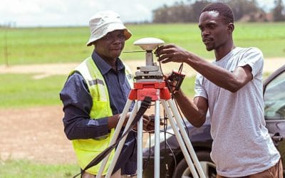
Physical Training
At Geoinfotech we offer extensive hands-on practical training and field experience for individuals, group or for organizations. Register to explore our courses on Drone, GIS, Remote Sensing, GPS, Python development, advanced analysis tools, and many more.

Online Traning
Explore Geoinfotech's online training platform, at home or anywhere you are on Drone, GIS, Remote Sensing, GPS, Python development, advanced analysis tools, and many more. We have developed our online platform to be responsive for easy navigation and professionally recorded for better understanding.

Land Surveyors in Nigeria
Buying land in Nigeria is a big investment. Whether you’re planning to build a home, start a...
Land Survey in Nigeria
Buying land in Nigeria is one of the most important financial decisions you’ll ever make. But it’s...

From Code to Map: Enhancing Collaboration Between Developers & GIS Professionals
Are you ready to unlock the synergy between software development and GIS workflows? Geoinfo...
Eye of the Storm: Why Drones are the New Standard for Roof Inspections in Nigeria (2026)
Storm events—heavy rainfall, strong winds, and tropical cyclones—are the primary enemies of...

Case Study: Successful Land Survey Project in Abuja Using Drone + GPS Tools (2026)
Abuja, Nigeria’s capital, is currently undergoing a massive geospatial transformation. With the...

How to Choose the Right GIS & Surveying Software Licenses in Nigeria (2026 Guide)
For small surveying firms in Lagos, Abuja, and beyond, buying the wrong software license isn't...
SERVICE LIST
We take your industry to the next level. Support Service Geoinfotech

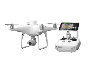
Drone (Survey, Inspection, Surveillance, and Mapping)

Geographic Information System

Land Surveying

Remote Sensing and Satellite Mapping

Hydrographic Survey (Bathymetry)

Geophysical Survey

Training (Beginners to Advance / Professional)

GeoStore (Buy Products) Hardware / Software