Search for the training you need
At Geoinfotech, we’re committed to supporting your training in geoinformatics and related technologies.
Whether you’re brand-new to ArcGIS, Drone, Surveying and Mapping or a seasoned GIS professional who wants to master the latest technology, we have resources to help you achieve your goals

Physical Training
At Geoinfotech we offer extensive hands-on practical training and field experience for individuals, group or for organizations. Register to explore our courses on Drone, GIS, Remote Sensing, GPS, Python development, advanced analysis tools, and many more.

Online Traning
Explore Geoinfotech's online training platform, at home or anywhere you are on Drone, GIS, Remote Sensing, GPS, Python development, advanced analysis tools, and many more. We have developed our online platform to be responsive for easy navigation and professionally recorded for better understanding.
AutoCAD for Surveyors: Essential Tools for Precision Mapping
Introduction If you’ve ever worked with survey data, you know how important precision is. Every...
Applications of Photogrammetry
Photogrammetry is changing the way we collect, analyze, and visualize spatial data. The...

Mastering GNSS RTK: Best Practices for Training Precision Surveying Professionals
In today’s era of high accuracy positioning, GNSS RTK (Real Time Kinematic) has become a...

GIS APPLICATIONS IN URBAN PLANNING: LAGOS CASE STUDIES
Introduction Urban planning in the twenty-first century increasingly relies on advanced geospatial...

Best Drone for Large-Scale Farming in Epe?
Agriculture in Epe, Lagos State, is rapidly evolving as farmers begin to adopt modern agricultural...

HOW DRONES ARE HELPING NIGERIAN FARMERS
Introduction Agriculture remains one of the most important sectors of the Nigerian economy,...
SERVICE LIST
We take your industry to the next level. Support Service Geoinfotech

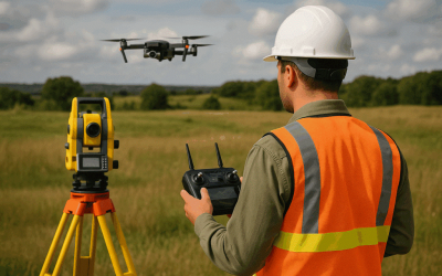
Drone (Survey, Inspection, Surveillance, and Mapping)

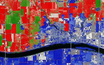
Geographic Information System

Land Surveying

Remote Sensing and Satellite Mapping

Hydrographic Survey (Bathymetry)

Geophysical Survey

Training (Beginners to Advance / Professional)

GeoStore (Buy Products) Hardware / Software