

Search for the training you need
At Geoinfotech, we’re committed to supporting your training in geoinformatics and related technologies.
Whether you’re brand-new to ArcGIS, Drone, Surveying and Mapping or a seasoned GIS professional who wants to master the latest technology, we have resources to help you achieve your goals

Physical Training
At Geoinfotech we offer extensive hands-on practical training and field experience for individuals, group or for organizations. Register to explore our courses on Drone, GIS, Remote Sensing, GPS, Python development, advanced analysis tools, and many more.

Online Training
Explore Geoinfotech's online training platform, at home or anywhere you are on Drone, GIS, Remote Sensing, GPS, Python development, advanced analysis tools, and many more. We have developed our online platform to be responsive for easy navigation and professionally recorded for better understanding.
SERVICE LIST
We take your industry to the next level. Support Service Geoinfotech

Drone (Survey, Inspection, Surveillance, and Mapping)

Geographic Information System

Land Surveying

Remote Sensing and Satellite Mapping

Hydrographic Survey (Bathymetry)

Geophysical Survey

Training (Beginners to Advance / Professional)

GeoStore (Buy Products) Hardware / Software
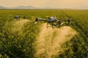
Drone Fertilizer & Foliar Nutrient Spraying in Nigeria: Precision Application for Better Crop Nutrition
Crop nutrition plays a major role in farm productivity. However, applying liquid...
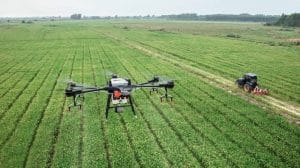
Drone-Based Nutrient Deficiency Detection in Nigeria: Using Multispectral & Red-Edge Imaging for Precision Fertilizer Management
Drone-Based Nutrient Deficiency Detection in Nigeria. Nutrient deficiency can reduce crop growth...
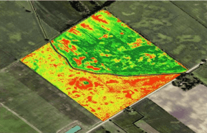
NDVI Analysis for Agriculture in Nigeria: How Drone Vegetation Maps Detect Crop Stress, Nutrient Problems, Disease & Poor Growth
A farm can look healthy from the ground while some parts of the field are already struggling. One...

Differences Between Surveying And Surveillance In The Geospatial Field
Differences Between Surveying And Surveillance In The Geospatial Field Differences Between...

Hydrography
Hydrography Hydrography is the branch of applied sciences that deals with the measurement...

Importance Of Land Survey
Importance Of Land Survey What is Land Survey Land Survey or simply Survey, is the scientific...