

Search for the training you need
At Geoinfotech, we’re committed to supporting your training in geoinformatics and related technologies.
Whether you’re brand-new to ArcGIS, Drone, Surveying and Mapping or a seasoned GIS professional who wants to master the latest technology, we have resources to help you achieve your goals

Physical Training
At Geoinfotech we offer extensive hands-on practical training and field experience for individuals, group or for organizations. Register to explore our courses on Drone, GIS, Remote Sensing, GPS, Python development, advanced analysis tools, and many more.

Online Training
Explore Geoinfotech's online training platform, at home or anywhere you are on Drone, GIS, Remote Sensing, GPS, Python development, advanced analysis tools, and many more. We have developed our online platform to be responsive for easy navigation and professionally recorded for better understanding.
SERVICE LIST
We take your industry to the next level. Support Service Geoinfotech

Drone (Survey, Inspection, Surveillance, and Mapping)

Geographic Information System

Land Surveying

Remote Sensing and Satellite Mapping

Hydrographic Survey (Bathymetry)

Geophysical Survey

Training (Beginners to Advance / Professional)

GeoStore (Buy Products) Hardware / Software
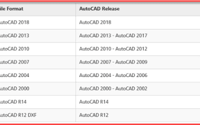
Everything You Need to Know About AutoCAD Version Converter
An AutoCAD Version Converter is a tool or feature used to change an AutoCAD drawing from one DWG...
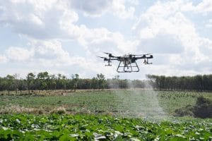
Drone Spraying Services in Nigeria: Complete Guide to Precision Agricultural Spraying, Crop Protection & Farm Applications
Drone spraying is changing how Nigerian farms handle crop protection. Instead of walking...
Explore the world of the best online casinos, where thrilling games, generous bonuses, and secure environments await players of all levels.
Discover the Best Online Casino: Unveiling Top Gaming Destinations In recent years, the online...

TACKLING INSURGENCY USING DRONE TECHNOLOGY
In tackling insurgency using drone technology. The Surveyor-General of the federation Abdul Ganiyu...

REMOTE SENSING FOR ACCURATE TRANSMISSION LINES
It’s usually a delight to enjoy steady electricity for the daily running of businesses and...

Geoinfotech Web Mapping Applications
WEB MAPPING: This is an interactive phase that includes a web browser on the client’s end and...