404
Oops!, that page can’t be found.
There are other options that might interest you below
Oops!, that page can’t be found.
There are other options that might interest you below
Search Results
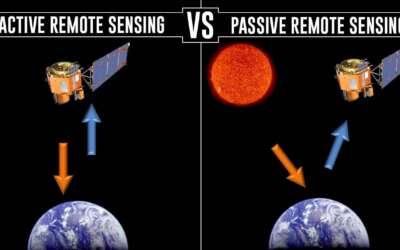
TECHNIQUES OF REMOTE SENSING
Techniques of Remote Sensing. Remote sensing is detecting and monitoring an area's physical characteristics by measuring its reflected and emitted radiation at a distance. The earth is scanned by satellites or high-flying aircraft in order to obtain information about...

DIFFERENCE BETWEEN DRONE SURVEYING AND MANUAL LAND SURVEYING
Difference between drone surveying and manual land surveying. Surveying is a means of making relatively large-scale, accurate measurements of the Earth's surfaces. Land Survey involves the scientific process of measuring the dimensions of a particular area of the...

FASHOLA, SGF ADVOCATES USING GEOSPATIAL INTELLIGENCE TO FIGHT INSURGENCY
FASHOLA ADVOCATES USING GEOSPATIAL INTELLIGENCE TO FIGHT INSURGENCY The Minister of Works and Housing, Babatunde Fashola, SAN, has called for the use of geospatial data by the military and other security agencies in the fight against insurgency in the country. The...

REMOTE SENSING AND THE ENVIRONMENT
Remote sensing and the environment Remote Sensing is the process of detecting and monitoring the physical characteristics of an area by measuring its reflected and emitted radiation at a distance (typically from satellite or aircraft). Special cameras collect remotely...

HOW GIS KNOWLEDGE CAN HELP IMPROVE RESULTS IN HOUSING SECTOR.
HOW GIS KNOWLEDGE CAN HELP IMPROVE RESULTS IN THE HOUSING SECTOR. Geographic Information Systems GIS is a tool mainly used to gather, analyse, and interpret data captured during the remote sensing process. It is applicable in different sectors where it is used by...

7 TIPS TO INCREASE YOUR DRONE FLYING SKILLS
7 tips to increase your drone flying skills Drones are Unmanned Aerial Vehicles used for many different functions, ranging from monitoring climate change to carrying out search operations after natural disasters, photography, filming, agriculture and delivering goods....

LEARN APPLICATION OF GIS WITH PYTHON AT 5% DISCOUNT
LEARN THE APPLICATION OF GIS WITH PYTHON AT 5% DISCOUNT Learn Application of Gis With Python at 5% Discount Hi there, If you have been on our website for a while or visited our social media pages, you already know that trainings are one of the core services we offer....

WHAT TO DO IF MY DRONE GETS WET
What to do if my drone gets wet? It’s totally NOT recommended to fly drones in the rain, mist, high humidity, or over water bodies with strong winds. Many drones have venting holes that can expose the electronics inside to moisture. Once water gets inside, short...
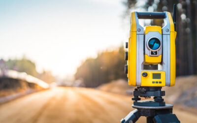
7 TIPS FOR MAINTENANCE OF SURVEYING EQUIPMENT
Adequate care and maintenance of the equipment, proper storage
CONTACT US